
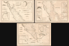
1799 Depot de la Marine Three Nautical Map or Chart Set of the Red Sea

This item has been sold.
Carte Générale de la Mer Rouge...
Red Sea and French attempts to sieze control of the India Ocean.
- Digital Map Information
- Suitable for large format printing
- Full resolution TIFF file
- ICC color profile embedded
- Delivered instantly via download link
Red Sea and French attempts to sieze control of the India Ocean.
This is a c. 1799 set of three nautical maps or charts covering the Red Sea, produced by the French Dépôt Général de la Marine. At the time, the Red Sea had become a key strategic waterway due to Napoleon's invasion of Egypt and the wider geopolitical struggles of the French Revolutionary Wars, prompting significant remapping.A Closer Look
This map consists of three sheets, each measuring about 25.5 x 37.5 in. The sheet containing the title cartouche covers the northern portion of the sea, with Suez and Cairo appearing at top-left. It extends south as far as Yambo (Yanbu) on the Arabian Coast and the Ile de la Emeraude (St. John's or Zabargad Island) and 'Cape Nose' on the Egyptian side. In ancient times, a bustling port existed on the south side of Cape Nose called Berenice that carried on a very busy trade with the Indian Subcontinent, importing spices and silk, causing Rome to rack up a large trade deficit in the process (it has become a very important archaeological site in recent years).The second sheet covers the middle portion of the Red Sea from the Ile de la Emeraude / Yambo down the coast of Sudan in the west and to the area around Al Qunfudhah (also known as Kunfuda, here as Comfida) on the Arabian coast, taking in Jeddah (Giddah) and the route to Mecca. The third sheet maps the southern portion of the Red Sea, through the Bab el-Mandeb, translating to the 'Gate of Lamentation,' likely named for the difficulty of navigating its waters.
Exceptional navigational detail is included throughout, with soundings, anchorages, hazards, shoals, bottoms, and other navigational information marked. Twelve insets provide additional detail on important islands, bays, and harbors (including Suez, Tor, Jeddah, and Moka), while some forty mountains or sets of mountains are depicted in profile. Coastal information on land is also included, from cities and settlements to terrain, mosques, and caravan routes. Additional notes provide essential information, such as 'Côte des Pirates' and 'Source d'Eau Douce.' The course of the Venus, commanded by François Étienne de Rosily-Mesros during a 1787 journey through the sea, is traced.
Rosily and the Venus' transit of the Red Sea was one part of a much longer voyage of hydrographic surveying that also traveled throughout the Indian Ocean and China Seas. Leaving France in February 1785 under the Ancien Régime, the voyage lasted seven years while France itself was roiled by revolution. Rosily's resulting charts were groundbreaking, especially those of the Red Sea, which was hitherto poorly mapped and notoriously dangerous, with a dense network of reefs, shoals, and narrow passages, compounded by strong seasonal winds and a scarcity of reliable fresh water and anchorages. This arduous but important work propelled Rosily to the position of director and inspector general of the Dépôt des Cartes et Plans de la Marine and gained the attention of Napoleon, to whom he provided helpful information to prepare for the 1798 Egyptian Expedition.
Historical Context
Around the time of this map's publication, the Red Sea was being transformed from a difficult-to-navigate but commercially important Ottoman waterway into a strategic theater of the French Revolutionary Wars. Its ports connected the Mediterranean world with Arabia, East Africa, and the Indian Ocean, including the transport of Hajj pilgrims and maritime linkages with overland caravan trades. Napoleon's invasion of Egypt in 1798 instantly elevated the region's geopolitical importance. France hoped that controlling Egypt might revive French commerce with the East, threaten Britain's communications with India, and perhaps provide a route for French intervention in the Indian Ocean. French forces occupied Suez in November 1798, and Napoleon visited the town the following month (his four-day journey from Cairo noted here), in part to search for the ancient Canal of the Pharaohs that ran between the Nile and the Red Sea and to consider the feasibility of reopening it.In the end, this and other French ambitions in Egypt had to be scrapped. Nelson's destruction of the French fleet at the Battle of the Nile on August 1-2, 1798, isolated Napoleon's army from France, while Britain and the East India Company moved to protect the Red Sea route to India. The Ottoman Empire, of which Egypt was formally a province, also declared war on France. By 1799, the Red Sea had thus become part of a much larger contest linking Egypt, Ottoman Arabia, British India, and Napoleon's unsuccessful Syrian campaign. In 1801, French forces in Egypt surrendered, but by then had drastically altered the future trajectory of the region, encouraging, among other things, the rise of Muhammed Ali and effective independence of Egypt from Ottoman control. Muhammed Ali's son and third successor, Mohamed Sa'id Pasha (r. 1854 - 1863), would oversee the start of construction on the Suez Canal.
Publication History and Census
These charts were prepared by the Dépôt Général de la Marine et des Colonies, based on observations by Vice Admiral François Étienne de Rosily-Mesros (here as 'Citoyen Rosili'), in Year VII (An VII) of the French Revolutionary calendar, which ran from September 22, 1798, through September 22, 1799. They were engraved by Charles-Etienne Collin, with letter engraving by L. Aubert. The three-chart set is cataloged in the holdings of the Bibliothèque nationale de France, the National Library of Israel, the Staatsbibliothek zu Berlin, the Bayerische Staatsbibliothek, the Sächsische Landesbibliothek - Staats- und Universitätsbibliothek, and the David Rumsey Historical Map Collection (as part of a larger bound collection of French charts of the era).Cartographers
François Étienne de Rosily-Mesros (January 13, 1748 - November 12, 1832) was a French hydrographer, explorer, and naval officer active during the French Revolutionary Wars (1792 - 1802) and subsequent Napoleonic Wars (1803 - 1815). Rosily was born in Brest , the son of a prominent French naval officer. He apprenticed as a naval officer from 1762 to 1769. Reaching his independence, in 1770 he was commissioned as an enseigne de vaisseau under Yves-Joseph de Kerguelen-Trémarec (February 13, 1734 - March 3, 1797). He accompanied Kurguelen on the Third French expedition in search of Terra Australis from 1772 - 1774. In 1775 Rosily took command of Vénus and spent several years charting the coasts of east Africa, the Red Sea, the Persian Gulf, and India. In 1778, Rosily was transferred to the Pondicherry-baesd Méduse, which mapped parts of the South China Sea, including Conchinchina, the south China, and the Philippines. During the Napoleonic period, Rosily had strained relations with the emperor, who despite considering him an able naval officer, derided him for his lack of active combat service. Napoleon instead deployed him to surveying and mapping expeditions consistent with his military ambitions - including a mapping of the coast of Africa. Napoleon eventually granting Rosily a major command in Cadiz, but arriving after the British destroyed the Cadiz fleet, he was unable to fulfill his commission. Rosily was made director of the Dépôt de Marine in 1795 and retained the position until 1805. After Napoleon was deposed in 1815, the new king Louis XVIII granted him the promotion he was denied under the emperor, making him a Grand Officer of the Légion d'Honneur. In 1816, for his many scientific expeditions, he was made a free associate of the Académie des Sciences. He was also made emeritus director of the Dépôt de Marine. He died in Paris in 1832. Further Details...
Charles-Étienne Collin (1770 - 1840) was a French engraver active in Paris during the late 18th and early 19th centuries. Collin was born in Paris to a long line of important French engravers dating back to Jean Collin. He was the son of Bernard Collin (1737 - 1791), son of Jean. Collin engraved for the seminal 1809 - 1822 Description de l'Egypte and extensively for the Dépôt de la Marine. He was contracted by his cousin by marriage, Phillipe Buache (1700 - 1773), for his exceptional engraving mastery to work for the Dépôt de la Marine from at least August 1793. He worked with his brother, Jean-Louis Collin (1775 - 1858), from 1800 to 1803. His son, also Charles-Étienne Collin or just Étienne Collin II (1790 - 1852), apprenticed under him and worked with him from 1821 to 1829. Under Charles-Étienne Collin (1770 - 1840) and then his son, the firm was located in Paris at N° 45, Rue de la Harpe - the last known work attributed to 'E. Collin' appeared in 1831. Distinguishing between the 'Collin' family of engravers on Dépôt de la Marine charts is difficult. The elder Étienne Collin (1770 - 1840) typically signed his work 'E. Collin' or later 'E. Collin père'. His son signs some of his work as 'E. Collin' and others as 'C.E. Collin fils.' There is some evidence of another generation of Collin engravers, also Charles-Étienne Collin, signing his work as 'C. E. Collin' between 1840 and 1875. Further Details...
L. Aubert (J.-B.-L. Aubert, Aubert père; fl. c. 1780 - 1831) was a prolific French copperplate engraver active in Paris during the late 18th and early 19th centuries. He specialized in delicate letter engraving (graveur en lettres), working for the Dépôt Général de la Marine, France's official naval hydrographic office. Aubert's calligraphic work featured prominently in some of the most historic scientific and maritime publications of the Revolutionary, Napoleonic, and Restoration periods. He was a primary letterer for the Atlas du Voyage de La Pérouse (1797), and engraved text for the charts of the Baudin expedition to Australia, including the 'Freycinet map,' the first full map of the Australian continent. Outside the Dépôt, Aubert was frequently commissioned by leading geographers and scholars, notably executing the lettering for Alexander von Humboldt's groundbreaking atlases, including those relating to Mexico and South America. His crisp typography and clean formatting helped set the aesthetic and technical standard for French naval and geographical mapping during the golden age of ocean exploration. Further Details...
Dépôt des Cartes et Plans de la Marine (fl. 1720 - present), often called the Dépôt Général de la Marine, was a French hydrographic mapping organization founded in 1720 under Charles-Hercule of Albert de Luynes (1674 - 1734). Much like the U.S. Coast Survey, the British Admiralty, and the Spanish Deposito Hydrografico, the Dépôt was initiated as a storehouse and distribution center of existing nautical and marine charts. Eventually the Dépôt initiated its own mapping activities in an attempt to improve and expand upon existing material. Some of the more prominent cartographers and hydrographers associated with the of Dépôt Générale des Cartes were, Philippe Buache, Jacques-Nicholas Bellin, Giovanni Rizzi-Zannoni, Rigobert Bonne, and Jean Nicolas Buache. Further Details...
Condition
Very good. Some transference and toning.
References
Rumsey 15934.476 - 15934.479. Bibliothèque nationale de France, département Cartes et plans, GE SH 18 PF 210 DIV 2 P 9/1. National Library of Israel, System No. 990024943090205171. OCLC 1606073123, 234196695.