
1860 F. G. Ch. Picard Illustrated Manuscript Journal Concerning Travel, History, etc.

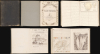
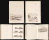
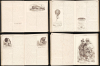
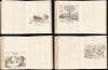
Le Souvenir. Voyages, Excursions, Histoire, Anecdotes, Descriptions, Promenades, Etc., Etc...
Lavishly illustrated manuscirpt journal.
Lavishly illustrated manuscirpt journal.
This is a 1860 French-language manuscript journal Le Souvenir written by F. G. Ch. Picard, likely of Geneva. Composed in Picard's clean hand and academic French, the work reads like an encyclopedia, covering a rambling range of topics from whaling to the cultures of Africa to the Chinese military, Daniel Boone, and ballooning. The work is rich with 26 masterfully drawn illustrations and 6 maps.A Closer Look
Entitled Le Souvenir [Memory], Picard's journal opens with a beautiful hand-drawn frontispiece evocative of 19th-century atlases. The 260 pages begin with a discussion of the Chinese Army and Navy (illus. Chinese fort at Peiho) and then move on to whales (illus.), the mountains of Switzerland, Jerusalem, and the Battle of Hastings. Discussions move on to camels, jaguars in Ecuador (including a hand-drawn map of Ecuador and a drawing of a jaguar), and eagles. The subsequent pages include commentaries on history, geography, ethnography, and modern technology (including early balloons and parachutes), as well as excerpts from several plays. Among the illustrations are a charming full-page illustration of marine animals (Page 133) and a half-page illustration of the Great Pyramid at Giza (Page 228). The journal ends mid-quotation while recounting the legend of William Tell. An illustration on the back of the final page makes it clear that Picard did not intend to continue the text.The Maps
The hand drawn maps are- République de l'Équateur - Carte N.1 (Page 22)
- Carte N. 2 - Sud de l'Afrique Le Cap etc. (Page 77)
- Carte N. 3 - La Suisse (Page 108)
- Carte N. 4 - Sahara ou Grand-Désert
- Carte N. 5 - Islande (Page 207)
- Carte N. 6 - De Genève à Saint-Cergues. -Dôle.- (Page 214)
Publication History and Census
This journal was written by F. G. Ch. Picard and dated 1860. As it is an entirely manuscript work, it is a unique artifact. We are aware of only one other work by F. G. Ch. Picard: an 1854 manuscript atlas held by the Bibliothèque de Genève.Cartographer
F. G. Charles Picard (fl. c. 1854 - 1860) is a scholar, historian, and geographer active in the mid-19th century. Picard was likely Swiss, possibly from Geneva. We have encountered one work authored by Picard: a 260-page manuscript journal that featured numerous hand drawn maps and other illustrations. The only other trace we have found is an Atlas Universel, also manuscript, held at the Bibliothèque de Genève. Further Details...
Condition
Quarto. 260 pp. of manuscript in two columns per page. Entirely in French. Bound in pebbled black cloth, unmarked. Front inner hinge cracked but holding. First quire loose but attached.