
1912 Osman Nuri Folding Map of the Levant and Hejaz w/ Hejaz Railway

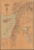

سوریه قطعهسی / [The Region of Syria].
Celebrating the Hejaz Railway from Damascus to Medina.
- Digital Map Information
- Suitable for large format printing
- Full resolution TIFF file
- ICC color profile embedded
- Delivered instantly via download link
Celebrating the Hejaz Railway from Damascus to Medina.
This exceptionally rare c. 1912 Ottoman folding map of the Levant highlights the Hejaz Railway. Across scorching deserts, waterless expanses, and some of the most unforgiving terrain on earth, the Ottoman Empire forged one of the Islamic world's great engineering achievements: the Hejaz Railway. Financed without European loans through contributions from Muslims around the globe and constructed increasingly by Ottoman engineers and Muslim workers, the line reached more than 1,300 kilometers from Damascus to Medina (المدينة) by 1908.A Closer Look
The map covers from southern Anatolia (the Aleppo Vilayet) in the north to the Gulf of Aqaba in the south, taking in Syria and Palestine, the northern half of the Sinai Peninsula as far west as the Suez Canal, and Cyprus. Administrative boundaries (vilayets, sanjaks, and kazas) are traced in red, while railways (existing and under construction), major roads, and minor roads are marked in black. Waterways are shaded blue, and mountainous areas are indicated. Cities and towns are recorded throughout. Towards bottom-right is an inset titled 'Map of the Hejaz Railway Route' (حجاز دمیر یولی كذرگاهى مرتسمی), showing two railway lines between Medina and Mecca under construction, neither of which was ever completed.Historical Context
Commissioned in 1900 by Ottoman Sultan Abdul Hamid II, the Hejaz Railway was an ambitious engineering project designed to connect Damascus with the Islamic holy cities of Mecca and Medina. While its primary religious purpose was to ease the grueling, months-long Hajj pilgrimage, the railway also held critical strategic value, allowing the empire to swiftly deploy troops and assert military control over its distant Arabian provinces at a time when centrifugal forces threatened the empire's very existence. To preserve pan-Islamic sovereignty and avoid dependence on European financiers, the project was funded entirely by donations from Muslims worldwide, alongside allocations from the Ottoman treasury. Similarly, though the Ottomans initially relied on German engineers, these were gradually replaced by Ottoman engineers (often trained in Germany). Staff along the railway, particularly its southern portion, were also exclusively Muslim to maintain the religious connotations of the project. Navigating harsh desert terrain, extreme heat, and severe water shortages, workers completed the narrow-gauge line to Medina in 1908. However, the planned extension to Mecca was never realized due to local tribal resistance and regional instability. Even the line to Medina was completed in a hurry and could not be considered fully operational until the eve of World War I (1914 - 1918).Although it marked an impressive achievement for the Ottoman state and society, the railway's operational lifespan was short-lived, brought to a violent halt by the onset of World War I. During the Arab Revolt against Ottoman rule, the line became a primary target for guerrilla warfare, famously sabotaged by Emir Faisal's forces and British officer T.E. Lawrence ('Lawrence of Arabia') to sever Ottoman supply chains. Following the post-war collapse of the empire, the railway was fragmented across newly drawn national borders, and 20th-century regional conflicts prevented any coordinated efforts to restore it fully. Today, while a few isolated northern sections in Jordan and Syria have seen sporadic use over the decades, most of the southern tracks lie abandoned to the desert sands, where preserved locomotives and eerie station ruins serve as striking historical monuments to a bygone era of imperial ambition.
Publication History and Census
This map was prepared by Osman Nuri (عثمان نوری), noted as a former military geography instructor and infantry Captain (Kolağası), not to be confused with the earlier Ottoman commander Osman Nuri Pasha (1832 - 1900). It was printed by the Mekteb-i Harbiye Matbaası (مکتب حربیه مطبعهسی), the Imperial Military Academy Printing House, and is dated 1327 AH in the Ottoman Rumi calendar, corresponding to 1911 or 1912 CE in the Gregorian calendar. We have been unable to identify any other examples of this map in institutional collections or market history.Cartographer
Mekteb-i Harbiye Matbaası (مکتب حربیه مطبعهسی ; c. 1834 - 1921) was the specialized publishing arm of the prestigious Ottoman Imperial Military Academy (Mekteb-i Harbiye) in Istanbul. The Mekteb-i Harbiye was established in 1834 after the dissolution of the janissaries. Operating as a state-controlled institutional press, the main purpose of the Mekteb-i Harbiye Matbaası was to produce the technical, scientific, and tactical literature required to modernize the empire's armed forces. More broadly, it served as a premier center for technological and scientific dissemination, bridging Western military theory with Ottoman intellectual life through advanced typography, high-quality translations, and precise cartography. As a critical part of the Imperial Military Academy, the Mekteb-i Harbiye Matbaası played an important role in the modernization efforts of the late Ottoman Empire. Further Details...
Condition
Very good. Dissected and mounted on linen.