
1937 Thompson Pictorial Map of the Americas, Pan Am's 'Lindbergh Trail'


This item has been sold.
Flying the Lindbergh Trail. An Aerial Travelogue of the Southern Americas.
Height of the 'Clipper Ship' Era.
- Digital Map Information
- Suitable for large format printing
- Full resolution TIFF file
- ICC color profile embedded
- Delivered instantly via download link
Height of the 'Clipper Ship' Era.
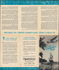
This is a scarce c. 1937 promotional folding map prepared by Kenneth W. Thompson for Pan American Airways. The map and photographs, and text on the verso, advertise commercial flights aboard Pan Am's distinctive flying boat 'Clippers,' offering routes along the 'Lindbergh Trail,' named for flights taken early in the career of renowned aviator Charles Lindbergh.A Closer Look
The map depicts a large swath of the Americas, between the southern United States and the northern half of Chile and Argentina. Pan Am's routes throughout the region are traced, with main routes in bold. Routes departing from the U.S. mostly leave from Pan Am's seaplane hub at Dinner Key, Miami. Surrounding the map are images of Pan Am planes, scenery, and locals at its many destinations throughout the Americas. The images are presented like pieces of a film reel, likely a tie-in with the film of the same name released simultaneously (see below).The 'Lindbergh Trail'
Before his historic May 1927 Transatlantic flight, Charles Lindbergh (1902 - 1974) was an unknown air mail pilot; afterward, he became one of the most famous men in the world overnight. His endearing Midwestern modesty enhanced rather than diminished his fame. An autobiography was published two months after his flight, statues went up on both sides of the Atlantic, and Lindbergh was the subject of constant attention from journalists (including gossip columnists), fans, and companies seeking his endorsement for their products. Often these had nothing to do with aviation, such as cigars, but a Lindbergh endorsement of an automobile, motorcycle, or, above all, an airplane was a major boon to any company lucky enough to receive it. Starting in the late 1920s, Lindbergh developed a close and lasting relationship with Pan American Airways and its driving force, Juan Trippe (1899 - 1981). In fact, within the relatively small world of early aviation and its even smaller subset of air mail services, the two men had met in 1926, when Lindbergh was still an obscure pilot.Beginning in early 1929, Lindbergh became a consulting technical advisor to the still-young airline (Head of Pan Am's Technical Committee) and took many exploratory trips along difficult potential routes, usually with his wife Anne Morrow (1906 - 2001) and often with Trippe and his wife, Elizabeth Stettinius. Despite being temperamentally different, the two men shared a devotion to aviation and a vision of a future of regular long-distance, intercontinental passenger air travel. Lindbergh was also a consistent and vocal advocate for the benefits of air mail, which was the primary means of revenue for Pan Am in its early years. Later in life, from 1965, Lindbergh would even serve on Pan Am's Board of Directors.
The present map reflects Pan Am's leveraging Lindbergh's fame to promote commercial passenger aviation. The name 'Lindbergh Trail' comes from a series of flights undertaken by Lindbergh throughout the Caribbean in the Spirit of St. Louis between December 1927 and February 1928. This 'Good Will Tour' of the Caribbean also became an opportunity to promote air mail, at the behest of the head of West Indian Aerial Express, Basil L. Rowe (who would also soon join Pan Am). After joining Pan Am, Lindbergh made additional flights through Latin America in 1929 - 1931, establishing routes that would become the mainstay of the airline in the 1930s. Text on the verso promotes passenger service to the indicated destinations, promising both comfort and excitement to travelers.
Pan Am's 'Flying Clipper Ships'
Pan Am rose to prominence in the 1930s as a pioneer of international air travel, especially through its use of the luxurious 'Flying Clipper Ships,' named after the oceangoing trading vessels of the late 18th and 19th centuries. These large seaplanes, most famously the quad-engine Sikorsky S-42 and Boeing 314, were designed for long-distance overwater routes at a time when few land-based runways could support such flights. Operating from bases in Miami, San Francisco, and New York, Pan Am's Clippers connected the Americas, the Pacific, and eventually the Atlantic, carrying passengers, mail, and prestige for the United States abroad. The first major milestone came in 1935 with the China Clipper's transpacific mail service between San Francisco and Manila, an extraordinary technical and navigational achievement that symbolized American aviation prowess.The 'Flying Clipper Ships' were marketed as airborne ocean liners, offering passengers a level of comfort and sophistication unparalleled in early commercial aviation. Interiors were furnished with lounges, dining rooms, and sleeping berths, and service rivaled that of first-class steamship travel. Trippe and Pan Am were masters of marketing, building and reinforcing (through multiple media, including film) the romance of the skies; where flight had only recently been the province of daredevils and madmen, it was now a safe, comfortable, respectable means of travel for the well-to-do (in reality, though luxurious, the planes could not fully overcome the inherent discomfort and dangers of air travel at the time).
Pan Am's Clipper operations also served a strategic role, helping chart air routes that later became crucial for military transport during World War II. By the late 1930s, the airline had inaugurated transatlantic service with the Boeing 314, linking New York to Europe and Africa. The Clipper era, though relatively brief, defined Pan Am's image, symbolizing adventure, luxury, and technological progress that would lead to even greater heights for passenger aviation in the Postwar period.
Publication History and Census
This map was drawn by artist Kenneth W. Thompson for Pan Am Airways (his name appears within the photograph of Lindbergh at left). It is undated, but from context can be dated to c. 1937, when an advertising campaign for the 'Lindbergh Trail' was launched (the airplane on the cover, a Sikorsky S-42, and the routes on the map are also consistent with a date of mid-late 1930s). In fact, a 1937 promotional film (now viewable on the YouTube channel of the Pan Am Museum Foundation) was produced with the exact same title as this map. Yet the map is quite scarce; we have not located it in any institutional collections, and it only occasionally comes to the market.Cartographer
Kenneth Webster Thompson (April 26, 1907 - April 4, 1996) was an American illustrator and painter. Thompson was born in Samford, Connecticut, and lived in New York City for most of his life, studying at the Grand Central Art School under George Pierce Ennis. During World War II he worked with the Library of Congress illustrating the War Effort and creating propaganda. His illustrations appear in Life, Colliers, American, and Look, among other publications. He earned numerous awards and honors for his work, among them an honorary membership to the Society of Illustrators. Further Details...
Condition
Very good. Light wear along original folds. Text on verso.
References
Rose, A., Empires of the Sky: Zeppelins, Airplanes, and Two Men's Epic Duel to Rule the World, (New York: Penguin Random House) 2021.