
1961 Alexander Land Development Maps, Federation of Malaya (Malaysia)

Federation of Malaya Land Development Maps.
Mining and Land Use in the Postcolonial Age.
Mining and Land Use in the Postcolonial Age.
This is a rare 1961 atlas of land development (i.e., land use) in the newly independent Federation of Malaya, prepared by the Federation's Geological Survey Department under the leadership of Joseph B. Alexander. Focusing on mining and mineral exploitation, the 56 maps provide a remarkably comprehensive overview of the Federation's constituent parts in the years just after independence. Both the content and production (overseen by a British geologist) reflect the distinctive, gradual transition away from colonialism on the Malay Peninsula.A Closer Look
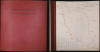
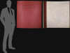
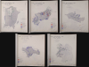
The atlas consists of a binder holding 56 maps of different parts of the Malay Peninsula along with an index map. The maps vary in scale by region and cover the entire contemporary Federation of Malaya: the nine Malay states and two of the Straits Settlements, Penang and Malacca. Particular attention is given to established mining hubs and potential new sites for exploitation in coastal states and deep in the interior in Kelantan.1:23 PMEach map includes a legend with shading indicating:- Land that has already been developed.
- Land with potential for, or favorable to, mineral, mining, and/or agricultural development.
- Land unsuitable for such development.
- Land protected in forest or game reserves.
Historical Context
Following its declaration of independence (Merdeka) on August 31, 1957, the Federation of Malaya entered a transformative era under Prime Minister Tunku Abdul Rahman. Politically, the early post-independence years were defined by state-building, the formal end of the 12-year Malayan Emergency against communist insurgents in 1960, and evolving regional security dynamics. To secure long-term political stability and maintain regional equilibrium, Tunku Abdul Rahman proposed expanding the Federation in 1961 to incorporate Singapore, Sarawak, North Borneo (Sabah), and Brunei. This proposal led directly to the creation of the Federation of Malaysia on September 16, 1963 (without Brunei; Singapore left the Federation in 1967). However, the expansion sparked significant geopolitical tensions, including Indonesia's hostile Konfrontasi campaign and the Philippines' territorial claims over Sabah. The nation also faced the complex task of forging a unified national identity within a multiethnic society composed of Malay, Chinese, Indian, and indigenous communities. The 1957 Federal Constitution reflected a delicate political compromise: it recognized the special position of the Malay population, safeguarded the sovereignty of the Malay Rulers, and established Islam as the state religion, while offering citizenship rights, cultural protections, and economic freedoms to non-Malay populations.Economically, post-colonial Malaya was, as it had been in the colonial period, heavily dependent on commodity exports, principally natural rubber and tin (the 'two pillars' of Malaya's economy), leaving federal revenues vulnerable to fluctuations in global market prices. For most of the 20th century, Malaya / Malaysia was the world's largest producer of tin, supplying between 30 and 40 percent of global output at its peak, and associated revenues were critical to government finances, which explains why locating new tin ore was a primary objective of the Geological Survey. The Survey itself also saw gradual change and significant continuities from the colonial period, being led and largely staffed at the higher levels by British people but moving to a new headquarters in Ipoh upon independence (see biography below).
Aside from tin and rubber, the Federation sought to combat rural poverty and address socioeconomic disparities between rural (largely Malay) agrarian communities and urban (largely non-Malay) commercial hubs by embarking on state-directed economic planning. A centerpiece of this initiative was the resettlement of landless families onto planned agricultural schemes dedicated to rubber and oil palm cultivation, laying the foundation for rural modernization and early economic diversification.
Publication History and Census
These maps were prepared by the Geological Survey Department under the leadership of Joseph B. Alexander, who described them, their production, and their intended purpose in an August 1964 article in the The Journal of Tropical Geography, published by the Departments of Geography of the University of Singapore and University of Malaya. The present atlas is uncatalogued in institutional collections and may be a sole surviving example. (In his article, Alexander states that the maps were 'distributed in atlas form to the appropriate Federal and State authorities,' suggesting a very limited print run).Cartographers
Joseph B. Alexander (February 29, 1912 - February 1996) was a British geologist active in Malaya (later Malaysia), who rose to become the first head of the country's Geological Survey Department in its era of independence. Born in Ipswich, Alexander was educated at the University of London and Royal School of Mines. He appears to have also received a graduate degree at the California Institute of Technology in the late 1940s. After completing his education, Alexander moved to Malaya and worked as a field geologist within the Geological Survey Department. Spending several decades there, Alexander rose to become the Survey's director in a period of transition, as Malaya became independent and the Survey moved to a new headquarters in Ipoh. During his tenure, Alexander modernized Malaya’s mineral exploration methodology by adopting airborne geophysical surveying. Under the auspices of the international Colombo Plan, he led initiatives using airborne magnetometer and scintillation counter surveys to systematically identify tin, iron, and radioactive mineral deposits. Throughout his career, Alexander published numerous maps, reports, and monographs on the geology of specific parts of the Malay Peninsula. He received the title of Commander of the Order of the British Empire and was also a fellow of the Geological Society and an Associate of the Royal School of Mines. Outside of work, Alexander served as the President of the Ipoh branch of the Y.M.C.A. while he was director of the Survey. He married a Chinese Malaysian woman named Rosa Ching Yeuk Sum, with whom he had at least one child. Further Details...
Geological Survey Department, Malaya (1903 - present) is the government body in Malaysia, and previously in British Malaya, tasked with technical functions related to minerals, geoscience, mining, and quarrying. Its history began in 1903 with the founding of the Geological Office in Kuala Lumpur, with John Brooke Scrivenor (1876 - 1950) being appointed the head of the office and the first geologist employed by the colonial state in Malaya. In 1908, the Geological Office was moved to Batu Gajah, Perak to oversee field investigations into the potential for tin mining in the region. In the following years, it helped to facilitate the development of Malaya into a mining and export powerhouse, with Scrivenor publishing a series of pioneering studies on the geology of the Malay Peninsula. In 1927, the Geological Office was renamed the Geological Survey Department, and soon thereafter, in 1931, Scrivenor stepped down as the Survey's director. In 1949, a distinct survey was established for Borneo (it later was reincorporated when Sabah and Sarawak joined the Federation of Malaya) and in 1957, the same year Malaysia achieved independence, the Geological Survey Headquarters moved to Ipoh, Perak. In 1973, the Survey's headquarters returned to Kuala Lumpur. Today, the body is known as the Jabatan Mineral dan Geosains Malaysia (JMG), also using the English name Department of Mineral and Geoscience Malaysia. Further Details...
Condition
Good. Most maps exhibit water stains along base - could be removed and washed individually. Slight foxing. Covers somewhat buckled.
References
Not in OCLC. Alexander, J., 'The Evolution of Land Suitability Maps in the Federation of Malaya' The Journal of Tropical Geography Vol. 18 (Aug. 1964), pp. 1-6.