
1945 U.S.S. Monrovia Archive of the WWII Invasion of Okinawa (Photographs, Documents, Map)

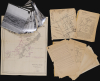
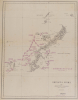
Okinawa Shima and Adjacent Islands. Screen Plan Okinawa--1. / U.S.S. Monrovia (APA-31) Amphibious Assault on Okinawa.
Operational archive documenting the final preparations for the invasion of Okinawa, the last great amphibious campaign of World War II.
$18,000.00
Choose a Collection:
This Item
Enquire
Operational archive documenting the final preparations for the invasion of Okinawa, the last great amphibious campaign of World War II.
An extraordinary discovery and an even more improbable survival, this archive from the U.S.S. Monrovia preserves the operational record of the April 1, 1945, Invasion of Okinawa, the final great amphibious campaign of World War II (1939 - 1945). Comprising aerial reconnaissance photographs, operational maps, and briefing papers prepared as late as March 31, 1945, the collection captures the tense final hours before the assault. Few surviving archives so vividly illustrate the intelligence, planning, and meticulous coordination behind one of the most consequential military landings of the twentieth century.The Archive
The archive includes:- Map of Okinawa Shima and the adjacent islands detailing the screening plan for the invasion
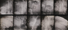
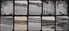
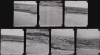
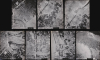
- 34 aerial photographs
- 25 loose sheets comprising 35 pages of text, with some printed on both sides
- Ship-to-shore diagrams and maps of Okinawa
The Photographs
The 34 aerial reconnaissance photographs depict Okinawa and nearby Ie Shima, the strategically important island captured by Allied forces to establish a forward airfield. Many focus on the invasion beaches, several taken from oblique angles to reveal terrain and defensive positions, while others record roads, villages, cultivated fields, and other features critical to amphibious planning. All are dated March 24 or March 27, 1945 - just days before the April 1 landings - making them among the last intelligence photographs available to the invasion force. Their presence in this archive suggests they were rapidly developed aboard one of the fleet's shipside photographic processing labs and distributed to the U.S.S. Monrovia as part of the final operational intelligence package immediately preceding the assault.The Documents
The documents pertain to the amphibious assault on Okinawa. Most are dated. The two earliest are dated March 2, 1945, and March 5, 1945, and detail the invasion waves and which LVTs are carrying which waves. A document dated March 21, 1945, details tides around Okinawa for the first five days of April. The rest of the documents are dated March 31, 1945 (the day before the invasion) and detail every aspect of the assault on Okinawa as it pertained to the U.S.S. Monrovia.- Identifies L-Day (April 1, 1945) and H-Hour (0830) for the invasion.
- Includes a probable timetable for the hours immediately preceding the landings.
- Provides detailed operational instructions for the Beach Party and Beachmasters.
- Explains the flag system used to identify landing craft and assign each vessel its role during the assault.
- Contains diagrams of the landing beaches and transport areas, with distances measured in yards.
- Illustrates the berthing plan for the 24 transport ships, including the U.S.S. Monrovia, within the Inner Transport Area.
- Features a comprehensive 20-point 'Instructions for Boat Crews' outlining procedures and responsibilities for the landings.
The Map
The map focuses on Okinawa and includes Kerama Retto and Iheya Retto, identifying islands in those groups. Red overprinting details the Screening Plan for the invasion and provides latitude and longitude for 12 positions where Navy ships were to be positioned. Each position is identified by its military alphabet codename: 'Alpha', 'Baker', 'Charlie', 'Dog', 'Easy', etc. Overprinting states that it was 'reproduced on board U.S.S. Bowditch'.Operation Iceberg: The Battle of Okinawa
The Battle of Okinawa began on April 1, 1945, when the United States Tenth Army landed on several beaches on the southern half of the island. A fleet of more than 1,500 vessels was assembled to support the invasion and 183,000 combat troops landed over the first few days. The number of combat troops would increase to over 250,000 by the end of the 82-day battle. Leading up to the landings, the naval guns and aircraft bombarded key targets. This was standard operating procedure before a landing, with the goal of 'softening up' the defenders. The initial landings were unopposed, and soldiers and Marines could walk across the invasion beaches upright, a feat not possible during any other landing on a Pacific island. It took only days to reach the other side of Okinawa and secure the 2 airfields that were their prime objectives. Before the landings, planners had believed that this would take weeks.Then the combat troops split up: the Army turned south, and the Marines went north. It quickly became clear that the bombardment preceding the landings had not been effective. The Japanese had built fortifications and bunkers into the hills and were going to make the invaders fight for every inch of Okinawa. By the end of the battle, American casualties numbered 49,151. The Navy suffered nearly 5,000 killed and nearly 5,000 wounded, an astounding 1:1 ratio. In addition, 36 ships were sunk, and over 350 more suffered some degree of damage from the nearly constant kamikaze attacks. At least 150,000 native Okinawans died, out of a population estimated at between 300,000 and 400,000.
These appalling casualty numbers shocked everyone in the United States, including President Harry S. Truman. The United States had been planning on invading the Japanese Home Islands in the fall of 1945, and war planners believed that casualty figures for that operation would far exceed those on Okinawa and Iwo Jima (which immediately preceded the invasion of Okinawa). The heavy civilian and military casualties experienced on Okinawa played a significant part in President Truman's decision to drop atomic bombs on Hiroshima and Nagasaki in August, which brought the war to a swift conclusion.
U.S.S. Monrovia (APA-31)
The U.S.S. Monrovia was a United States Navy Crescent City-class attack transport. Monrovia was launched on September 19, 1942, and commissioned on December 1, 1942. After shakedown and amphibious training exercises in the Chesapeake Bay in early 1943, Monrovia left Norfolk, Virginia, on May 10, 1943, for the Mediterranean and her first combat assignment during World War II (1939 - 1945). She was the command ship of the Western Task Force for Operation Husky (the invasion of Sicily) and suffered slight damage to her engine room after two near misses on June 11, 1943. Monrovia returned to Virginia in August 1943 with Italian POWs aboard after being repaired in Algiers. By the end of August, Monrovia was on her way to the Pacific with U.S. Marines aboard. Monrovia's first stop in the Pacific was at Wellington, New Zealand, in October 1943, before heading to Efate, the staging ground for the invasion of Tarawa. Monrovia served as the flagship of Transport Division 18 during the invasion of Tarawa, launched on November 20, 1943. After the battle, Monrovia transported American casualties and a few POWs to Hawaii. Monrovia next saw action during the invasion of Kwajalein on January 31, 1944, and then took part in the assault on Saipan (June 15-22, 1944) and Guam (July 22-29, 1944). Then Monrovia participated in the landings at Leyte in the Philippines (October 30, 1944, and November 18, 1944) and the Lingayen Gulf landings on Luzon (January 9, 1945). Monrovia's last operation was the invasion of Okinawa, where she remained on station from April 1 through April 5, 1945, before returning to the west coast of the United States for overhaul.Publication History and Census
Neither the photographs nor the documents have publication information. Most were likely created onboard the U.S.S. Monrovia for internal use.Condition
Very good to fair. Map has wear along original fold lines and light soiling. All photographs very good to excellent. Documents have chipping, wear to folds, and old tape repairs, but no loss to text.