This item has been sold, but you can get on the Waitlist to be notified if another example becomes available, or purchase a digital scan.
1874 Habersham Map of Oregon w/ Swamp Lands Act Manuscript
Oregon-habersham-1874$1,250.00


Title
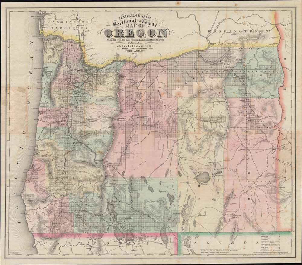
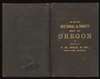
Habersham's Sectional and County Map of Oregon.
1874 (dated) 31 x 35 in (78.74 x 88.9 cm) 1 : 760320
1874 (dated) 31 x 35 in (78.74 x 88.9 cm) 1 : 760320
Description
This 1874 Gill / Habersham map of Oregon is one of the earliest and best separate issue maps of Oregon, here amended with meticulous manuscript annotations illustrating one of the largest and most egregious land grabs in Oregon history. Moreover, the manuscript annotations also bring to light the impact of the little-known Swamp Lands Act on eastern Oregon.
Coverage embraces the whole of Oregon, from the Columbia River to California and Nevada, and from the Pacific to the Idaho Territory. Where federal land office surveys have been completed, the land is platted. Otherwise, rivers, lakes, and mountain terrain, as well as political divisions, extant and proposed roads and railroads, forts, and more are presented.
Of note are the gold regions in upper Baker County, Oregon's richest gold region with a history of mining booms dating back to 1861.
In Oregon, the situation was unusual, in that, while Louisiana swamplands were legitimate swamps, most of the claimed lands in Oregon were in the arid south and southeast, attached to lakes and rivers. Instead of proper swamps, these were in fact oases, representing some of the most useful and valuable real estate in the state.
Oregon did not take advantage of the Swamp Lands Act until about 1872, but when it did, a flood of applications for vast near-free lands were filed. There was no limit placed on the acreage an individual could claim, and only 20% of the purchase price of one dollar an acre had to be paid. Like in other states, the Swamp Lands Act in Oregon quickly succumbed to political infighting, graft, and corruption. The valuable lands were claimed by powerful politicians, businesspeople, and the well connected. In many cases, deeds were issued without even the required deposit. Moreover, the Oregon senate often sold the lands before they took official ownership from the federal government - although the deeds were later supported by the Land Office. Where funds were collected, they were, for the most part, embezzled or misappropriated. It did however succeed in creating a host of extremely wealthy landowners.
A Closer Look
The map was drawn by Robert Alexander Habersham while he was serving as a military engineer in the U.S. Army Adjunct General's Office, Portland. Through his office, Habersham had access to the most up to date civil, government, and military surveys, which he compiled into this comprehensive map - at the time the best map of the state to date. Some of the manuscript maps Habersham drew to create this full-state production survive in the National Archives.Coverage embraces the whole of Oregon, from the Columbia River to California and Nevada, and from the Pacific to the Idaho Territory. Where federal land office surveys have been completed, the land is platted. Otherwise, rivers, lakes, and mountain terrain, as well as political divisions, extant and proposed roads and railroads, forts, and more are presented.
Of note are the gold regions in upper Baker County, Oregon's richest gold region with a history of mining booms dating back to 1861.
Ish's Manuscript Updates
The map was owned by William K. Ish (see below), a prominent Oregonian famer and businessman. Ish has meticulously updated the map in light red manuscript to reflect his astonishing land grab of some 570,000 acres in eastern Oregon under the Swamp Lands Act (below). The manuscript annotations feature Ish's multiple claims, some as large as 100,000 acres, all around lakes and rich river valleys. Moreover, the Ish claims generally follow in the corridor of a proposed extension linking the Central Pacific Railroad to the Columbia River - also marked out by Ish. As far as we have been able to determine, Ish's claims were successful, making Ish one of early Oregon's most prominent families.The Swamp Lands Act
The Swamp Lands Act of 1849 was a federal initiative intended for the state of Louisiana wherein federally owned swamp land (of which Louisiana had millions of acres) would be passed, free, to the state, who could then sell it to private investors. The funds raised were then intended to construct drains and levees necessary to reclaim these same lands, making them valuable and thus turning a profit for the initial investors. The act was extended to other states, including Oregon, in 1860.In Oregon, the situation was unusual, in that, while Louisiana swamplands were legitimate swamps, most of the claimed lands in Oregon were in the arid south and southeast, attached to lakes and rivers. Instead of proper swamps, these were in fact oases, representing some of the most useful and valuable real estate in the state.
Oregon did not take advantage of the Swamp Lands Act until about 1872, but when it did, a flood of applications for vast near-free lands were filed. There was no limit placed on the acreage an individual could claim, and only 20% of the purchase price of one dollar an acre had to be paid. Like in other states, the Swamp Lands Act in Oregon quickly succumbed to political infighting, graft, and corruption. The valuable lands were claimed by powerful politicians, businesspeople, and the well connected. In many cases, deeds were issued without even the required deposit. Moreover, the Oregon senate often sold the lands before they took official ownership from the federal government - although the deeds were later supported by the Land Office. Where funds were collected, they were, for the most part, embezzled or misappropriated. It did however succeed in creating a host of extremely wealthy landowners.
Provenance: William K. Ish
This map was the property of William King Ish (1823 - February 5, 1882), whose name is handwritten on the inside of the binder. The Ish family were among the most prominent early settlers of Oregon. Ish was born in Laudon, Virginia to a prosperous slave-owning family. Shortly before the outbreak of the American Civil War (1861 - 1865), the very large Ish clan emigrated to Jacksonville, Oregon, where they are first recorded in the 1860 census. Within a short time, Ish became involved with John B. Hailey, former governor of the Idaho Territory, with whom in 1863 he established the Oregon and Idaho Stage Company. The stage initially ran from Umatilla, Oregon to Boise, Idaho Territory. Later they expanded to serve the Idaho Basin and Owyhee mines. Ish sold his Stage Company interest in 1865, using the capital to make an egregious land grab in eastern Oregon under the 'Swamp Lands Act'. In 1872, he was the second largest applicant in the state, with pending applications for some 570,000 acres, behind only the lumber magnate Henry C. Owen, who applied for 1,000,000. Later, in 1877 he incorporated the Oregon and Alaska Mining Company with Charles and C. P. Hogue.Publication History and Census
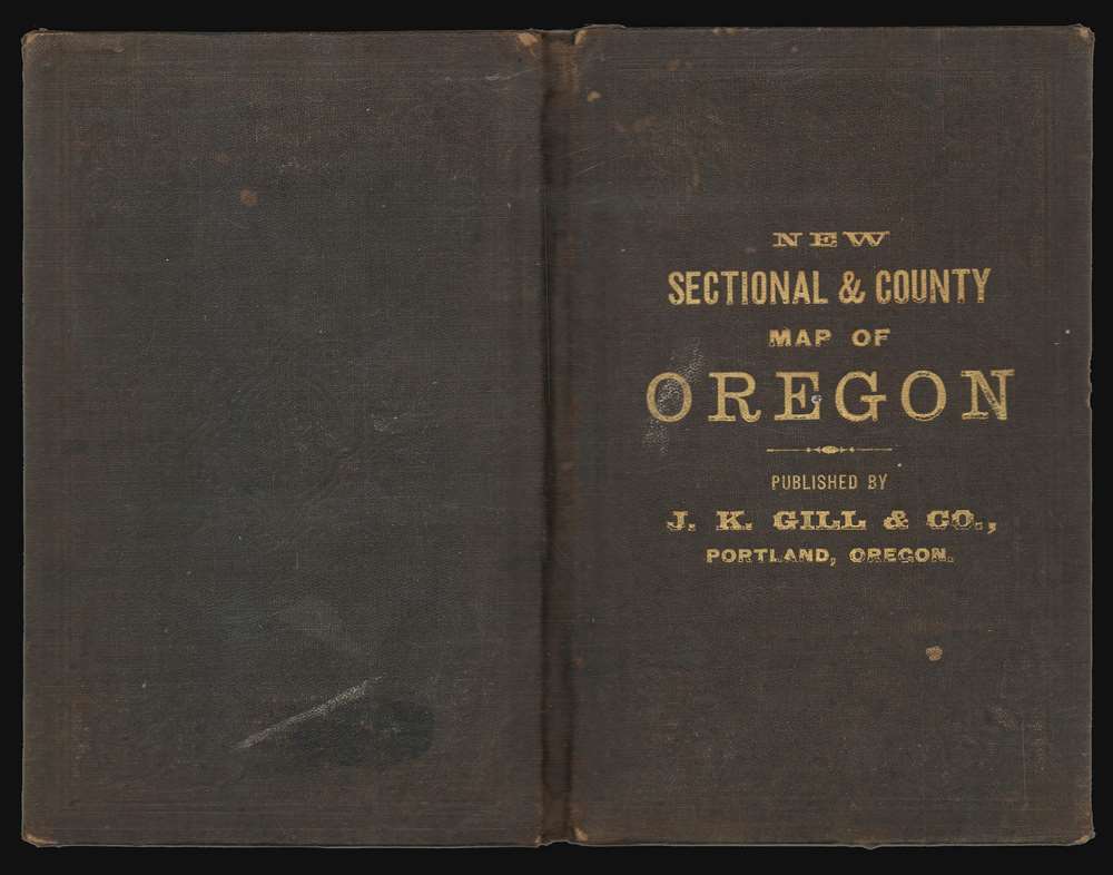
This map was engraved and printed in New York by G.W. and C. B. Colton for Habersham. It was first published in Portland, Oregon, in 1874, by the bookseller and stationer J. K Gill. Gill issued later editions of the map under his own name, dropping Habersham, and was able to have them engraved and printed in Portland. All examples are scarce, but this one, with the remarkable Swamp Lands / Ish manuscript content, is unique.CartographerS
Robert Alexander Habersham (September 7, 1838 - April 15, 1921) was a civil and military engineer active in Washington and Oregon in the mid to late 19th century. Habersham was born in Habersham County, Georgia (named after his ancestors), where he was a descendent of Revolutionary War veteran James Habersham. It is unclear where he was educated as an engineer, but he worked as an engineer in Brazil on the Dom Pedro II railroad, during which time he met and married Mariquinha Dos Reis. In the 1870s he was in the U.S. Army, serving as an engineer with the rank of 2nd Lieutenant in the 1st Cavalry. He worked in the Portland Office of the Army Corps of Engineers, achieving the rank of general. From 1896, he served two terms as United States Surveyor General of Oregon. Among his more notable work was the 1874 survey of the Cascades of the Columbia River, for which he served as chief of the party. Later in life (after 1914), Habersham relocated to his wife's hometown in Brazil. He died in São Paulo, Brazil, in 1921 and is buried in the Araça cemetery. He is known for detailed and significant maps of Oregon, Washington, and Alaska. More by this mapmaker...
John Kaye Gill (May 6, 1851 - December 30, 1929) was an American journalist, publisher, and stationer active in Massachusetts and Oregon in the late 19th and early 20th centuries. Gill was born in Holmfirth, England, but emigrated to the United States in 1855, when he was just 3 or 4. After working as a correspondent for the Smithsonian Institution, he relocated to Portland, Oregon, where he established himself as a stationer, publisher, and bookseller. He is best known for issuing an updated and expanded edition of François Norbert Blanchet's 1852 Dictionary of the Chinook Jargon. While involved with emigration and settlement in Oregon, Gill was openly critical of the poor treatment of the indigenous population. He published several important maps of Oregon, Washington, and Alaska, both with others, such as Robert Alexander Habersham (1838 - 1921) and independent under his own imprint. Gill lived in Portland until his death of an arterial hemorrhage in 1929. Learn More...
Joseph Hutchins Colton (July 5, 1800 - July 29, 1893), often publishing as J. H. Colton, was an important American map and atlas publisher active from 1833 to 1897. Colton's firm arose from humble beginnings when he moved to New York in 1831 and befriended the established engraver, Samuel Stiles. He worked under Stiles as the 'Co.' in Stiles and Co. from 1833 to 1836. Colton quickly recognized an emerging market in railroad maps and immigrant guides. Not a cartographer or engraver himself, Colton's initial business practice mostly involved purchasing the copyrights of other cartographers, most notably David H. Burr, and reissuing them with updated engraving and border work. His first maps, produced in 1833, were based on earlier Burr maps and depicted New York State and New York City. Between 1833 and 1855, Colton proceeded to publish a large corpus of guidebooks and railroad maps, which proved popular. In the early 1850s, Colton brought his two sons, George Woolworth Colton (1827 - 1901) and Charles B. Colton (1832 - 1916), into the map business. G. W. Colton, trained as a cartographer and engraver, was particularly inspired by the idea of creating a large and detailed world atlas to compete with established European firms for the U.S. market. In 1855, G.W. Colton issued volume one of the impressive two-volume Colton's Atlas of the World. Volume two followed a year later. Possibly because of the expense of purchasing a two-volume atlas set, the sales of the Atlas of the World did not meet Colton's expectations, and so, in 1856, the firm also issued the atlas as a single volume. The maps contained in this superb work were all original engravings, and most bear an 1855 copyright. All of the maps were surrounded by an attractive spiral motif border that would become a hallmark of Colton's atlas maps well into the 1880s. In 1857, the slightly smaller Colton's General Atlas replaced the Atlas of the World. Most early editions of the General Atlas published from 1857 to 1859 do not have the trademark Colton spiral border, which was removed to allow the maps to fit into a smaller format volume. Their customers must have missed the border because it was reinstated in 1860 and remained in all subsequent publications of the atlas. There were also darker times ahead; in 1858, Colton was commissioned at a sum of 25,000 USD by the government of Bolivia to produce and deliver 10,000 copies of a large format map of that country. Although Colton completed the contract in good faith, delivering the maps at his own expense, he was never paid by Bolivia, which was at the time in the midst of a series of national revolutions. Colton would spend the remainder of his days fighting with the Bolivian and Peruvian governments over this payment, and in the end, after a congressional intervention, he received as much as 100,000 USD in compensation. Nonetheless, at the time, it was a disastrous blow. J. H. Colton and Company is listed as one of New York's failed companies in the postal record of 1859. This led Colton into the arms of Alvin Jewett Johnson and Ross C. Browning. The 1859 edition of Colton's General Atlas lists Johnson and Browning as the 'Successor's to J. H. Colton' suggesting an outright buyout, but given that both companies continued to publish separately, the reality is likely more complex. Whatever the case may have been, this arrangement gave Johnson and Browning access to many of Colton's map plates and gave birth to Johnson's New Illustrated (Steel Plate) Family Atlas. The Johnson's Atlas was published parallel to Colton's atlases well into the 1880s. The Colton firm itself subsequently published several other atlases including an Atlas of America, the Illustrated Cabinet Atlas, the Octavo Atlas of the Union, and Colton's Quarto Atlas of the World. They also published a large corpus of wall maps, pocket maps, and guides. The last known publications of the Colton firm date to 1897 and include a map and a view, both issued in association with the Merchant's Association of New York. Alice M. Colton married August R. Ohman (May 3, 1859 - April 22, 1934) on January 5, 1897. In 1898, Ohman joined the Colton firm, which continued to publish as Colton, Ohman & Co. until 1901. Learn More...
Condition
Very good. Old fold lines. Map has verso stabilization at most fold intersection. Minor spotting here and there, especially where originally attached binder. There are some old tape repairs at left center, near the border, and at the fold intersection near Springfield. Accompanied by original binder.
References
OCLC 820458087.