
1882 Baur Enormous Folding Wall Map of the Austro-Hungarian Empire

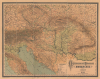
Oesterreichisch Ungarische Monarchie.
Balancing Out the Balkans.
- Digital Map Information
- Suitable for large format printing
- File Size: 223.67 MB
- File Type: ZIP / TIFF
- ICC color profile embedded
- Delivered instantly via download link
Balancing Out the Balkans.
This is a massive (56 x 70.5 in.) folding wall map of the Austro-Hungarian Empire, prepared in 1882 by Carl Friedrich Baur. It depicts the lands of the Dual Monarchy in the aftermath of the 1878 Congress of Berlin, which saw Austria-Hungary occupy Bosnia and Herzegovina as part of a coordinated effort to limit Russian influence in the Balkans.A Closer Look
The map's considerable size allows for stunning detail over a portion of central and eastern Europe, spanning from central Germany (Fulda) to Volhynia in the north to Rome and Montenegro, Serbia, and Wallachia in the south. Color shading and hachures are used to indicate terrain and elevation, while the peaks of mountains, glaciers, ice fields, and swamplands are noted. Cities, towns, and villages are marked throughout according to symbols explained in the legend at bottom. Roads, railways, administrative borders, and rivers are traced (the Danube or Donau being especially prominent), while forts, fortifications, historic battlefields, spas and springs, mines, and saltworks are also indicated.Historical Context
This map was produced during a period of complex geopolitical jockeying in the aftermath of German unification under Prussian (rather than Austrian) domination, the weakening of the Ottoman Empire, and growing Russian influence in the Balkans. Austria-Hungary, which was formed in large part as a result of Austria's defeat at the hands of Prussia in 1866, remained neutral in the Russo-Turkish War (1877 - 1878), but the resulting Treaty of San Stefano almost guaranteed Russian indirect control of the Balkans. Therefore, with British support and the mediation of Otto von Bismarck, a new arrangement for the Balkans was negotiated at the 1878 Congress of Berlin. As a result, Serbia, Montenegro, and Romania became independent, while Austria occupied but did not annex Bosnia and Herzegovina, which remained nominally under Ottoman rule. Nevertheless, they are included within the borders (Haupt-Reichsgrenze) of Austro-Hungary here, reflecting their true status as de facto colonies of the Dual Monarchy. In contrast to Russian-led pan-Slavism, Austria-Hungary adopted a conservative cosmopolitanism to counter Russian influence, an approach that coalesced in the 1870s under Foreign Minister Gyula Andrássy.Publication History and Census
This map was edited by Carl Friedrich Baur and published by Eduard Hölzel Geographisches Institut in Vienna in 1882. The map is quite rare; we have not been able to locate any examples of this edition of the map in institutional collections or on the market, while other editions (dating to between 1874 and 1880) are held by the Bibliothèque nationale de France and the British Library.Cartographers
Carl Fredrich Baur (fl. c. 1850 - 1900) was a German map publisher active in Stuttgart during the mid to late 19th century. Baur was little known outside of Germany but nonetheless produced a number of important map most of which had a thematic or historic context. His most notable work is most likely the 1857 Atlas fur Handel und Industrie fur Kaufleute, Fabrikanten und Gewerbetreibende, one of the first industrial and commercial atlases of the 19th century. Further Details...
Eduard Hölzel (October 8, 1817 - December 21, 1885) was a bookseller and publisher best known for his geographic educational works and atlases of the lands of the Austro-Hungarian Empire. Born in Prague, Hölzel came from a family with wide interests and a propensity for the arts. His father was an amateur painter and friend of Alois Senefelder (1771 - 1834), the inventor of lithography, and his son Adolf Hölzel (1853 - 1934) became a noted painter. Eduard Hölzel trained as a bookseller in Germany before opening his own shop in Olomouc, Moravia, in 1844. His success with this store led him to open more branches in several nearby cities. In 1858, he partnered with the geographer Blasius Kozenn (1821 - 1871) to publish a pioneering school atlas, which went on to be reissued for many years in various languages and became known to generations of pupils in the Austrian and Hungarian lands as the 'Kozenn School Atlas' (its full title being Geographischer Schulatlas für die Gymnasien, Real- und Handelsschulen der österreichischen Monarchie). In 1861, Hölzel acquired the Vienna lithographic printing firm of Carl Horegschi and founded his own geographical institute and publishing house. In 1871, Hölzel moved to Vienna and began to prepare his sons Hugo and Adolf to take over the company. However, Hugo was often ill and Adolf turned to painting, so that Hölzel's son-in-law Emil Kosmack came to play a major role. Just before his death, Hölzel transferred his company to Hugo and Kosmack, both of whom would be dead within a decade. Hugo Hölzel's widow retained ownership of the company while management passed to Wilhelm Zwierzina. The firm faced many ups and downs over the following decades, but remarkably survives today as Hölzel Verlag with a focus on educational materials. Further Details...
Condition
Very good. Even overall toning. Some soiling. Original linen backing stable.
References
OCLC 556461666, 494208510.