
1864 Noel / Vivien Massive Case Map of the Ottoman Empire

This item has been sold.
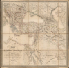
Carte de l'Empire Ottoman Comprenant les Possessions de la Porte en Europe, en Asie et en Afrique; avec les parties limitrophes de l'Arabie, de la Perse, de la Russie et de l'Empire d'Autriche.
Keeping the Ship Afloat
- Digital Map Information
- Suitable for large format printing
- Full resolution TIFF file
- ICC color profile embedded
- Delivered instantly via download link
Keeping the Ship Afloat
This is an impressive, large-format 1864 folding map of the Ottoman Empire and environs, prepared by Louis Vivien de Saint-Martin and Joseph-Marin-Adolphe Noël des Vergers and published by J. Barthelemier. It presents the Empire in the aftermath of the Crimean War (1853 - 1856), when the Empire attempted to modernize and recover from the loss of territory earlier in the century.A Closer Look
The map covers from Austria (Vienna appears near the top-left corner) to the Caspian Sea in the north and from the Gulf of Sidra to the Persian Gulf in the south. Administrative borders (eyalets and sanjaks) are traced while the territories of respective empires and kingdoms are color-shaded, as indicated below the title at bottom. Main roads are traced in black in the Asian portion of the Empire, while cities and towns, mountains, waterways, minor roads, and maritime features (such as banks in the Red Sea) are indicated throughout. An inset at bottom-right covers the southernmost part of Arabia and the adjoining part of the Red Sea and Egypt. Sixteen scales at bottom-right reflect the complexity of cultures and measures within and along the borders of the Ottoman Empire.Keeping the Ship Afloat
This map was made during a period when the Ottoman Empire seemed to be successfully responding to several setbacks earlier in the 19th century. Although still under continuous threat by foreign powers, namely Russia, the intervention of France and Britain in the Crimean War (1853 - 1856) appeared to limit Russian expansionism. The Tanzimat reforms launched in 1839 were making slow but tangible changes to the Empire, introducing modern ideas and technology. Legal and political measures were also undertaken to mollify the increasingly self-conscious nationalities of the Empire. These reform efforts were embraced with renewed enthusiasm upon the ascension of Sultan Abdulaziz I in 1861, who aimed to modernize the Empire's military and infrastructure. He also oversaw the implementation of administrative reforms (not reflected here) launched in 1864 that completely reorganized the internal structure of the Empire. However, as his successors would discover, Abdulaziz's sensible reforms were inadequate in retrospect, and some even appeared to worsen rather than ameliorate the Empire's most pressing problems, especially the rise of nationalism.Publication History and Census
This map was published in 1864 by J. Barthelemier, successor to cartographer and map publisher Charles Picquet. It is a later edition of a map first prepared by Noël and Vivien in 1824 as twelve separate sheets. The map was later compiled as a folding map and published in multiple editions thereafter. The present work is a considerably later and seemingly rarer edition, updated to reflect territorial changes (such as those resulting from the Crimean War in Southern Bessarabia). The Noël and Vivien map bears a similarity to a contemporary map by Pierre Lapie, noted as being 'dressée en 1816' but not published until 1828, making it difficult to ascribe primacy. In any event, we have been unable to locate this 1864 Barthelemier edition of this map in any institutional collections or on the market.Cartographers
Louis Vivien, called Vivien de Saint-Martin, (May 17, 1802 - December 26 1896) was a 19th-century French geographer. Prolific and long lived, he had at least a dozen major titles to his credit, including an 1841 history of the French Revolution, an 1844 history of Napoleon, an 1873 history of geography, and (in partnership with Franz Schrader) his Atlas universal de géographique. Nothing has come down to us of his early years, but he was hailed during his lifetime: he was Honorary President of the Société de Géographie de Paris, member of the Royal Academy of Sciences in Berlin, and honorary member of the Royal Academy of Madrid. Further Details...
Joseph-Marin-Adolphe Noël des Vergers (June 2, 1805 - January 2,1867) was a French classicist, historian, archaeologist, and Orientalist. His father was Marin Noël des Vergers (1759 - 1836), a prominent businessman and later député of the Yonne department under the July Monarchy. In his youth, the younger Noël became a research assistant of chemist Baron Louis Jacques Thénard (1777 - 1857) and travelled widely through Europe and the Middle East, learning Arabic sufficiently well to translate a book by the Mamluk-era scholar Abulfeda. During the July Monarchy (1830 - 1848), he was sent to Sicily to examine the history and archaeology of the island's Islamic period. Later, in the 1850s, he and Italian archaeologist Alessandro François discovered and excavated the remains of the Etruscan port of Populonia. His published works included additional translations from Arabic, a history of Arabia, several studies of the Etruscans, and works on Homer and Marcus Aurelius. Due to his importance for understanding Etruscan culture, Noël has been and remains better known in Italy than his native France. Further Details...
Charles Picquet (April 15, 1771 – January 15, 1827) was a French cartographer active in Paris during the Napoleonic and post-Napoleonic Eras. Picquet was born in Romagna-sous-Montfaucon, Meuse, France. From about 1798 Picquet supplied maps to the Dépôt de la Guerre. From 1806 he was appointed to Napoleon's Cabinet Topographique. Being politically dexterous, he was able to retain this position after the fall of Napoleon under both Louis XVIII and Charles X. Under Louis XVIII he also obtained the Brevet de Géographe Ordinaire du Cabinet Topographique. He worked with the cartographer Adrien-Hubert Brué (1787 - 1832) on a major atlas project. When Charles Picquet died in 1827, his son, Pierre-Jacques Picquet, continued to publish under his father's imprint name well into the middle part of the 19th century. From roughly 1839, one J. Barthelemier also claimed to be the 'seul acquéreur et successor' of the 'ancienne maison Ch. Picquet' though it is unclear if he succeeded the younger Picquet or challenged his claim to succession. Barthelemier only published maps infrequently until the late 1850s, after which he maintained a more steady output until the early-mid 1870s. Further Details...
Condition
Very good. Dissected into twenty-eight sections and laid down on linen. Some wear and splitting along fold lines and at intersections. Separations to linen reinforced on verso.