
Picquet, Charles

Charles Picquet (April 15, 1771 – January 15, 1827) was a French cartographer active in Paris during the Napoleonic and post-Napoleonic Eras. Picquet was born in Romagna-sous-Montfaucon, Meuse, France. From about 1798 Picquet supplied maps to the Dépôt de la Guerre. From 1806 he was appointed to Napoleon's Cabinet Topographique. Being politically dexterous, he was able to retain this position after the fall of Napoleon under both Louis XVIII and Charles X. Under Louis XVIII he also obtained the Brevet de Géographe Ordinaire du Cabinet Topographique. He worked with the cartographer Adrien-Hubert Brué (1787 - 1832) on a major atlas project. When Charles Picquet died in 1827, his son, Pierre-Jacques Picquet, continued to publish under his father's imprint name well into the middle part of the 19th century. From roughly 1839, one J. Barthelemier also claimed to be the 'seul acquéreur et successor' of the 'ancienne maison Ch. Picquet' though it is unclear if he succeeded the younger Picquet or challenged his claim to succession. Barthelemier only published maps infrequently until the late 1850s, after which he maintained a more steady output until the early-mid 1870s.
One of the earliest obtainable specific maps of Charleston, South Carolina.
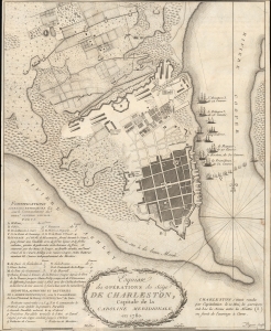
Esquisse des Opérations du Siège de Charleston, Capitale de la Caroline Méridionale, en 1780.
$1,750.00
Acquire
- Digital Map Information
- Suitable for large format printing
- File Size: 10.8 MB
- File Type: ZIP / TIFF
- ICC color profile embedded
- Delivered instantly via download link
An excellent 1787 American Revolutionary War map of Charleston, South Carolina. The map illustrates the 1780 Siege of Charleston, a major American Revolutionary War (1775 - 1783) battle, and one of the most devastating American defeats of the war. (more details)
New England during the War of 1812.
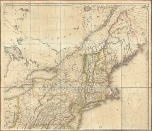
[New England].
$1,000.00
Acquire
- Digital Map Information
- Suitable for large format printing
- File Size: 36.52 MB
- File Type: ZIP / TIFF
- ICC color profile embedded
- Delivered instantly via download link
The northeastern sheet of Pierre Francois Tardieu's 1812 four-sheet map of the United States of America, based on Aaron Arrowsmith's seminal 1796 map of the same. Its publication coincided with the outbreak of the War of 1812 (1812 - 1815). Aside from its aesthetic qualities and level of detail, the map is notable for demonstrating the territorial evolution of the new republic. (more details)
Highlights numerous Native American tribes in the American West, including the Sioux and Osage.
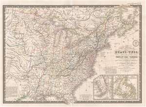
Carte Générale des États-Unis, des Haut et Bas-Canada, de la Nouvelle Ecosse, du Nouveau Brunswick, de Terre-Neuve, etc.
$200.00
Acquire
- Digital Map Information
- Suitable for large format printing
- DPI: 300
- File Size: 9.86 MB
- File Type: ZIP / TIFF
- ICC color profile embedded
- Delivered instantly via download link
This is an 1836 Adrien-Hubert Brué and Charles Picquet map of the United States. The map depicts the region from the Black Hills to the Atlantic Ocean and from Canada to Texas and the Gulf of Mexico. Beautifully engraved, myriad cities, towns, and villages are ... (more details)
The Caribbean in striking detail.
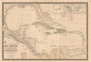
Carte Générale des Îles Antilles, des Îles et Bancs de Bahama, des États-Unis de l'Amérique-Centrale, de la Mer du Mexique, etc.
$900.00
Acquire
- Digital Map Information
- Suitable for large format printing
- File Size: 45.19 MB
- File Type: ZIP / TIFF
- ICC color profile embedded
- Delivered instantly via download link
This is a beautiful and wonderfully detailed Adrien-Hubert Brué and Charles Picquet 1845 map of the West Indies. Published 4 years after the Federal Republic of Central America ceased to exist, the map still illustrates that short-lived Central American republic. (more details)