1866 Van de Velde Wall Map of the Holy Land / Israel / Palestine
Palastina-vandevelde-1866$2,500.00

Title
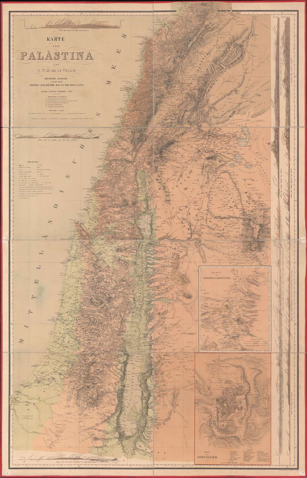
Karte von Palästina.
1866 (dated) 54 x 34.75 in (137.16 x 88.265 cm) 1 : 315000
1866 (dated) 54 x 34.75 in (137.16 x 88.265 cm) 1 : 315000
Description
One of the most important 19th-century maps of the region, this is the 1866 German edition of the Charles William Meredith van de Velde map of the Holy Land. Created from Van de Velde's surveys, the map depicts from Syria to the Dead Sea and from the Mediterranean Sea to Mount Zalmon (Alsadamus Mons). Per Mapping the Holy Land: The Foundation of a Scientific Cartography of Palestine, Van de Velde's map of Palestine
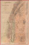
represented the complete body of Western geographical knowledge on Palestine, critically compiled, verified on-site and completed by his own measurements and his own (physical) experience, including the hardships needed to make a scientific map.Van de Velde effortlessly blends the modern and the ancient. Myriad cities and towns are labeled throughout, including Jerusalem, Hebron, Tyre, Sidon, and Damascus, and inset maps focus on Jerusalem itself and Jerusalem and its environs. Several terrain profiles appear around the sheet as well. One, in the upper left corner above the title, depicts the road from Beirut to Damascus. Another, below the title, illustrates the region from Cap Carmel to the Lake of Tiberias. Several profiles appear along the right border and run one into another, making it difficult to discern exactly where one stops and the next begins at a glance.
Publication History and Census
This map was created by Charles William Meredith van de Velde and published in 1866 by Justus Perthes. It was engraved in Gotha by Carl Hellfarth. In addition to the present German edition, English and French editions were published, but the publication history of each is difficult to trace. It appears that at least two different states of the English edition were published, one in 1858 and the other in 1865. We have found evidence of only one French edition. We note twelve examples of the present German edition cataloged in OCLC which are part of the collection at Princeton University, Duke University, the University of Michigan, the University of California Berkeley, the Royal Danish Library in Copenhagen, and the Sächsische Landesbibliothek in Dresden.CartographerS
Charles William Meredith van de Velde (December 3, 1818 - March 20, 1898) was a Dutch cartographer, painter, missionary, lieutenant commander second class, and honorary member of the Red Cross. Born in Leeuwarden, Van de Velde was educated at the Naval Academy at Medemblik and earned the rank of lieutenant commander second class. He worked in the topographical office in Batavia (modern-day Jakarta) from 1830 until 1841 and was eventually appointed the office's director. He published the 1857 Faces of the Dutch East Indies about his time in Batavia. The work was illustrated by fifty plates of his own composition. He was forced to return to Europe in 1844 due to health concerns, but visited Ceylon (Sri Lanka), the Transvaal, and the Cape of Good Hope during the voyage. Once back in Europe, Van de Velde devoted himself to geographic, ethnographic, and cartographic pursuits, and also worked as a missionary, draftsman, and nurse. He visited Palestine in 1851 and undertook measurements and made drawings that he used to publish two maps in 1857 through Justus Perthes. He published a work on Palestine and Syria in 1857 in Paris (written in French) that contained 100 of his illustrations. Van de Velde worked with the Dutch Red Cross from its inception in 1863 and was present at the opening conference in Geneva that year. The following year he was sent to Denmark to help treat soldiers wounded during the Prussian-Austrian War, and six years later was called to France to work with the Dutch doctors treating soldiers wounded during the Franco-Prussian War. Van de Velde died in Menton, France on March 20, 1898. More by this mapmaker...
Carl Hellfarth (November 30, 1846 - July 12, 1918) was a German printer. Hellfarth was born in Gotha, Germany. He married Amalie Friederike Marie Möller (1850 - 1916) on June 16, 1873, and they had eight children. Learn More...
Johan Georg Justus Perthes (September 11, 1749 - May 2, 1816) was one of the most important German cartographic engravers of the 19th century. He was born in the Thuringian town of Rudolstadt, the son of a court physician. In 1778, he began working as a bookseller in Gotha. Perthes began his publishing empire shortly thereafter with the 1784 issue of the famed survey of European nobility known as the Almanac de Gotha. In the next year, 1785, he founded the cartographic firm of Justus Perthes Geographische Anstalt Gotha. His son Wilhelm Perthes (1793 - 1853) joined the firm in 1814. Wilhelm had prior publishing experience at the firm of Justus Perthes' nephew, Friedrich Christoph Perthes, who ran a publishing house in Hamburg. After Justus Perthes died in 1816, Wilhelm took charge and laid the groundwork for the firm to become a cartographic publishing titan. From 1817 to 1890. the Perthes firm issued thousands of maps and more than 20 different atlases. Along with the visionary editors Hermann Berghaus (1797 - 1884), Adolph Stieler (1775 - 1836), and Karl Spruner (1803 - 1892), the Perthes firm pioneered the Hand Atlas. When Wilhelm retired, management of the firm passed to his son, Bernhardt Wilhelm Perthes (1821 – 1857). Bernhardt brought on the cartographic geniuses August Heinrich Peterman (1822 - 1878) and Bruno Hassenstein (1839 - 1902). The firm was subsequently passed to a fourth generation in the form of Berhanrd Perthes (1858 – 1919), Bernhard Wilhelm's son. The firm continued in the family until 1953 when, being in East Germany, it was nationalized and run as a state-owned enterprise as VEB Hermann Haack Geographisch-Kartographische Anstalt Gotha. The Justus family, led by Joachim Justus Perthes and his son Wolf-Jürgen Perthes, relocated to Darmstadt where they founded the Justus Perthes Geographische Verlagsanstalt Darmstadt. Learn More...
Condition
Very good. Dissected and mounted on linen in eight (8) panels. Linen exhibits wear along original fold lines. Pinholing in corners.
References
OCLC 11294785.