
Hellfarth, Carl
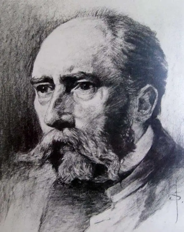
Carl Hellfarth (November 30, 1846 - July 12, 1918) was a German printer. Hellfarth was born in Gotha, Germany. He married Amalie Friederike Marie Möller (1850 - 1916) on June 16, 1873, and they had eight children.
From the sea to the Sudan.
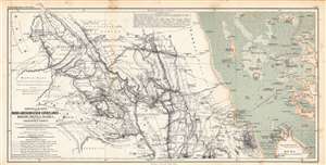
Originalkarte der Nord-Abessinischen Grenzlande Bogos, Mensa, Marea und der umliegenden Gebiete...
$350.00
Acquire
- Digital Map Information
- Suitable for large format printing
- File Size: 37.15 MB
- File Type: ZIP / TIFF
- ICC color profile embedded
- Delivered instantly via download link
This is an 1864 Augustus Petermann and Bruno Hassenstein map of what is today Eritrea, including a nautical chart of the Red Sea along the Eritrean coast. It illustrates the routes of mid-19th century European explorers from the Red Sea westwards to the Sudan. (more details)
Tracing the route of the Nile.
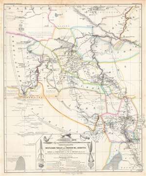
Originalkarte des westlichen Theiles des oberen Nil-Gebietes zur Übersicht der Reisen und Forschungen...
$275.00
Acquire
- Digital Map Information
- Suitable for large format printing
- File Size: 39.41 MB
- File Type: ZIP / TIFF
- ICC color profile embedded
- Delivered instantly via download link
This is a detailed 1865 Bruno Hassenstein map of the Upper White Nile, concurrent with the eastern part of today's South Sudan. It traces the routes of German and other European explorers of the mid-19th century, including those whose journeys had recently concluded in the months and years prior to publication. (more details)
German edition of one of the most important 19th century maps of the Holy Land.
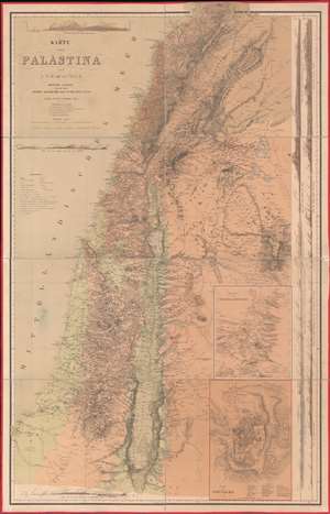
Karte von Palästina.
$2,500.00
Acquire
- Digital Map Information
- Suitable for large format printing
- File Size: 100.2 MB
- File Type: ZIP / TIFF
- ICC color profile embedded
- Delivered instantly via download link
One of the most important 19th-century maps of the region, this is the 1866 German edition of the Charles William Meredith van de Velde map of the Holy Land. Created from Van de Velde's surveys, the map depicts from Syria to the Dead Sea and from the Mediterranean Sea to Mount Zalmon (Alsadamus Mons). Per Mapping the Holy Land: The Foundation of a Scientific Cartography of Palestine, Van de Velde's map of Palestine
represented the complete body of Western geographical knowledge on Palestine, critically compiled, verified on-site and completed by his own measurements and his own (physical) experience, including the hardships needed to make a scientific map.Van de Velde effortlessly blends the modern and the ancient. Myriad cities and towns are labeled throughout, including Jerusalem, Hebron, Tyre, Sidon, and Damascus, and inset maps focus on Jerusalem itself and Jerusalem and its environs. Several terrain profiles appear around the sheet as well. One, in the upper left corner above the title, depicts the road from Beirut to Damascus. Another, below the title, illustrates the region from Cap Carmel to the Lake of Tiberias. Several profiles appear along the right border and run one into another, making it difficult to discern exactly where one stops and the next begins at a glance. (more details)
Mauch scouts out the Mozambican interior.
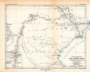
Originalkarte von Carl Mauch·s Reise von Simbabye nach Senna, 1871/72.
$350.00
Acquire
- Digital Map Information
- Suitable for large format printing
- File Size: 16.81 MB
- File Type: ZIP / TIFF
- ICC color profile embedded
- Delivered instantly via download link
This is an 1874 Augustus Petermann map of central Mozambique, tracing the journey of Carl (or Karl) Mauch, a German explorer. It depicts the area between the Zambezi and Save Rivers, where the Portuguese had long maintained a coastal presence with more tenuous control inland. (more details)
Advances in 19th Century Climate Science.
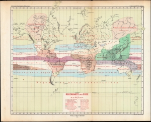
Regenkarte der Erde.
$250.00
Acquire
- Digital Map Information
- Suitable for large format printing
- File Size: 15.02 MB
- File Type: ZIP / TIFF
- ICC color profile embedded
- Delivered instantly via download link
A colorful map of the world on a Mercator Projection demonstrating climate regions, produced by Alexander Voeikov and published in 1874 in Petermann's Geographische Mitteheilungen. (more details)
Siwa, Bahariya, Farafra, Dakhla-Kharga Circuit.
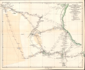
Originalkarte der von G. Rohlfs geführten Expedition in die Libysche Wüste, 1873 - 1874.
$500.00
Acquire
- Digital Map Information
- Suitable for large format printing
- File Size: 12.48 MB
- File Type: ZIP / TIFF
- ICC color profile embedded
- Delivered instantly via download link
A fascinating map of the deserts of western Egypt and eastern Libya, tracing the routes of the 1873 - 1874 Rohlfs Expedition, drawn by the expedition's surveyor Wilhelm Jordan. It is one of the few, and perhaps the first, early maps to detail the desert oases of western Egpyt. Today, the Siwa, Bahariya, Farafra, Dakhla-Kharga Route is a possible if rugged circuit for the adventurous traveler. (more details)
Missionaries in China and social upheaval.
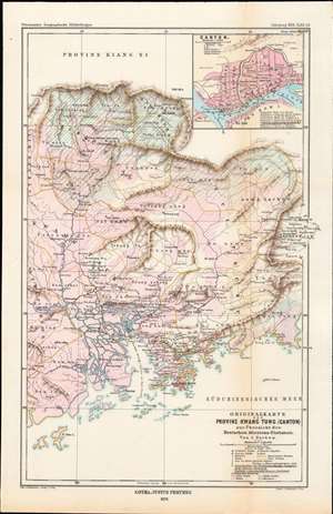
Originalkarte der Provinz Kwang Tung (Canton) zur Übersicht der Deutschen Missions-Stationen von J. Nacken / [Original map overview of the German mission stations of the province of Kwang Tung (Canton)].
$450.00
Acquire
- Digital Map Information
- Suitable for large format printing
- File Size: 7.92 MB
- File Type: ZIP / TIFF
- ICC color profile embedded
- Delivered instantly via download link
This is an 1878 Rev. Johannes Nacken map of the German mission stations in Guangdong Province, China, originally published in the geography journal Petermann's Geographische Mitteilungen. The map is indicative of the level of geographic and cultural knowledge about China in Europe at the time. (more details)