
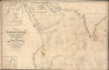
1845 Walker Nautical Chart of Persian Gulf, Arabian Sea, Indian Ocean


This item has been sold.
Chart of the Indian Ocean from the Cape of Good Hope to Calcutta, including the Red Sea and the Persian Gulf.
The China Trade in the Wake of the Opium War.
- Digital Map Information
- Suitable for large format printing
- File Size: 1059.71 MB
- File Type: ZIP / TIFF
- ICC color profile embedded
- Delivered instantly via download link
The China Trade in the Wake of the Opium War.
This is John Walker's 1845 blueback nautical map of the Indian Ocean, featuring extensive annotations relating to a 1847 - 1849 voyage of the barque Anne Maclean. It is notable for reflecting British hydrographers' and geographers' better understanding of the coastlines of the Indian Ocean, particularly along the Arabian Peninsula and the Persian Gulf, and for demonstrating Britain's growing hegemony over the Indian Ocean as part of its global trading networks.A Closer Look
This chart covers from the Red Sea and the east coast of Africa as far as the northern part of Mozambique and Madagascar to the east coast of India (Hindoostan), taking in the Arabian Sea and Persian Gulf. Soundings, hazards, shoals, rocks, islands, islets, ports, settlements, and coastal features (bays, capes, points, river deltas, etc.) are noted throughout in remarkable detail. Insets include the harbors and bays of Bombay, Aden, and Port Louis on Mauritius.The chart is notable for demonstrating improved understanding of the geography of the Arabian Peninsula in particular, including depicting Qatar as a peninsula (from British surveys in the 1820s) and noting Bahrein Island, 'El Biddah' (Doha), and 'Jezeerat Biliyard' roughly at the location of modern-day Abu Dhabi. With these improvements, nearly the entire coastline of this portion of the Indian Ocean between Madagascar and Calcutta had been well-surveyed, except for a small portion of the African coast south of Zanzibar and a portion of the Arabian Peninsula between Cape Isolette (Ras Madrakah) and Masirah Island.
Voyage of the Anne Maclean
The map features extensive annotations relating to a 1847 - 1849 voyage undertaken by Captain John Niven between Ardrossan (near Glasgow) to Aden (Persian Gulf), Bombay, China, and eventually to Jamaica and London on the barque Anne Maclean (Anna Maclean or Ann Maclean). The daily progress of the voyage is tracked along with annotations on the various parts of the trips ('Aden to Bombay,' 'From China to Madras,' and so on). Niven had overseen the construction of the ship, his second after the Earl of Eglington, and named it after his older sister Anne, who had married one John Maclean. According to the 1960 book The Family of Niven: with Biographical Sketches, the net profits from the voyage were about 1500 Pounds, of which Niven received one-eighth plus a small salary. Using these funds, combined with what he attained by selling the ship, Niven moved to the United States of America in 1850, settling in Indiana, after which the ship was owned and captained by John Laing, Niven's former shipmate. Laing undertook a 1851 voyage from Clyde to Ceylon, but the ship's fate afterwards is unknown.Historical Context
By the 1840s, the British East India Company (EIC) and the Royal Navy had effectively transformed the Indian Ocean from a contested space of diverse merchant networks into a 'British Lake.' This hegemony was built on a sophisticated 'triangular trade' system linking Britain, India, and China, in which Indian opium provided the necessary liquidity to purchase Chinese tea and silk without draining Britain's silver reserves.The conclusion of the First Opium War (1839 - 1842) served as a catalyst that solidified this regional supremacy. The 1842 Treaty of Nanjing forced the opening of five treaty ports and the cession of Hong Kong. This fallout fundamentally altered Indian Ocean dynamics, as Britain had already seized Singapore (1819) and Aden (1839), along with its EIC outposts in India. Aside from the Dutch presence in the East Indies, the British now had almost exclusive control over the primary gateways of the Indian Ocean, from South Africa to China, allowing them to regulate the flow of global traffic.
Blueback Charts
Blueback nautical charts began appearing in London in the late 18th century. Bluebacks, as they came to be called, were privately published large-format nautical charts known for their distinctive blue paper backing. The backing, a commonly available blue manila paper traditionally used by publishers to wrap unbound pamphlets, was adopted as a practical way to reinforce the low-quality paper used by private chart publishers to cut costs. That being said, not all blueback charts are literally backed with blue paper; some are unbacked or backed with linen. Moreover, blueback charts, which were typically composed of multiple sheets, were designed in a modular fashion so that multiple charts could be joined to create truly massive custom maps suited for specific voyages. The earliest known blueback charts include a 1760 chart issued by Mount and Page, and a 1787 chart issued by Robert Sayer. The tradition took off in the early 19th century, when British publishers like John Hamilton Moore, Robert Blachford, James Imray, William Heather, John William Norie, Charles Wilson, David Steel, R. H. Laurie, and John Hobbs, among others, rose to dominate the chart trade. Bluebacks became so popular that the convention was embraced by chartmakers outside of England, including Americans Edmund March Blunt and George Eldridge, as well as Scandinavian, French, German, Russian, and Spanish chartmakers. Blueback charts remained popular until the late 19th century, when government-subsidized organizations like the British Admiralty Hydrographic Office and the United States Coast Survey began issuing their own superior charts on high-quality paper that did not require reinforcement.Publication History and Census
This chart was prepared by John Walker, 'Geographer to the East India Company,' and published by W. H. Allen and Company in London. It is the northern part of a two-sheet chart, the bottom half covering Africa from Mozambique to the Cape Colony and the southern Indian Ocean, but it is here a standalone. Nonetheless, it is rare in any state and important for being an early chart connected with the British India and China Trade. Several editions of this chart were published between 1842 and 1857, with this second edition cataloged only in the holdings of Yale University, the National Library Board of Singapore, the Eberhard Karls Universität Tübingen, and the Bayerische Staatsbibliothek.Cartographers
John Walker (1787 - April 19, 1873) was a British map seller, engraver, lithographer, hydrographer, geographer, draughtsman, and publisher active in London during the 19th century. Walker published both nautical charts and geographical maps. His nautical work is particularly distinguished as he was an official hydrographer for the British East India Company, a position, incidentally, also held by his father of the same name. Walker's maps, mostly published after 1827, were primarily produced with his brothers Charles Walker and Alexander Walker under the imprint J. and C. Walker. Among their joint projects are more than 200 maps for the influential Society for the Diffusion of Useful Knowledge Atlas (SDUK). In addition they published numerous charts for James Horsburgh and the British Admiralty Hydrographic Office, including Belcher's important map of Hong Kong and Carless' exploratory map of Karachi. The J. and C. Walker firm continued to publish after both Walkers died in the 1870s. Further Details...
William Houghton Allen (April 14, 1788 - January 1855) was a bookseller and publisher in London, England. He was born in New Sleaford, Lincolnshire, England. Nothing is known of his early education, but he was admitted to the London Company of Stationers as a bookseller in 1817. Shortly afterwards, in 1818, he partnered with others to form 'Black, Kingsbury, Parbury and Allen'. This would evolve into Kingsbury, Parbury, and Allen (William Houghton Allen, Thomas Kingsbury, Charles Parbury) in 1822, and again into Parbury, Allen, and Co. in 1827. In 1835, he struck out on his or, partnering with his sons James Pearce Allen(1818 - 1878) and William Ferneley Allen (1816 - 1877) as 'W. H. Allen and Company'. As 'W. H. Allen, the firm established close ties with the British East India Company, who had offices nearby, also on Leadenhall Street. The firm later moved to 12 Waterloo Place. After Allen's death, the firm went through numerous acquisitions and mergers with the name 'W.H. Allen' persevering until 1991, when it was subsumed into Virgin Publishing. Further Details...
Condition
Average. Sailed nautical chart with manuscripts recording a known voyage. Original linen backing (not blue). Edge wear with some chipping. Stains and oils fingerprints.
References
OCLC 1077786355, 723462783. Niven, J., The Family of Niven : with Biographical Sketches, (San Francisco: The Recorder Printing and Publishing Co.) 1960.