Digital Image: 1805 William Faden Nautical Chart of Coastal Peru
Peru-faden-1805_d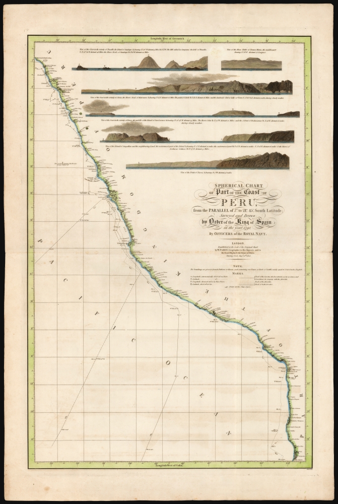

Title
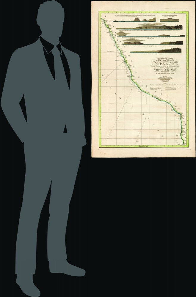
Spherical chart of part of the coast of Peru, from the Parallel of 7.° to 21.° 45.' South Latititude; Surveyed and Drawn by Order of the King of Spain in the year 1790, By Officers of the Royal Navy.
1805 (dated) 33.5 x 22 in (85.09 x 55.88 cm) 1 : 2150000
1805 (dated) 33.5 x 22 in (85.09 x 55.88 cm) 1 : 2150000
Description
FOR THE ORIGINAL ANTIQUE MAP, WITH HISTORICAL ANALYSIS, CLICK HERE.
Digital Map Information
Geographicus maintains an archive of high-resolution rare map scans. We scan our maps at 300 DPI or higher, with newer images being 600 DPI, (either TIFF or JPEG, depending on when the scan was done) which is most cases in suitable for enlargement and printing.
Delivery
Once you purchase our digital scan service, you will receive a download link via email - usually within seconds. Digital orders are delivered as ZIP files, an industry standard file compression protocol that any computer should be able to unpack. Some of our files are very large, and can take some time to download. Most files are saved into your computer's 'Downloads' folder. All delivery is electronic. No physical product is shipped.
Credit and Scope of Use
You can use your digial image any way you want! Our digital images are unrestricted by copyright and can be used, modified, and published freely. The textual description that accompanies the original antique map is not included in the sale of digital images and remains protected by copyright. That said, we put significant care and effort into scanning and editing these maps, and we’d appreciate a credit when possible. Should you wish to credit us, please use the following credit line:
Courtesy of Geographicus Rare Antique Maps (https://www.geographicus.com).
How Large Can I Print?
In general, at 300 DPI, you should at least be able to double the size of the actual image, more so with our 600 DPI images. So, if the original was 10 x 12 inches, you can print at 20 x 24 inches, without quality loss. If your display requirements can accommodate some loss in image quality, you can make it even larger. That being said, no quality of scan will allow you to blow up at 10 x 12 inch map to wall size without significant quality loss. For more information, it is best consult a printer or reprographics specialist.
Refunds
If the high resolution image you ordered is unavailable, we will fully refund your purchase. Otherwise, digital images scans are a service, not a tangible product, and cannot be returned or refunded once the download link is used.
Cartographer S
William Faden (July 11, 1749 - March 21, 1836) was a Scottish cartographer and map publisher of the late 18th century. Faden was born in London. His father, William MacFaden, was a well-known London printer and publisher of The Literary Magazine. During the Jacobite Rebellion (1745 - 1746), MacFaden changed his family name to Faden, to avoid anti-Scottish sentiment. Faden apprenticed under the engraver James Wigley (1700 - 1782), attaining his freedom in 1771 - in the same year that Thomas Jefferys Sr. died. While Thomas Jefferys Sr. was an important and masterful mapmaker, he was a terrible businessman, and his son, Jefferys Jr., had little interest in building on his father's legacy. MacFaden, perhaps recognizing an opportunity, purchased his son a partnership in the Jefferys firm, which subsequently traded as 'Faden and Jefferys'. Jefferys Jr. also inherited Jefferys Sr.'s title, 'Geographer to the King and to the Prince of Wales'. With little interest in cartography or map publishing, Jefferys Jr. increasingly took a back seat to Faden, and by 1776, he had withdrawn from day-to-day management, although he retained his financial stake. The American Revolutionary War (1775 - 1783) proved to be a boom for the young 'Geographer to the King', who leveraged existing materials and unpublished manuscript maps to which he had access via his official appointment to publish a wealth of important maps, both for official use and the curious public - this period of prosperity laid the financial underpinning for Faden, who by 1783, at the end of the war, acquired full ownership of the firm and removed the Jefferys imprint. In 1801, he engraved and published the first maps for the British Ordnance Survey. By 1822, Faden published over 350 maps, atlases, and military plans. He retired in 1823, selling his plates to James Wyld Sr. Faden died in 1836. More by this mapmaker...
Felipe Bauzá y Cañas (February 17, 1764 - March 3, 1834) was a Spanish cartographer, navigator, and naval officer active in the late 18th and early 19th centuries. Bauzá was born on the Balearic Islands in the Mallorcan city of Palma. He attended the Spanish maritime college in Cartagena, Spain. He saw action during the Siege of Gibraltar (1779 - 1782), the capture of Port Mahón, and a campaign against the Moors (1783 - 1784). Exhibiting a proficiency in mathematics and draftsmanship, he subsequently trained as a hydrographer and cartographer under Vicente Tofiño (1732 – 1795), the premier Spanish nautical chartmaker of the day. Bauzá was the head cartographer on the Malaspina Expedition (1789 - 1794) to the Americas, Oceania, and Australasia. From 1797, he worked with the Depósito Hidrográfico / Dirección Hidrografica in Madrid, becoming head of said organization in 1815. Renowned as a cartographer, he was honored with the Russian Cross of St. Vladimir in 1816 and was elected a Foreign Member of the Royal Society of London in 1819. From about 1800, he began assembling a personal collection of maps and charts intended to form the backdrop of a series of definitive maps of Latin America. Political fate intervened with his plan. Bauzá was a supporter and leader of the of Rafael de Riego Revolution in 1920, and served the Cortes Generales during the Trienio Liberal ('Three Liberal Years', 1820 - 1823), as the deputy for Mallorca. After the fall of that regime, in 1823, he was sentenced to death by King Ferdinand VII. Bauzá fled to England in that year, taking with him his nautical charts and other geographical source materials. Bauzá and his family struggled in London, attempting to support themselves by publishing his cartography and selling parts of his collection to the British Admiralty's Hydrographic Office. His death sentence was finally commuted in 1833, but before he could return to Spain, he died of a brain hemorrhage. He family was left in destitution and his widow Teresa Rivera y Bauzá, made ends meet by selling his map collections. Some went to foreign governments (Venezuela) but most are not part of the Bauzá collection in the British Library. Learn More...
References
OCLC 77879427.