
1958 Hunting Aerosurveys Aerial Image Runs of Qatar North of Doha

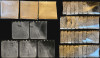
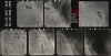
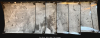
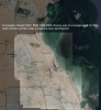
Hunting Aerosurveys Ltd. Qatar. Run 25 / Run 26 / Run 26 ext.
Early Photogrammetric Aerial Survey of Qatar.
Early Photogrammetric Aerial Survey of Qatar.
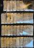
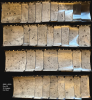
An exceptional discovery: three 1958 portfolios containing 80 original photogrammetric photographs, encompassing three aerial 'runs' over Qatar by Hunting Aerosurveys. They were produced on behalf of J.D. and D.M. Watson, British consulting engineers contracted by Qatar to engineer a stable, clean water supply for the rapidly expanding Doha. Coverage focuses on a peninsula-wide strip just north of Doha commiserate with the site of the ongoing Lusail megadevelopment.A Closer Look
The collection consists of 80 photos comprising the bulk of three aerial 'runs'. A 'run' refers to a single flight wherein photographs are taken at short intervals. In this case, each photo overlaps the previous by about 4 inches. Between the 3 runs, coverage embraces Qatar from roughly 25.43 - 25.51° North Latitude and from the east coast just north of Doha to the west coast in the vicinity of the Bay of Zekreet (Arabic: دَوْحَة زِكْرِيت). These include, on the easternmost sheets where the aerial photography runs began, an area about 10-14 km north of Doha's city center in the Al Daayen (الضعاين) municipality, including the developments of Rawdat Al Hamama (روضة الحمام), Al Sakhama (الصخامة), Umm AL Amad (أم العمد), and Umm Şalāl 'Alī (أم صلال عل).Contents include:
- Run 25 5836-5882, includes only 5836-5874, missing 8 plates (38 plates).
- Run 26 5966-6000 is complete (34 plates). Adjoins 25 just to the south.
- Run 26 Ext 6634-6647, includes only 6634-6640, missing 7 plates (7 plates). Extends Run 26 to the west coast.
This area in the vicinity of Doha comprises the northern sections zoned for Lusail (لوسيل), a massive, state-of-the-art urban development envisioned as a smart, sustainable, and futuristic city. Lusail spans over 38 square kilometers and is designed to accommodate more than 200,000 residents, with facilities for 170,000 workers and 80,000 daily visitors. The development is named after the historic town of Lusail, once the home of Qatar’s founding father, Sheikh Jassim bin Mohammed Al Thani.
Historical Context
These aerial surveys mark the beginning of Qatar's explosive oil-driven development in the second half of the 20th century. Located just to the south of the area covered here, Doha in 1958 remained a modest but rapidly evolving coastal town rooted in its traditional identity as a pearl-diving and fishing village. It was in the early stages of modernization, with basic infrastructure like paved roads, electricity, and water distribution being rapidly introduced. The region's fast-paced growth exacerbated existing challenges that plagued the Qatari Peninsula from antiquity - namely, a severely limited fresh water supply incapable of supporting sustained expansion and population growth. With oil income pouring in, the Emir Sheikh Ali bin Abdullah Al Thani contracted the British engineering firm J. D. and D. M. Watson to devise a solution. (By this time the Watsons had retired, and the work was carried out by Charles Hogg and George Martin Swan). The firm specialized in large-scale sewage, drainage, and infrastructure projects. With a lack of groundwater or rivers, the solution devised was the construction of massive seawater desalination plants. This work laid the foundation for the breakneck development in the subsequent decades that continues unabated to this day.Publication History and Census
This set of surveys was produced in 1958 by Hunting Aerosurveys on behalf of the civil engineering firm J.D. and D. M. Watson. We see no other cataloged surviving examples.Cartographer
Hunting Geology and Geophysics Ltd. (1952 - 1987) was a British surveying firm that specialized in cutting-edge methods of mapping, especially aeromagnetic surveys, and focused on discovering potential reserves of natural resources, especially fossil fuels. It was part of the larger Hunting Group, originally founded in 1874 as a shipping company by Charles Hunting, and later moving into aircraft, surveying, and petroleum. Companies within the Hunting group frequently merged with each other and with outside acquisitions, leading to frequent name changes; in this case, Hunting Aerosurveys (founded 1944) merged with Hunting Geophysics (founded 1952) to form Hunting Surveys in 1960. In 1965, a public company was formed called Hunting Associated Industries Ltd., which included Hunting Surveys (Holdings) Ltd. but not a new entity, Hunting Geology and Geophysics Ltd., which remained part of the privately-owned Hunting Group. In 1987, Hunting Geology and Geophysics Ltd. was closed down in a consolidation process that saw the public company (now Hunting PLC) buy out the Hunting Group, though the Hunting family retains a significant share of the company's stock and one of its members remains Chairman of the Board. Hunting Geophysics, and later Hunting Geology and Geophysics Ltd., made pioneering surveys of Great Britain itself, along with several countries in Central Africa (seeking uranium and other minerals), the Philippines, Ethiopia, and especially countries in the Middle East, where the company conducted critically important surveys that helped to develop the lucrative oil industries of the United Arab Emirates, Qatar, and Kuwait, among others. Further Details...
Condition
Very good. Original wraps worn and torn. Individual photos (9.75 x 9.25 in) exhibit slight edge wear.