
This item below is out of stock, but another example (left) is available. To view the available item, click "Details."
Details
1862 Colton Railroad Tourist Pocket Map of New England
1862 (dated) $900.00
1886 Colton Railroad Tourist Pocket Map of New England
RailroadNewEngland-colton-1886$600.00

Title
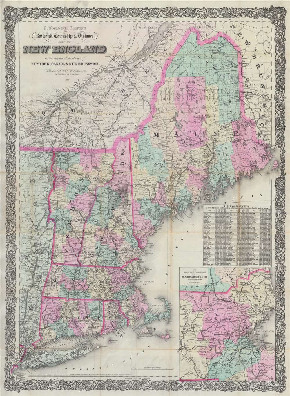
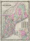
G. Woolworth Colton's Railroad, Township and Distance Map of New England with adjacent portions of New York, Canada and New Brunswick.
1886 (dated) 38.5 x 28 in (97.79 x 71.12 cm) 1 : 900000
1886 (dated) 38.5 x 28 in (97.79 x 71.12 cm) 1 : 900000
Description
This is an 1886 George Woolworth and Charles B. Colton railroad pocket map of New England. Created as a travel aid, the map details the expansive railroad network extending from Maine and Quebec to Long Island. Towns and villages along the railroad lines are identified and mileage is provided. An inset in the lower right focuses on the busy eastern Massachusetts corridor between Boston and Worcester. A table above the inset contains distances by rail from nearly 200 towns to New York, Hartford, Providence, Boston, Montpelier, Concord, and Augusta.
During this same era, much of the population began migrating westward, discovering the vastness and beauty of the American west. It is during this time the first national parks are established, transforming Americas relationship with the great outdoors. This new perspective, along with the perception that living in cities was unhealthful, led to the establishment of country and seaside 'resorts'. The constantly expanding railway network serviced the prosperous retreats. Nonetheless, it was not until the 1920s or 1930s, and the rise of the automobile, that vacationing became a viable activity across most of American society.
Late 19th Century Vacationing
As the Industrial Revolution progressed, population centers began shifting towards cities. These internal migrants found jobs in factories and mills, over time evolving into a prosperous middle class. Increased industrialization also led to urban pollution. This pollution, along with the increase in income, led to the want and need to 'escape' the city and 'get back to nature'.During this same era, much of the population began migrating westward, discovering the vastness and beauty of the American west. It is during this time the first national parks are established, transforming Americas relationship with the great outdoors. This new perspective, along with the perception that living in cities was unhealthful, led to the establishment of country and seaside 'resorts'. The constantly expanding railway network serviced the prosperous retreats. Nonetheless, it was not until the 1920s or 1930s, and the rise of the automobile, that vacationing became a viable activity across most of American society.
Publication History and Census
This map was created by George Woolworth and Charles B. Colton and published in 1886. The Coltons published editions of the present map beginning as early as 1864. The present 1886 edition is not cataloged in OCLC.Cartographer
Joseph Hutchins Colton (July 5, 1800 - July 29, 1893), often publishing as J. H. Colton, was an important American map and atlas publisher active from 1833 to 1897. Colton's firm arose from humble beginnings when he moved to New York in 1831 and befriended the established engraver, Samuel Stiles. He worked under Stiles as the 'Co.' in Stiles and Co. from 1833 to 1836. Colton quickly recognized an emerging market in railroad maps and immigrant guides. Not a cartographer or engraver himself, Colton's initial business practice mostly involved purchasing the copyrights of other cartographers, most notably David H. Burr, and reissuing them with updated engraving and border work. His first maps, produced in 1833, were based on earlier Burr maps and depicted New York State and New York City. Between 1833 and 1855, Colton proceeded to publish a large corpus of guidebooks and railroad maps, which proved popular. In the early 1850s, Colton brought his two sons, George Woolworth Colton (1827 - 1901) and Charles B. Colton (1832 - 1916), into the map business. G. W. Colton, trained as a cartographer and engraver, was particularly inspired by the idea of creating a large and detailed world atlas to compete with established European firms for the U.S. market. In 1855, G.W. Colton issued volume one of the impressive two-volume Colton's Atlas of the World. Volume two followed a year later. Possibly because of the expense of purchasing a two-volume atlas set, the sales of the Atlas of the World did not meet Colton's expectations, and so, in 1856, the firm also issued the atlas as a single volume. The maps contained in this superb work were all original engravings, and most bear an 1855 copyright. All of the maps were surrounded by an attractive spiral motif border that would become a hallmark of Colton's atlas maps well into the 1880s. In 1857, the slightly smaller Colton's General Atlas replaced the Atlas of the World. Most early editions of the General Atlas published from 1857 to 1859 do not have the trademark Colton spiral border, which was removed to allow the maps to fit into a smaller format volume. Their customers must have missed the border because it was reinstated in 1860 and remained in all subsequent publications of the atlas. There were also darker times ahead; in 1858, Colton was commissioned at a sum of 25,000 USD by the government of Bolivia to produce and deliver 10,000 copies of a large format map of that country. Although Colton completed the contract in good faith, delivering the maps at his own expense, he was never paid by Bolivia, which was at the time in the midst of a series of national revolutions. Colton would spend the remainder of his days fighting with the Bolivian and Peruvian governments over this payment, and in the end, after a congressional intervention, he received as much as 100,000 USD in compensation. Nonetheless, at the time, it was a disastrous blow. J. H. Colton and Company is listed as one of New York's failed companies in the postal record of 1859. This led Colton into the arms of Alvin Jewett Johnson and Ross C. Browning. The 1859 edition of Colton's General Atlas lists Johnson and Browning as the 'Successor's to J. H. Colton' suggesting an outright buyout, but given that both companies continued to publish separately, the reality is likely more complex. Whatever the case may have been, this arrangement gave Johnson and Browning access to many of Colton's map plates and gave birth to Johnson's New Illustrated (Steel Plate) Family Atlas. The Johnson's Atlas was published parallel to Colton's atlases well into the 1880s. The Colton firm itself subsequently published several other atlases including an Atlas of America, the Illustrated Cabinet Atlas, the Octavo Atlas of the Union, and Colton's Quarto Atlas of the World. They also published a large corpus of wall maps, pocket maps, and guides. The last known publications of the Colton firm date to 1897 and include a map and a view, both issued in association with the Merchant's Association of New York. Alice M. Colton married August R. Ohman (May 3, 1859 - April 22, 1934) on January 5, 1897. In 1898, Ohman joined the Colton firm, which continued to publish as Colton, Ohman & Co. until 1901. More by this mapmaker...
Condition
Very good. Exhibits light wear along original fold lines. Verso reinforcements to several fold intersections. Exhibits minor loss at a handful of fold intersections.