
1945 Thomas Bros. Map of San Francisco, Berkeley, and Oakland

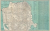
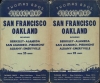
Thomas Bros. Street Map San Francisco, Oakland, including Berkeley-Alameda, San Leandro-Piedmont, Albany-Emeryville.
Bay Area near the End of World War II.
- Digital Map Information
- Suitable for large format printing
- Full resolution TIFF file
- ICC color profile embedded
- Delivered instantly via download link
Bay Area near the End of World War II.
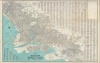
An impressively detailed c. 1945 large-format indexed folding map of San Francisco by Thomas Bros. The verso includes an equally comprehensive map of Oakland, Berkeley, Alameda, and other East Bay cities. Together, they reflect the development and integration of the Bay Area in the years before, during, and after World War II.A Closer Look
Coverage extends from Lake Merced in the south to the Golden Gate Bridge in the north and from the Great Highway in the west to Hunters Point in the east. It notes all major streets, piers, parks, cemeteries, reservoirs, streetcar, cable car, and bus lines, along with other features. A street index is included at right, corresponding to a grid surrounding the map, as well as indexes of points of interest in Golden Gate Park, the Presidio, Civic Center, and beyond. Illustrations appear throughout, depicting buildings, recreational opportunities, and other local characteristics.The map reflects the state of the city around the end of World War II (1939 - 1945) when it neared a configuration resembling that of today, with the Sunset and southern parts of the city almost fully developed. Ghosted-in streets in the McLaren Park Site shown here were never built, although parts of the originally designated park land were put to other uses over the years. In 1946, the park's current boundaries were fixed, and it was properly developed as a park with playgrounds, walking trails, sports fields, and a golf course.
Verso Map
This map is oriented towards the northeast, depicting the cities of the East Bay (San Francisco Bay Area), including Berkeley, Oakland, Alameda, San Leandro, Piedmont, Albany, Emeryville, and part of El Cerrito. An alphanumeric grid surrounds the map in the border and corresponds to indexes around the map for streets of individual East Bay cities. Roads, rail and streetcar lines, city and county limits, and waterways are clearly denoted. The University of California (Berkeley) is situated towards the top left. The presence of U.S. military facilities, marked with American flags, is exceptionally prominent, including the Alameda Naval Air Station and the Oakland Army Base.Publication History and Census
This map was published by Thomas Brothers around 1945. It is noted among the holdings of the California State University, Northridge, Indiana University, and University of Illinois at Urbana Champaign in the OCLC. The recto and verso maps also may have been separately issued, though the lack of a dated copyright makes this difficult to verify. A map closely resembling the recto map was printed in color for Thomas Bros.' San Francisco Info-Guide. However, there are other slight differences aside from coloration between that map and the present one (for example, the present map lacks Laurel Hill and Cavalry Cemeteries, which were in the process of being relocated c. 1945).Cartographer
Thomas Brothers (1915 – 1999) was a prominent California-based English-American publisher specializing in maps and guidebooks. Founded in Oakland in 1915 by George Copeland Thomas, Guilbert Thomas, and Leonard Thomas, the company began modestly, selling maps of movie stars' homes from a Hollywood street corner, before developing into a major cartographic and guidebook publisher. Following George Thomas's death in 1955, his widow retained attorney Warren Wilson to organize the company's affairs. When none of the Thomas heirs expressed interest in continuing the business, Wilson and accountant Tom Tripodic purchased it, preserving the Thomas Brothers tradition while pursuing a new direction and eventually relocating the company's headquarters from San Francisco to Irvine, California. The firm prospered under Tripodic, growing to more than 200 employees and dominating the West Coast map market. Rand McNally acquired Thomas Brothers in 1999, laid off many of its experienced cartographers and employees in 2003, and closed the company's remaining California operations in 2009. Further Details...
Condition
Very good. Light wear along original folds.
References
OCLC 1056157854.