This item has been sold, but you can get on the Waitlist to be notified if another example becomes available, or purchase a digital scan.
1885 Pavie Map of Southern Thailand and Cambodia - First Mission Pavie
SiamCambodge-pavie-1885$3,750.00

Title
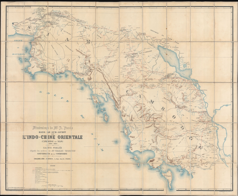
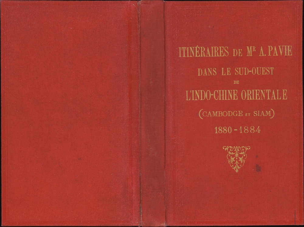
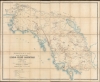
Itinéraires de Mr. A. Pavie dans le sud-ouest de L'Indo-Chine Orientale (Cambodge et Siam) (1880 - 1884).
1885 (undated) 42 x 51 in (106.68 x 129.54 cm) 1 : 460000
1885 (undated) 42 x 51 in (106.68 x 129.54 cm) 1 : 460000
Description
Considered the first scientific survey of Cambodia and southeastern Thailand, this seminal map was published following the 1884 completion of the first and most controversial Mission Pavie (1879 - 1885). Pavie's exploration, mapping, construction of telegraph lines, and successful negotiations with Rama V of Siam, laid the groundwork for the French colonial takeover of Cambodia. The present example is the explorer Auguste Jean-Marie Pavie's own copy.
Leaving Saigon in 1880, they traveled up the Mekong to Cambodia, where they explored Khmer ruins at recently discovered Angkor, producing detailed studies of the staggering architecture. From there, they continued to Siam, where Pavie met with King Chulalongkorn (Rama V; 1853 - 1910), with whom he negotiated a treaty that acknowledged French control of Cambodia in exchange for French recognition of Siamese sovereignty over the Chao Phraya delta. The treaty moreover laid down a line of demarcation between Siam and French Indochina, which was later finalized in the 1904 Franco-Siamese Treaty. En route, Pavie also laid telegraph lines from Bangkok to Pnom Pehn and Kampot.
A Closer Look
This zincograph map is expansive, with coverage from Bangkok east to Pnom Pehn, and south to include the island of Phu Quoc (now Vietnam). Western and southern coverage is limited by the Gulf of Siam, while eastern coverage terminates at the Tonle Sap and the Mekong River. Within its area of focus, the map offers more detail than any previous map of the same region, with meticulous delineation of river courses and topography. The complex routes of the first Mission Pavie, as well as the new telegraph lines they constructed, are highlighted in red.Historical Context
This map was produced in the context of French colonial expansion westward from Saigon into Cambodia. The colonial administrator in Saigon, Charles Antoine François Thomson (1845 - 1898), named here in the title, was in the process of leveraging diplomatic, economic, and military superiority to assert French control over Cambodian King Norodom (1834 - 1904). Pavie's first mission, while ostensibly scientific in nature, corresponded closely with these efforts and was undoubtably as much espionage and laying the groundwork for future French administration as academic research. Pavie's team, nonetheless, included botanists, geologists, archaeologists, and linguists.Leaving Saigon in 1880, they traveled up the Mekong to Cambodia, where they explored Khmer ruins at recently discovered Angkor, producing detailed studies of the staggering architecture. From there, they continued to Siam, where Pavie met with King Chulalongkorn (Rama V; 1853 - 1910), with whom he negotiated a treaty that acknowledged French control of Cambodia in exchange for French recognition of Siamese sovereignty over the Chao Phraya delta. The treaty moreover laid down a line of demarcation between Siam and French Indochina, which was later finalized in the 1904 Franco-Siamese Treaty. En route, Pavie also laid telegraph lines from Bangkok to Pnom Pehn and Kampot.
Missions Pavie
The 'Missions Pavie' (1879 - 1895) were a series of groundbreaking expeditions spanning some sixteen years into the little-known interior of Southeast Asia. The missions were instigated, led, and organized by the dynamic French explorer/diplomat Auguste Jean-Marie Pavie (1847 - 1925), known euphemistically as 'L'Explorateur aux Pieds Nus' ('The Barefoot Explorer') for his adoption of traditional Southeast Asian dress and customs. Collectively, the 'Missions Pavie' explored the largely unmapped inland territory between Siam (Thailand) and French Indochina (Vietnam), including much of modern-day Cambodia, Laos, and Vietnam. They were an extraordinary achievement, not only for their scope, scholarship, and accuracy, but also for the positive relationships they built with the peoples encountered - generally setting the stage for a peaceful transition to French regional hegemony.- 1879 - 1885 - Cambodia and Southeastern Siam as far as Bangkok
- 1886 - 1889 - Northeastern Laos and the Black River as far as Hanoi
- 1889 - 1891 - The Mekong River from Saigon to Luang Prabang
- 1894 - 1895 - The Laos-China-Burma border on the left bank of the Mekong to the Red River
Zincography
Zincography, or 'zinco' for short, is a planographic printing process similar to lithography. The process was known as early as 1801, when lithography inventor Alois Senefelder (1771 - 1834) in his original English patent for lithography, mentioned the possibility of using zinc plates over traditional limestone. The first zincographic process was subsequently patented in 1834 by Federico Lacelli. The process operates like traditional stone-lithography wherein ink applied to the plate is repelled by the hygroscopic areas, and attracted to the fuchsine areas. It offers several advantages, most importantly, zinc plates are lighter and cheaper than lithographic stones, economizing the process considerably. As such, the process was embraced by various cartographic agencies that demanded mobility and economy, among them the British Ordinance Survey, the French Bureau Topographique, and many military mapping agencies. It was followed by photo-zincography, photo-lithography, and photogravure.Publication History and Census
This map was printed around 1885, following the first 'Mission Pavie'. It was drawn in Cochinchine (Vietnam) by V. Roger and engraved in Paris by Maurice Perrin, where it was printed by Augustin Challamel. The map is rare. We note three other known examples in OCLC, one at the Bibliothèque nationale de France, a second at Oxford's Bodleian Library, and a third at the National Library of Australia.CartographerS
Auguste Jean-Marie Pavie (May 31, 1847 - June 7, 1925) was a French civil servant, explorer, and diplomate active in Southeast Asia in the late 19th and early 20th century. Pavie was born in Dinan, Brittany, the son of a cabinetmaker. As a young man he had a thirst for travel and adventure, joining the army in 1864, at age 17. By 1869 he was in Cochinchina (Vietnam) with the Troupes de Marine. He returned briefly to France to fight the Franco-Prussian War (1870 - 1871) but was back in Indochina by late 1871. He was posted to the telegraph station at Kampot, Cambodia, where he remained until about 1879. During this time, he 'went native', wearing local clothing and mastering Cambodian. In 1879, he caught the attention of Charles Le Myre de Vilers (1833 - 1918), governor of Cochinchina. Le Myre de Vilers assigned him to the first of what would become known collectively as the 'Missions Pavie' (1879 - 1895), a series of groundbreaking expeditions spanning some 16 years into the little-known interior of Southeast Asia:
- 1879 - 1885 - Cambodia and Southern Siam as far as Bangkok
- 1886 - 1889 - Northeastern Laos and the Black River as far as Hanoi
- 1889 - 1891 - The Mekong River from Saigon to Luang Prabang
- 1894 - 1895 - The Laos-China-Burma border on the left bank of the Mekong to the Red River.
Jean Baptiste Marius Augustin Challamel (March 18, 1818 - October 20, 1894) was a French historian, editor, and publisher active in Paris in the mid to late 19th century. Challamel is best known as a historian. Even so, although prolific, his personal work more often falls into pop-history and has little originality or merit. More significantly, Challamel also founded Challamel et Cie., a publishing house at 5 Rue Jacob. From this location, Challamel published extensively for French colonial interests in Africa, Asia, Indochina, and Polynesia. His work includes some of the most significant works documenting late 19th century French scientific discoveries, navigation, cartography, and scholarship. He held the contract for official French colonial office printings, including for the Bureau Topographique and the Service Geographique. Although Challamel died in 1894, his firm continued to operate until the 1920s. His heirs, operating under the same name, moved tore 17 Rue Jacob and renamed their firm Librairie Maritime et Coloniale, Augustin Challamel, Editeur. Learn More...
Eugène Dufrenoy (January 21, 1834 - 190x), aka Dufrenois, was a French printer, lithographer, and engraver active in Paris during the second half of the 19th and the early 20th centuries. Dufrénoy born in Bourg-la-Reine, in what is today the southern suburbs of Paris. He was based, for at least part of his career, at 34 Rue du Four, Paris. In 1881 Dufrénoy acquired a large space at 49 Rue du Montparnasse. This space still operates as a printshop with Dufrénoy's old presses as IDEM Paris. ˜ Learn More...
Condition
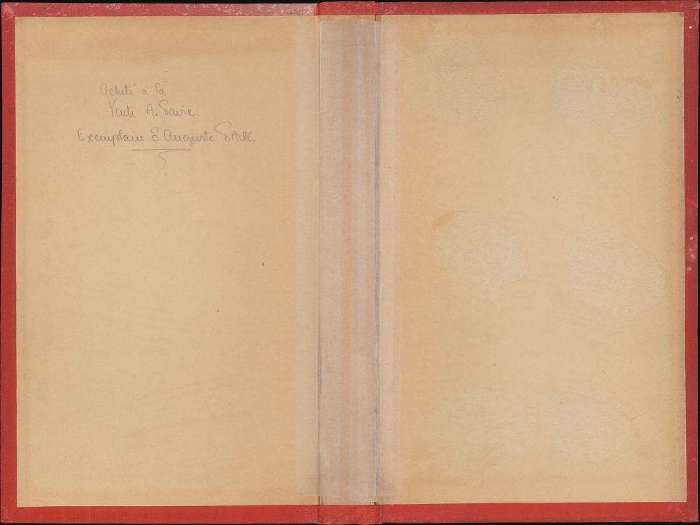
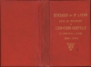
Very good. Original binder inscribed on inner cover by Pavie.
References
National Library of Australia, MAP RM 2809. Bodleian Library, Maps A18002217294. Bibliothèque nationale de France GE B-227.