
1895 Nakamura Map of Formosa - a diplomatic ploy to take over Taiwan!


Detailed Map of Taiwan Field Survey. / 實地踏測台灣詳密地圖
Japanese diplomatic and propaganda con-job on the Qing.
$11,000.00
Choose a Collection:
- Digital Map Information
- Suitable for large format printing
- Full resolution TIFF file
- ICC color profile embedded
- Delivered instantly via download link
This Item
Enquire
Japanese diplomatic and propaganda con-job on the Qing.
This 1895 Nakamura Yoshimatsu map of Taiwan is one of the most unsung but influential examples of persuasive cartography ever published. The large-scale map of Taiwan appeared at the end of the First Sino-Japanese War (August 1, 1894 - April 17, 1895), just prior to the Treaty of Shimonoseki (April 17, 1895) and the Japanese invasion of Taiwan (May 29, 1895 - October 21, 1895). The map, attributed to a likely fictional British naval officer named John Waters, employs creative cartography to reshape Taiwan, while retaining the overall area, effectively reducing the size of Qing-controlled Formosa and increasing the size of the ungoverned 'savage zones' - a ploy that played into the Japanese position that the Qing did not truly possess the island. It was likely presented at the Shimonoseki negotiations, where the Japanese were able to take advantage of Qing China's infamous lack of cartographic knowledge about Formosa to formally seize the island. This is the first edition of this map, published on January 20, 1895. It also accompanies the booklet Taiwan-tō Chishi-yō (臺灣島地誌撮要), a combination gazetteer of Taiwan and historiographical justification of the Japanese seizure of the island using Confucian political morality and just-war rhetoric.A Closer Look
This map was likely a diplomatic and propaganda ploy prepared in anticipation of the Shimonoseki treaty negotiations, which included an Imperial Japanese demand for the Qing cession of Formosa/Taiwan. The map illustrates Taiwan/Formosa with a striking, malformed shoreline and inaccurate interior, expanding Tainan and Hsinchu harbors into vast bites, adding corresponding projections to eastern Formosa, and shifting the Central Mountains westwards. Shimizu further misses the geography of the Tamsui River and Taipei entirely, instead placing Tamsui on the island's northwest coast, where Hsinchu is actually located. A note near the inaccurately placed Tamsui refers to the Sino-French War (1884 - 1885); fighting did indeed take place near Tamsui, but a map of the conflict should have pointed Shimizu to the harbor's correct location. The capital of Taiwan (台灣府城) is noted in large letters at present-day Tainan, while smaller text (台灣府) more accurately indicates its location at today's Taichung, though even this was inaccurate, as the capital had moved to Taipei from Taichung in 1887. The deviations from established Formosa cartography, much of which was available to the Japanese, indicate an insidious intent - a diplomatic deception intended to diminish the territorial significance of Qing-administered Formosa, then limited to the coastal lowlands west of the Central Mountain Range, while at the same time exaggerating the eastern ungoverned tribal regions and retaining the island's overall area.The Inaccuracies: Mistakes or Deceitful Propaganda?
The map is rife with errors and inaccuracies that are difficult to explain, especially when the inset regional map in the lower left presents a far more accurate picture of Taiwan/Formosa. We are also aware of c. 1874 manuscript maps collected by the Japanese that are far more accurate and detailed. Curiously, the errors are most pronounced on the historically well-mapped western or 'Chinese' side of the island. As previously noted, the cartographer exaggerates the size of Tainan and Hsinchu harbors, transforming them into vast bights, while at the same time mapping corresponding land projections on the eastern side of the island. Given that the western bays are mirrored by eastern projections, one might be tempted to assign this to a series of inaccurate measurements.There are several hints that this is not the case. First, Formosa is mapped correctly in the inset regional map in the lower left. Moreover, we are aware that the Japanese had accurate European maps of Taiwan collected for the Japanese Punitive Expedition of 1874. Second, the enlarged bays correspond to the largest and most important harbors in Taiwan at the time, Tainan and Hsinchu. The mismapping of these harbors dually reduced the apparent size of western Formosa, which was predominantly Qing Chinese, and correspondingly increased the size of the 'uncivilized' tribal lands of eastern Formosa - long a thorn in the side of Qing provincial administrators.
While this map was printed near the end of the First Sino-Japanese War, in February 1895, the powers had yet to sit down at the Shimonoseki negotiating tables, which did not occur until March 20, 1895. Nonetheless, Japanese interest in Formosa was well-established. Near the end of the Sino-Japanese War, the U.S. Minister in Beijing, Colonel Charles Denby, wrote, 'China ceding Taiwan to Japan was sure to be a condition of any peace settlement.'
During the negotiations at Shimonoseki, the Qing were initially unwilling to surrender Taiwan, recognizing its strategic military and commercial potential. Nonetheless, they ultimately relented. One imagines the Japanese negotiator pulling out this map, proudly proclaiming that it was a 'new' survey made by a 'British Royal Navy' officer and so sure to be accurate. Then, saying, 'Look how small the area of western Formosa under your control is! Look at these dangerous tribal lands in the mountains, who are always at war with you! We are doing you a favor…'
Japanese Occupation of Taiwan
Japan occupied Taiwan from 1895 to 1945. Japanese naval forces invaded Taiwan in May 1895, less than a month after the Treaty of Shimonoseki (April 17, 1895). The occupation of Taiwan fit into Imperial Japan's Nanshin-ron (南進論) or Southern Expansion Doctrine, which argued that Taiwan, Southeast Asia, and the Philippines were essential to Japan's economic and territorial growth. Katsura Taro (1747 - 1913), a Yamaguchi Samurai, wrote of Taiwan's significance, 'It is not only the most ideal location for expanding power to southern China, but also the islands of Southeast Asia.' Although there were some indigenous attempts at resistance and self-governance, including the founding of the 'Republic of Formosa,' Asia's first republic, the Japanese were quickly able to suppress Formosan nationalism. In less than 6 months, Japanese naval forces achieved, with the arguable exception of the tribal central highlands, full control of the island. Taiwan was Japan's first major extraterritorial holding, and Imperial Japan worked diligently to transform it into a showpiece 'model colony.' Japan lavished resources on the island's economy, including public works, industrial development, and cultural Japanization. After an initial period of unrest, the Japanese were generally effective in Taiwan, where they were, for the most part, well received by the Taiwanese, who appreciated their advanced technology and economic growth. Of course, the darker side of Imperial Japanese investment in Taiwan was its planned essential role in supporting Japanese military aggression in the Asia-Pacific.The Mysterious Source: John Walter / Water
Text on the map claims the cartography is copied from work done by a former British Royal Navy officer named John Walter or Water (ジョン・ウォートル), who supposedly surveyed Taiwan in 1894. We have been unable to trace Walter/Water/Waters or any survey work completed by this individual. Certainly, the British Royal Navy was active in around Formosa from 1817 and had successfully compiled a respectable map of the coast by 1867, but there is no record of 'Walter,' or any variant thereof, associated with any of the survey teams. We did identify a marine engineer by the name of 'John Walker' who was active in the Japan trade in 1894 when he was involved with a shipwreck of the Japanese-owned steamer Nagato Maru. Whoever 'Walter' was, he was either a terrible hydrographer or intentionally deceitful. Walter's map was translated into Japanese by Matsumoto Nikichi. It is likely that 'Walter' was a fiction created by the Japanese publisher Nakamura Yoshimatsu (中村芳松) to confer British legitimacy upon the map.The Inset Maps
From just under the title block, the insets are, clockwise,- 江蘇島 ('Jiangsu Island' - perhaps another cartographic myth that was seemingly meant to be located at the mouth of the Yangtze River)
- 海南島 (Hainan Island - also misshapen, though not as badly as Taiwan on the main map)
- 舟山島 (Zhoushan Island, oriented with east at top)
- 菲律賓群島 (Philippine Islands, north oriented)
- 澎湖島 (Penghu Island - supposedly, does not clearly resemble any of the Penghu Islands, and indicating a field for fishing sardines or herring 鰯魚場 off the east coast)
- 竹山島 (Zhushan Island - probably meant to represent three close islands of Upper, Middle, and Lower Zhushan 上竹山岛, 中竹山岛, 下竹山岛 off the coast of Ningbo).
- 崇明島 (Chongming Island)
- 普陀山島 (Putuoshan Island - identified as Putuoshan, but more closely resembles nearby Zhuijiajian Island, a strange error given the island's long connection with Japanese Buddhism; north oriented)
- 南澳島 (Nan'ao Island) - Small Island in Shantou County, directly west of Taiwan on China coast - oriented to the south.
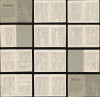
Taiwan-tō Chishi-yō (臺灣島地誌撮要) : Gazeteer and Justification
This is the only example of this map we've found that also includes its original accompanying booklet, Taiwan-tō Chishi-yō (臺灣島地誌撮要), edited by Jōsai Inshi (城西隠士) and printed by Maeda Kikumatsu (前田菊松). This work, comprising 18 pages as well as front and back covers, combines the features of a gazetteer - describing the island of Formosa, its people, history, climate, and geography - and a justification for the Japanese takeover. The writing takes on a historiographic tone that is at once pro-Japanese, anti-Western, and anti-Chinese. The text includes a long historical discussion (台灣往事ノ事實), claimed to have originally been written in Chinese, about the conquest of Formosa by the Zheng Chenggong (鄭成功 / Koxinga), who drove out the Dutch and established the Kingdom of Tungning in opposition to the Manchu-Qing dominion. It emphasizes that Koxinga was half-Japanese, underscoring long-standing Japanese claims to the island. It goes on to describe the 1874 Japanese Punitive Expedition to Formosa (Mudan Incident; 牡丹社事件) as a way to illustrate the weakness of Qing administration on Formosa, and the tide of Japanese victories during the First Sino-Japanese War (1894 - 1895). Japan's rise to power is described in historiographical terms reflective of proto-colonial Confucian ideology, suggesting a natural and moral act aligned with Heaven's mandate and global progress. We believe this booklet to be historically important and have accordingly included a full scan of all text.The work features a Latin-text letter written by the supposed Waters to the map's translator Matsumoto in Meiji-period pseudo-English, a type of writing that emerged in Japan during the late 19th century by printers, scholars, or translators who were imitating Western epistolary style without a mastery of English grammar or idiom. It is difficult to unpack, but not as random as it might seem, as it reflects phonetic approximations, literal Japanese-to-English constructions, and transliteration errors relating to typesetting and translation. Here is a detailed breakdown for anyone interested:
Original:
Famollin an permae of ineith an confu nesh. Dancing the noneefr Formosa camin gaull an wacuae zantio from 1,8 91 wakele the meleletu Saefegle yme 1,8 93 to year antnal Maculte the hotne porhanis daiotls Kaiticimong fand waris ueetering a clucistols the Inlmus burnis is writmong I isug Formosa me hastrsicr mope of Formosa…
Interpretation:
Following my previous communication and confirmation, I have completed a map of Formosa (Taiwan). The map was begun in 1891 and completed in 1893. It was compiled from various sources and records, and I have written about Formosa according to what I have learned.
Original:
Mr Shwmekar donbul it is wrvelnmirn yarsllkuars an melgring the mina nawanar I am cilicius…
Interpretation:
Mr. Schumacher [possibly a Western collaborator] assisted with verifying various places and names. I am conscious that there remain some inaccuracies.
Original:
…sauteing a coliu hawakar barissne necely is me morssnsiun uariyoxoson geldoos…
Interpretation:
I have carefully adjusted the boundaries and coastlines according to the most recent observations and reports.
Original:
…I am stonjculitng uariyons of colusmitonan me sosgle devly I amis on wakar meclmovon is ynlrsh hajntons Formosa glateka donlee overoon it is we melestls…
Interpretation:
I have studied various colonial maps and compared them with my own field notes on Formosa. The final map is, I believe, accurate and complete.
Original:
…ranpaing tilmaghinon can I enustar me waodus poceur a gastr yon we atowan the endsens to hadalker is hadlesong…
Interpretation:
I hope that this map may assist navigators, travelers, and those engaged in geographical studies of this island.
Original:
…Map of Formosa they eljm haigantor and sievalls we kändree the siluninoe to elmosting to me coclets goos einding I dont no…
Interpretation:
If there are errors or omissions in the details, I ask readers to kindly inform me.
Original:
The govarste a coste is pawales and nobul been budstor as you roomels of its nobul; be besece voris and eutling I am ontame gondore gosster of yoorastr…
Interpretation:
The government has not supported the cost of publication; I have produced it privately and at my own expense.
Original:
…no good ponmetrs cozetee an inkalsu which has cosepte for yaluston been wandrss the bifalermin an dangui it is masefin goods is Geography serins England, and University of Cambridge sekulinte…
Interpretation:
Nevertheless, I hope it will be found useful by students of geography both in England and at the University of Cambridge, where modern geographical studies are flourishing.
Original:
…Year of 1894. Mr. N. Matsumoto, Osaka Japan. Woutll, Corea.
Interpretation:
Mr. N. Matsumoto, Osaka, Japan - 1894.
Woutul, Korea.