
1845 Murataya City Map of Edo (Tokyo), Japan

[Edo].
The Tokugawa Scheme to Control Daimyo.
$2,200.00
Choose a Collection:
- Digital Map Information
- Suitable for large format printing
- Full resolution TIFF file
- ICC color profile embedded
- Delivered instantly via download link
This Item
Enquire
The Tokugawa Scheme to Control Daimyo.
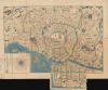
This is a 1845 Murataya Hikobē map of Edo (Tokyo), Japan, the capital of the Tokugawa Shogunate. It is particularly notable for recording the residences, often multiple residences, and family crests of daimyo from throughout Japan in Edo, a critical piece of the Tokugawa's measures to control them and ensure national unification.A Closer Look
This map is oriented with west at the top and north at the right, with the Edo Castle (御) at the center. It labels roads, neighborhoods, bridges, government offices, temples and shrines, agricultural fields on the edge of the city, and other features throughout. It is particularly detailed on the location of residences of daimyo, recording them with the family emblems (mon) of each.In the box at the bottom-left, symbols used on the map to indicate the differing types of daimyo residences are explained: upper residences (上屋敷) near Edo Castle and to house the daimyo himself, particularly if he was serving in a government role and needed to access the castle; middle residences (中屋敷) to potentially house the daimyo and certainly his servants and family; and lower residences (下屋敷), generally on the outskirts of Edo, used as a pleasure retreat and country home. These multiple residences, in addition to those in their home province, were the result of the sankin kōtai system established early in the Tokugawa era (1600 - 1868), which required daimyo to house their heirs in Edo full-time and to alternate their own residences between their home provinces and Edo. This allowed the Tokugawa to keep tabs on potentially disloyal daimyo, groom their heirs to be loyal to the shogun, and impoverish the daimyo through the cost of building and maintaining multiple residences while also traveling frequently, endeavors which led daimyo to engage in conspicuous consumption to try to outdo each other.
The same box at the bottom-left also includes a clever circular table of distances, recording the distances of various cities, temples, shrines, and other landmarks from Nihonbashi in Edo, the traditional starting point of the Tōkaidō. The circle notes the cardinal directions and the points on the traditional feng shui compass used in East Asia.
The Tokugawa Period
In the second half of the 16th century, Japan underwent a process of unification that was strongly influenced by exchanges with the outside world, including by way of Japanese settlers in Southeast Asia. After completing the process of unification in 1600, the Tokugawa Shogunate was concerned about the problems that these exchanges presented (namely Christianity and guns for wayward daimyo) and nominally closed off Japan from the outside world on pain of death (known as the sakoku or 'locked country' policy).Nonetheless, outside influences continued to come into Japan, primarily through Nagasaki, where Dutch and Chinese traders were allowed to reside on offshore islands. Moreover, foreign vessels landed on Japan's shores (and were usually attacked) with increasing frequency in the 18th and early 19th century. Several visitors from other countries came to Nagasaki over the years, so that Japanese intellectuals had an awareness of changes in maritime technology, cartography, hydrography, and other fields. Still, this steady drip of outside information was not enough for the Tokugawa to fully realize the rapidly emerging threat of foreign invasion, which only became clear with the arrival of American 'black ships' in 1853.
Edo - The 'Floating World'
The benefits of national unification, the end of incessant warfare, and the adaptation of outside influences to the Japanese context allowed for a virtuous cycle of prosperity under the Tokugawa. Edo, Osaka, and other cities flourished. The population of Edo likely reached one million in the early 18th century, making it one of the largest cities in the world at the time. The urban economy was buoyed by elaborate, commercialized service industries ranging from restaurants, publishing, and entertainment (sumo, kabuki) to prostitution. The heady atmosphere of major Japanese cities, especially Yoshiwara, Edo's red-light district, became known as the 'floating world,' and woodblock prints depicting this vibrant social sphere (Ukiyo-e) became coveted in their own right.It is important to note that this world of entertainment and pleasure was only available to the elite of Edo society, composed mainly of daimyo and samurai, and to a lesser extent the new urban middle class. As seen here, the residences of the daimyo, along with temples and shrines, occupied the majority of the urban space of Edo, while the much larger population of commoners (shomin, 庶民) and outcasts (eta 穢多 and hinin 非人, later known as burakumin 部落民) lived in tightly packed gated-off neighborhoods (machi 町) and villages of thatched cottages on the outskirts of the city, respectively.
Publication History and Census
This map was published by Murataya Hikobē (村田屋彦兵衛) in 1845 (Kōka 2). It was one of several maps of Edo published in the late Tokugawa period with a similar appearance (see, for example, our earlier listings Edo-takashibasanyu-1854 and Edo-japan-1849), though these often differed considerably in the information in the box at the bottom-left and other details, as with the strong emphasis on daimyo residences here. Murataya seems to be among the rarer of these variants. No information about his biography is available, and he only produced one other work, an untitled map of Japan (one example cataloged as 日本道中案内図 by the National Institute of Japanese Literature). All examples of the present map are untitled on the map itself, but sometimes are accompanied by a cover containing the title 'Eidai oedo ezu' (永代御江戸繪圖). For this reason, the map is either cataloged as untitled or with this cover title.In any event, we have only been able to identify one institutional holding of this edition of the map, at the National Museum of Japanese History, while the Nichibunken (International Research Center for Japanese Studies) holds an 1843 edition, the University of California Berkeley an 1853 edition, and the Fukuoka City Museum an 1861 edition, while the National Museum of Japanese History also holds examples from 1846 and 1849.
Condition
Good. Wear on old fold lines Some verso reinforcement.
References
National Museum of Japanese History, ID H-1242-9-75-2.