1859 Rey Historical / Biblical Case Map of the Holy Land, Tribe of Judah
TribudeJuda-rey-1859$4,000.00


Title
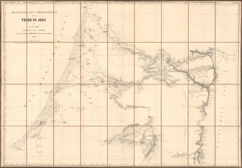
Reconaissance topographique de la Tribu de Juda.
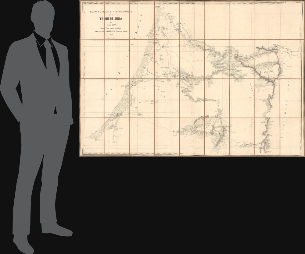
1859 (dated) 35 x 50 in (88.9 x 127 cm) 1 : 110000
1859 (dated) 35 x 50 in (88.9 x 127 cm) 1 : 110000
Description
This is Alban-Emmanuel Guillaume Rey's c. 1859 large-format folding map of the Holy Land, and more specifically, the lands of the Tribe of Judah, one of the ancient Twelve Tribes of Israel. Rey's expedition to Palestine, which resulted in this map, was an early example of Biblical geography, combining modern surveying techniques with the scholarly study of religion, archaeology, linguistics, and other emerging disciplines.
A Closer Look
The map covers from Jaffa (now part of Tel Aviv-Yafo) in the north to Khan Younis south of Gaza in the south, and from the Mediterranean Sea in the west to the Dead Sea (lac Asphaltite) in the east. Settlements are noted throughout with their modern (Arabic) names and, where suitable, their ancient (Hebrew) names in parentheses; Jerusalem appears towards top-right. Terrain is depicted along the Mediterranean coast, while contour lines indicate changes in elevation. Waterways, ancient ruins, roads, paths, churches, mosques, roadside blockhouses, and ancient sites (such as Solomon's Pools / Vasques de Solomon southwest of Bethlehem, which provided water for aqueducts feeding into Jerusalem) are also recorded throughout. Descriptive text in French appears throughout, noting ruins and characteristics of the terrain, especially along the Dead Sea.Tribe of Judah
The Tribe of Judah was one of the Twelve Tribes of Israel in ancient times, traditionally descended from Judah, the fourth son of the patriarch Jacob (also called Israel) and Leah, his first wife. The tribe played a major role in the history and identity of the Israelites and, later, the Jewish people. According to scripture, Judah was a major power in the region during the united monarchy under Kings Saul, David, and Solomon (c. 11th - 10th centuries BCE). When the tribes split around 930 BCE, Judah became the core of the southern kingdom, called the Kingdom of Judah (the ten northern tribes formed the Kingdom of Israel). Judah lasted until the onset of the Babylonian Captivity in 586 BCE, but has had a deep influence on Jewish identity since, from the establishment of Jerusalem as the capital of the United Kingdom (and later the Kingdom of Judah) by King David (the city's emblem incorporates the Lion of Judah), to the very word 'Jew' (Yehudim), based on the tribe's name.Publication History and Census
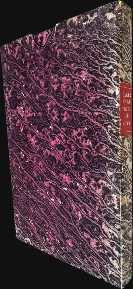
This map was prepared by Rey and originally appeared as a two-sheet map to accompany his book Étude Historique et Topographique de la Tribu de Juda (Paris: A. Bertrand, 1862). However, the present example is separately issued, dissected, and laid on linen for folding into a slipcase. This presentation of the map is very rare; we have been unable to locate it in any institutions, and it has only sporadically appeared on the market in recent years.Cartographer
Alban-Emmanuel Guillaume Rey (May 28, 1837 - April 4, 1916) was a French baron, archaeologist, topographer, and Orientalist recognized as a foundational figure in the archaeology of the Crusades. He is particularly noted for his scholarly contributions on medieval fortifications and the French colonial presence in Syria during the twelfth and thirteenth centuries. Rey was born in Chaumont, Haute-Marne, France. In 1856, he was invited by one of his teachers to attend a trip organized by Œuvre des Écoles d'Orient (now known as Œuvre d'Orient) where he began a lifelong study of Arabic. After the trip's completion, he helped complete a French-Arabic dictionary compiled by the Œuvre, an organization he would remain involved with for the rest of his life (sitting on its Board of Directors for nearly 60 years). He also became involved with several archaeological and scholarly societies at this time, including the Société savante des antiquaires de France. In 1857-1858, at the age of twenty, Rey undertook his first journey to Syria, focusing on the Hauran region. He would return several times, most notably in August 1859, when he traveled alongside photographer Louis de Clercq, who had been commissioned by the French Ministry of Education to document the expedition. During this mission, Rey produced a significant large-scale map of central Palestine (our map), reflecting his early commitment to rigorous archaeological and topographic research in the Near East. Rey became known as a pioneer and special authority on the archaeology of the Crusaders and Crusader states in the Levant, work for which he was knighted by the Pope. Rey also was admitted to the French Légion d'honneur. He served as an officer in the Franco-Prussian War, but after the war returned to his researches, keeping up a steady output of publications into the early 20th century. More by this mapmaker...
Condition
Very good. Folds into original marbled slipcase. Old linen backing stable.