
1959 Metropole Press City Map of Plan of Hong Kong

Welcome to Hong Kong.
Cold War Listening Post, Conduit for Cultural Exchange.
Cold War Listening Post, Conduit for Cultural Exchange.
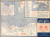
This 1959 map of Hong Kong was printed by Metropole Press for the Servicemen's Guides Association and intended for American military personnel passing through Hong Kong at the height of the Cold War. Although Hong Kong was a British colony inhabited primarily by Chinese people, this map reflects a period when American military, cultural, and economic influence in Hong Kong was large and growing.A Closer Look
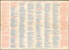
The main map is centered on Victoria Harbor, allowing for inclusion of the southern portion of Kowloon along with the most developed, harborside portion of Hong Kong Island. Streets are labeled throughout, while points of interest and theaters are marked with red letters and numbers that correspond to the indexes above. Red lines also trace ferry and streetcar lines and mark churches and synagogues. An inset at the top-left covers Central, the bustling, dense heart of the city, where many attractions are located. Another inset at top-right covers Hong Kong more widely, including part of the New Territories and outlying islands like Lantau, emphasizing opportunities for scenic walks (i.e., hikes). The verso contains important practical information on shopping, restaurants, money exchange, interactions with local police, and more.As the Servicemen's Guides Association, as explained on the verso, was deeply connected with Protestant and Catholic clerics and the Hong Kong Women's Association, the guide does not mention some of the seedier, though no doubt popular, destinations for U.S. military personnel (see below). However, warnings about crime, reflecting the colony's desperate poverty, abound. To the left of the title, sailors are warned, 'Do Not Carry Your Money in Your Jumper Pockets.' Above, a similar warning appears about 'street guides,' who in reality were scam artists in cahoots with local gangs. Green text and diagonal lines caution that 'Kowloon City (Walled), Rooftop Dwellings Out of Bounds at All Times,' the former being a reference to the notorious enclave that housed thousands of refugees in unregulated high-rises intersected by narrow alleys, making it one of the most densely populated places on Earth at the time.
Cold War Listening Post, R. and R. Station
This map was produced at the height of the Cold War, when Hong Kong was the frontline in the very active rivalry between the West (especially the U.S. and U.K.) and the People's Republic of China (P.R.C.). At this point, the Korean War was recent memory, the First Taiwan Strait Crisis even more so, and the U.S. maintained an embargo of the People's Republic all along the Chinese coast. Great Britain had recognized the People's Republic in 1950 and had received assurances from the P.R.C. about its status; indeed, for several years travel and trade between the British colony and the Chinese mainland were fairly easy. (The Communists badly needed foreign currency and resources amid the U.S. embargo.) Nevertheless, as Cold War tensions deepened, the border between the P.R.C. and Hong Kong hardened, and the colony became a key 'listening post' for Western, and especially American, military and intelligence outfits. CIA agents, U.S. Military Intelligence attachés, and State Department 'China watchers' turned the colony into a command center for open-source analysis and covert espionage, everything from interviewing refugees and defectors from the P.R.C. (who were numerous, especially with the onset of the ill-conceived Great Leap Forward in 1958) to translating mainland Chinese newspapers and broadcasting anti-Communist messages into the People's Republic. British authorities quietly tolerated this extensive American intelligence presence, recognizing that while it carried diplomatic risks, the intelligence the U.S. shared was essential to defending the colony on the Cold War front line.The U.S. Navy also used Victoria Harbor as a major rest-and-recuperation port for warships serving in the Far East, which is likely the source of the present map. Given the U.S. Navy's large presence in the region at the time, this constant naval traffic injected millions of U.S. dollars directly into the colony's developing service economy. Districts like Wan Chai transformed overnight to accommodate the influx, giving rise to a bustling ecosystem of custom tailors famous for 24-hour suit fittings, sampan ferry operators, restaurants, and souvenir shops. It also fueled a sprawling nightlife and red-light industry that provided lucrative, if informal, livelihoods for thousands of residents during an era of severe refugee poverty. Culturally, the American naval footprint acted as a powerful conduit for Westernization, introducing American popular culture to a traditionally staid (at least at the elite level) Anglo-Chinese society. Visiting servicemen brought rock 'n' roll, jazz, blue jeans, and American cocktails, which quickly spilled out of harbor bars and into mainstream Hong Kong youth culture, helping accelerate Hong Kong's evolution into a vibrant, modern, and cosmopolitan global city.
Publication History and Census
This map was printed in 1959 by Metropole Press for the Servicemen's Guides Association, which had been formed in 1953 by the American business community in Hong Kong. The map is dedicated to members of COMCRUDESPAC (Commander, Cruiser-Destroyer Force, Pacific Fleet), which coordinated training and operations for the U.S. Navy's Pacific Fleet. As noted on the cover panel, this is the map's third edition. We do not locate any examples of this edition in institutional collections. The University of California, Berkeley; Yale University; the University of Hong Kong; and the Chinese University of Hong Kong hold earlier editions.Cartographer
Metropole Press (華藝印務局; fl. c. 1958 - 1991) was a Hong Kong-based printer located at 52 Lockhart Road in Wan Chai. It is best known for printing a map and guide for military personnel visiting Hong Kong titled 'Welcome to Hong Kong,' arranged for by the Servicemen's Guides Association, a joint effort by the American business community, Catholic and Protestant clergy, and the Hong Kong Women's Association. Although the company operated until the early 1990s, its output was likely works of an ephemeral nature as only one other publication is cataloged, a Chinese-language guide on harmonica playing (《口琴奏法(附世界名曲)》) published in 1968. Further Details...
Condition
Good. Some toning. Verso repairs to fold separations and at fold intersections. Slight loss at a fold intersection. Location index on verso.