
1942 CBC Pictorial Wall Map of the World, World War II


This item has been sold.
CBC World War Map on Mercator's Projection.
A little-known octopus map.
- Digital Map Information
- Suitable for large format printing
- File Size: 92.34 MB
- File Type: ZIP / TIFF
- ICC color profile embedded
- Delivered instantly via download link
A little-known octopus map.
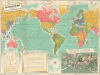
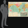
This is a colorful, large-format c. 1942 Canadian Broadcasting Corporation (CBC) pictorial map of the world illustrating events early in World War II (1939 - 1945). Aside from presenting the conflict from the often-overlooked Canadian perspective, the map is notable for its distinctive aesthetic. Of note, a pictorial map in the lower right incorpoates the 'octopus theme', popluarized by Fred Rose in the late 1800s, to illustrate the grasping reach of German Nazi and Japaense Imperial expansion.A Closer Look
The map presents the world on a Mercator Projection with Canada and the United States at center, thereby dividing Eurasia (and the two main theaters of the war). Countries are color-shaded according to their allegiances (Axis, Allied, Neutral, with the British Empire highlighted in red). A detailed legend at bottom-left explains symbols used throughout for railways, sea routes, naval and air bases, and ice limits of the world's oceans and seas. Additional symbols indicate a variety of resources important for the war effort, such as iron, coal, and oil. An inset map at bottom-right, done in a stylized Social Realist aesthetic, depicts the conflict with Germany and Japan as octopuses spreading their tentacles across the world, with the Allied powers offering up their resources and manpower for resistance. A text box at bottom explains that listeners to the CBC (which dominated Canadian airwaves as both a broadcaster and regulator) could use the map to track the progress of the war while listening to daily news broadcasts.This map was prepared at the low-point of the war for the Allies (a noted in the legend explains that it reflects the situation in March 1942). Although the Nazis had been stopped outside Moscow in December 1941, they still occupied large portions of the Soviet Union, while Japan was just completing a lightning advance through Southeast Asia. While the Allied waited for the vast resources and manpower of the United States to be fully mobilized and for the Soviets to recuperate strength, they planned local counter-attacks to boost morale (often at great cost), such as the Doolittle Raid on Tokyo in April 1942 or the Canadian-led Dieppe Raid in August. The references to strategy reflect contemporary debates among the Allies; while they agreed that primary effort should be directed towards defeating Germany, they disagreed on how to go about doing it. Eventually, the British convinced the Americans that the best course was to chip away at the periphery of the Axis' European empire before rushing headlong into an invasion of France, to the annoyance of the Soviets, who desperately wanted a 'second front' to alleviate pressure, as the bulk of German and Axis forces were on the Eastern Front.
Canada's World War II
Canada entered the Second World War on September 10, 1939, with an independent decision of its own Parliament, signaling both loyalty to Britain and the country's growing autonomy. In the early years of the war, Canada played an essential role as an industrial and training hub. The British Commonwealth Air Training Plan, headquartered in Canada, became one of the largest aviation training programs in history, preparing more than 130,000 aviators for service across the Allied air forces. Most of those trained were British, Canadian, Australian, or New Zealander, but the Plan also trained crews from throughout the Commonwealth, occupied countries (such as Poland and the Netherlands), and beyond. At the same time, Canadian shipyards and factories rapidly expanded production, supplying escorts, merchant ships, vehicles, munitions, and other materiel critical to sustaining the Allied war effort, particularly during the Battle of the Atlantic.Canadian forces saw major combat beginning with the costly 1942 raid on Dieppe, which, despite heavy losses, provided important lessons for the later Normandy invasion. From 1943 onward, Canadian troops fought in the Italian campaign and then played a significant role in Northwest Europe after D-Day, including the liberation of the Netherlands. On the home front, the war effort spurred economic transformation, including the growth of manufacturing and increased participation of women in the workforce. By the end of the war, Canada had emerged as a significant military power with one of the world's largest navies and air forces, and its contributions helped shape its postwar identity as a committed participant in international security and reconstruction.
Publication History and Census
This map was drawn by Harris-Parlane Studios and was copyrighted to (i.e., designed by) the graphic arts firm McLaren and McCaul for the CBC. A note in the legend explains that the map reflects battle lines as of March 17, 1942. The map is recorded among the holdings of four institutions in the OCLC, all in Canada: the University of Toronto, Brock University, Carleton University, and Western University. Scarce to the market.Cartographer
John Wilson McLaren (1896 - 1988), often as J. W. McLaren, was a Scottish-born Canadian painter, illustrator, and owner of a successful graphics art firm in the mid-20th century. Emigrating to Canada with his family as a child, McLaren gravitated towards the graphic, literary, and performing arts and served as an entertainer and comedian for Canadian units in the First World War. After the war, McLaren worked for the firm Rous and Mann in Toronto before founding his own graphic arts company and partnering with John McCaul, who operated the sales portion of the business. The company found quick success and signed up many leading Canadian companies as clients. McLaren's aesthetic was up-to-date and his methods even avant-garde; he was among the first to use plasticine to produce three-dimensional promotional sets. In 1950, McLaren and McCaul closed operations. McLaren briefly continued the business with his son, John, as McLaren and Son, Ltd., but this company lasted only two years and J. W. McLaren began a long retirement filled with painting and other artistic works. Further Details...
Condition
Very good. Light wear along original fold lines. Verso repairs to fold separations. Slight loss at a few fold intersections. Closed edge tears that enter border professionally repaired on verso.
References
OCLC 290981148, 1110211726.