
1945 XIV Corps Newsprint Map of the Philippines and Solomon Islands


This item has been sold.
XIV Corps. Liberators of Manila. Kings of the Solomons.
Liberators of Manila ... Kings of the Solomons.
Choose a Collection:
- Digital Map Information
- Suitable for large format printing
- Full resolution TIFF file
- ICC color profile embedded
- Delivered instantly via download link
This Item
Enquire
Liberators of Manila ... Kings of the Solomons.
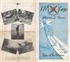
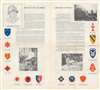
A rare find, this is a 1945 XIV Corps newsprint pamphlet map of the Philippines and the Solomon Islands. The map focuses on the Southwest Pacific (identifying Guadalcanal, New Georgia, and Bougainville in the Solomon Islands but not labeling New Guinea). A fist wearing a gauntlet emphasizes the XIV Corps' drive north from Guadalcanal through the Solomons to Manila, which the corps liberated on February 24, 1945. Opposite this striking map are five printed Army Signal Corps photographs of XIV Corps soldiers.Verso ContentAlthough more accurately identified as the two inner pages of this four page pamphlet, the verso of this sheet bears text descriptions of the XIV Corps' actions in the Solomons and in Luzon both before and after the liberation of Manila. These actions earned the corps the monikers 'Kings of the Solomons' and 'Liberators of Manila'. A portrait of Lieutenant General O. W. Griswold (1886 - 1959) occupies the top left corner. A photograph of XIV Corps troops occupies the opposite corner. Unit insignia of the divisions attached to the XIV Corps during World War II create the rest of the border. These include the 1st Cavalry Division, the 2nd and 3rd Marine Divisions, and several Army Infantry Divisions, including the 25th, 37th, 38th, and 43rd.Publication History and Census
This map was 'prepared and reproduced by the 670th Engineer Topographic Company under supervision of XIV Corps Public Relations Office'. We are aware of only two other cataloged examples, which are part of the collections at the Australian War Memorial and Research Centre in Canberra, Australia and the Wisconsin Veterans Museum Research Center in Madison, Wisconsin.
Condition
Very good. 1 folded sheet (4 pages). Exhibits wear along original fold lines. Exhibits slight loss at a fold intersection. Text and printed images on verso.
References
OCLC 221128526; 74908243.