
Bright, William Thomas (sold)

William Thomas Bright (July 22, 1839 - August 13, 1932) was an American draftsman and civil servant. Born in Washington, D.C., Bright lived in Washington all his life. He worked for the U.S. Coast Survey and then the U.S. Coast and Geodetic Survey as a draftsman from at least 1857 until he retired in 1907. He died suddenly at home on August 13, 1932. Bright married Sarah E. Holroyd in 1865, with whom he had four children, two sons and two daughters.
Rare, separately issued map of Woods Hole, Cape Cod - near Martha's Vineyard!
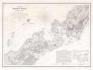
The Harbor of Wood's Hole Massachusetts.
sold
- Digital Map Information
- Suitable for large format printing
- File Size: 13.75 MB
- File Type: ZIP / TIFF
- ICC color profile embedded
- Delivered instantly via download link
This is a rare separately issued 1857 U.S. Coast Survey nautical chart or map of Woods Hole, Massachusetts, near Martha's Vineyard. The map depicts the southwestern tip of Barnstable County, Nonameseset Island, and parts of nearby Naushon Island. Exceptional detail is displayed, down to the level of individual buildings and streets. The Woods Hole blacksmith shop, a 'yellow house,' and the 'new church' are among the sites identified. Woods Hole itself, the passage for ships between Vineyard Sound and Buzzards Bay known for its extremely strong current, is illustrated with numerous depth soundings. Sailing instructions and other practical information for the mariner appear in the lower right. (more details)