
Camy, Edward (sold)

Edward Camy (1904 – 1958) was a California based illustrator and graphic artist active in the first half of the 20th century. Camy did extensive work for the Alaska Steamship Line and the Santa Fe Railroad. He also produced graphic advertisements for Dole Pineapple and Signal Gasoline. He cartographic work is limited to only a few mops, most in the cartoonish style of his most famous work, A Good-Natured Map of Alaska. Camy was born in Fresno, California and lived most of his life in San Francisco.
Stunning early map of the Niagara Isthmus with exceptionally fine engraving.
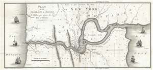
Plan de la Cataracte de Niagara et le l'Isthme qui separe les Lacs Erié et Ontario.
sold
- Digital Map Information
- Suitable for large format printing
- DPI: 300
- File Size: 3.5 MB
- File Type: ZIP / TIFF
- ICC color profile embedded
- Delivered instantly via download link
A wonderful 1801 map of the Niagara Falls and the Niagara isthmus between Lake Erie and Lake Ontario. Oriented to the west, this map covers the Niagara River from Lake Erie to Lake Ontario. It identifies Fort Erie, Fort Niagara, Grand Isle, and of course, Niagara ... (more details)
First edition of Camy's humorous pictorial map of Alaska.
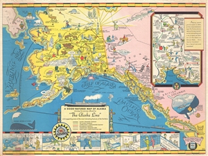
A Good-Natured Map of Alaska, showing the services offered by 'the Alaska Line' and suggesting some of the most interesting features of the Territory.
sold
- Digital Map Information
- Suitable for large format printing
- File Size: 17.26 MB
- File Type: ZIP / TIFF
- ICC color profile embedded
- Delivered instantly via download link
A delightful 1934 first edition pictorial map of Alaska drawn by Edward Camy to promote 'The Alaska Line . Drawn in the style of Jo Mora, Camy's map covers most of Alaska and parts of the Yukon and British Columbia as far south as Seattle. For a place that is ... (more details)
First edition of Camy's humerous pictorial map of Alaska.
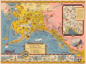
A Good-Natured Map of Alaska, showing the services offered by 'the Alaska Line' and suggesting some of the most interesting features of the Territory.
sold
- Digital Map Information
- Suitable for large format printing
- File Size: 11.7 MB
- File Type: ZIP / TIFF
- ICC color profile embedded
- Delivered instantly via download link
A delightful 1934 first edition pictorial map of Alaska drawn by Edward Camy to promote 'The Alaska Line'. Drawn in the style of Jo Mora, Camy's map covers most of Alaska and parts of the Yukon and British Columbia as far south as Seattle. For a place that is shrouded in twilight for several months a year, this map is remarkably bright and sunny – no doubt an attempt by the Alaska Line to offset the image of Alaska as cold and dreary. Cartoonish vignette illustrations elaborate on Alaska's flora, fauna, culture, scenery, mineral wealth, and the activities that can be enjoyed there. The route of the steamship line is traced as it weaves around the islands near Sitka on its way to Valdez and Kodiak. Other routes go directly to Nome or island hop through the Aleutians. An inset map in the upper right quadrant offers travelers the option to disembark in Cordova and set out on an inland tour to Fairbanks, visiting Mount McKinley and Anchorage before re-embarking at Seward. A cartoon strip along the bottom of the map follows the adventures of two travelers as they dine, dance, sleep and play their way up the coast. A whale in the lower left is advertised as a 'portable geyser'. (more details)
First edition of Camy's humorous pictorial map of Alaska.
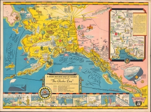
A Good-Natured Map of Alaska, showing the services offered by 'the Alaska Line' and suggesting some of the most interesting features of the Territory.
sold
- Digital Map Information
- Suitable for large format printing
- File Size: 42.46 MB
- File Type: ZIP / TIFF
- ICC color profile embedded
- Delivered instantly via download link
A delightful 1934 first edition pictorial map of Alaska drawn by Edward Camy to promote 'The Alaska Line. (more details)