
Cerri, Carlo (sold)

Carlo Cerri (fl. c. 1840 - 1860) was an Italian engraver and cartographer active in the middle part of the 19th century. Cerri, who was based in Milan, issued a number of large scale maps of Italy geared toward state use, such as postal maps, and the "Grand Tour" tourist market.
Monumental wall map of Itay.
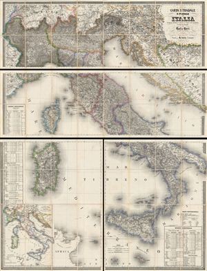
CARTA STRADALE E POSTALE DELL'ITALIA Disegnata secondo le Carte e le Opere più accreditate dei moderni geografi da CARLO CERRI nella proporzione di 1:804,000 del naturale l'anno 1852.
sold
- Digital Map Information
- Suitable for large format printing
- File Size: 1714.37 MB
- File Type: ZIP / TIFF
- ICC color profile embedded
- Delivered instantly via download link
This is the scarce 1859 edition of Carlo Cerri's monumental postal map of Italy. First published in 1849, this is one of the largest and most magnificent maps of Italy to emerge from the 19th century – the age of the Grand Tour. This particular example was ... (more details)