
Coronelli, Vincenzo Maria
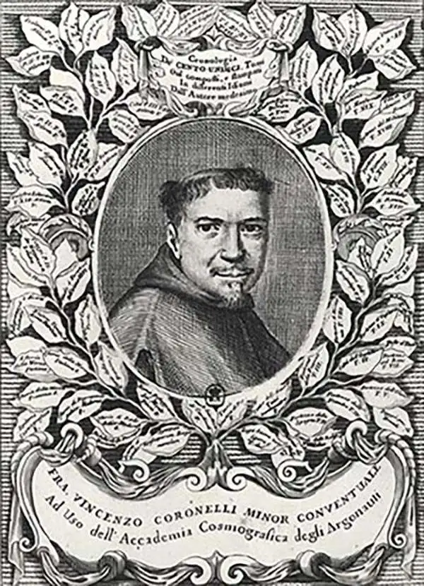
Vincenzo Maria Coronelli (August 16, 1650 - December 9, 1718) was an important 17th-century cartographer and globe maker based in Venice. Coronelli was born the fifth child of a Venetian tailor. Unlikely to inherit his father's business, he instead apprenticed in Ravenna to a woodcut artist. Around 1663, Coronelli joined the Franciscan Order and, in 1671, entered the Venetian convent of Saint Maria Gloriosa dei Frari. Coronelli excelled in the fields of cosmography, mathematics, and geography. Although his works include the phenomenal Atlante Veneto and Corso Geografico, Coronelli is best known for his globes. In 1678, Coronelli was commissioned to make his first major globes by Ranuccio II Farnese, Duke of Parma. Each superbly engraved globe was five feet in diameter. Louis IV of France, having heard of the magnificent Parma globes, invited Coronelli to Paris, where from 1681-83 he constructed an even more impressive pair of globes measuring over 12 feet in diameter and weighing 2 tons each. The globes earned him the patronage of Louis XIV and privileged access to French cartographic information from Jesuit sources in the New World, particularly Louisiana. Coronelli returned to Venice and continued to publish globes, maps, and atlases, which were admired all over Europe for their beauty, accuracy, and detail. He had a particular fascination for the Great Lakes region, and his early maps of this area were unsurpassed in accuracy for nearly 100 years after their initial publication. He is also well known for his groundbreaking publication of the first accurate map depicting the sources of the Blue Nile. At the height of his career, Coronelli founded the world's first geographical society, the Accademia Cosmografica degli Argonauti, and was awarded the official title Cosmographer of the Republic of Venice. In 1699, in recognition of his extraordinary accomplishment and scholarship, Coronelli was also appointed Father General of the Franciscan Order. The great cartographer and globe maker died in Venice at the age of 68. His extraordinary globes can be seen today at the Bibliothèque Nationale François Mitterrand in Paris, Biblioteca Marciana in Venice, the National Library of Austria, the Globe Museum in Vienna, the Library of Stift Melk, the Special Collections Library of Texas Tech University, as well as lesser works in Trier, Prague, London, and Washington D.C. Coronelli's work is notable for its distinctive style, which is characterized by the high-quality white paper, dark intense impressions, detailed renderings of topographical features in profile, and numerous cartographic innovations.
Crete and the Southern Greek Islands.
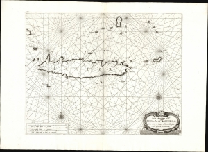
Coste Maritime dell' Isola di Candia con tutte le Baye e Porti di essa e dell' Isole la circonviene.
$1,000.00
Acquire
- Digital Map Information
- Suitable for large format printing
- File Size: 18.42 MB
- File Type: ZIP / TIFF
- ICC color profile embedded
- Delivered instantly via download link
This is Francesco Maria Levanto's 1664 chart of Crete and the adjacent Greek islands, in its 1698 Coronelli edition. Levanto's nautical atlas, Prima parte dello Specchio del Mare, was a translation of Pieter Goos' 1662 Zee-spiegel. The Italian adoption of this cartographic model is testimony to the primacy of 17th century Dutch hydrography, however misplaced it may have been in this case. (more details)
The Atlantic Islands, Real and Imagined, from the Finest Printed Globe of the 17th Century.
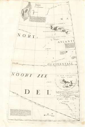
[Untitled Globe Gore of the Atlantic Ocean from the Equator to approximately 50º north].
$750.00
Acquire
- Digital Map Information
- Suitable for large format printing
- Full resolution TIFF file
- ICC color profile embedded
- Delivered instantly via download link
This scarce, beautiful engraving is a 1688 Coronelli globe gore map of the Atlantic Ocean from the Equator to 50° N, encompassing the Grand Banks, the Azores Islands, and the Cape Verde Islands. It was engraved in Vincenzo Coronelli's 42-inch (3 1/2 foot) terrestrial globe, reprinted in 1697 for inclusion in his Libro dei Globi and Isolario. In addition to the above locations, it includes near the equator an archipelago labeled 'Revedo de S. Pedro' which may represent the Atlantic island of Saint Paul. Among the other islands featured is the mythical paradise of St. Brendan. (more details)
'... most momentous map of the American south-west published ...' - Burden
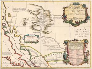
Le Nouveau Mexique appelé aussi Nouvelle Grenade et Marata Avec Partie de Californie, Selon les Memoires les plus Nouveaux.
$14,500.00
Acquire
- Digital Map Information
- Suitable for large format printing
- File Size: 17.16 MB
- File Type: ZIP / TIFF
- ICC color profile embedded
- Delivered instantly via download link
A seminally important map, this is the 1687-88 Coronelli-Nolin separately-published map of the North American Southwest, in its first edition. This map is a cornerstone for any collection dedicated to the southwest: it is the first published map to introduce the cartography of Don Diego Peñalosa with regard to the Rio Grande valley as far north as Santa Fe. Peñalosa's cartography not only has a swashbucklingly enigmatic history, but it is also foundational for most subsequent maps of the region for the next century. This is also one of the earliest maps, following the 1660 Nicolosi map, to correctly map the Rio Grande emptying into the Gulf of Mexico as opposed to the Sea of California. (more details)
Cornerstone American Cartography.
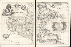
America Settentrionale Colle Cuoue Scoperte fin all' Anno 1688.
$16,000.00
Acquire
- Digital Map Information
- Suitable for large format printing
- File Size: 46.86 MB
- File Type: ZIP / TIFF
- ICC color profile embedded
- Delivered instantly via download link
This is Vincenzo Coronelli's striking 1688 two-sheet map of North America - one of the largest and most influential atlas maps to appear in the late 17th century. It emerged as much of North America had yet to be penetrated or was in the earliest stages of exploration and colonization - a true golden land of possibility. There is much of interest, including being among the first maps to embrace the cartography of Don Diego Peñalosa in New Mexico, a bold embrace of the Insular California trope, recognition of the Danish explorations of Jens Munk, an early usage of the term Chicago (Chekagou), and an interesting mapping of the apocryphal Lake May, the great inland sea of the southeast. (more details)
Cannibalism in the Amazon.
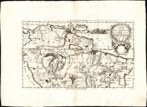
Corso del Fiume Dell Amazoni.
$950.00
Acquire
- Digital Map Information
- Suitable for large format printing
- File Size: 16.09 MB
- File Type: ZIP / TIFF
- ICC color profile embedded
- Delivered instantly via download link
This is Vincenzo Maria Coronelli's beautiful and fascinating map of the northern parts of South America, focusing specifically on the Amazon River and the interior of Brazil and Peru. (more details)
An elegantly engraved West Indies.
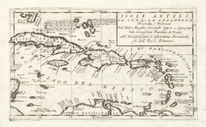
Isoli Antili, La Cuba, La Spagnuola, Descritta, e Dedicate Dal Padre Maestro Coronelli, Lettore, e Cosmografo della Serenissima Republica di Venetia All' Illustrissimo S. Sebastiano Bernardi, fu dell Ecc. S. Francesco.
$1,000.00
Acquire
- Digital Map Information
- Suitable for large format printing
- DPI: 600
- File Size: 23.39 MB
- File Type: ZIP / TIFF
- ICC color profile embedded
- Delivered instantly via download link
This Vincenzo Coronelli's 1689 map of the Caribbean. It spans from the tip of Florida to the northern coast of South America, thus embracing all of the West Indies and part of the Bahamas. Cuba, Hispaniola, and Puerto Rico are situated prominently. The map is boldly engraved in the inimitable style of Coronelli's works. (more details)
A map of the Rhine River and the Electorate of Cologne, one of the many administrative divisions of the Holy Roman Empire.
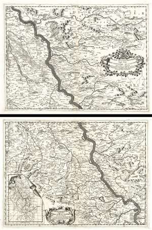
Parte Settentrionale degli Stati Dell'Elettore di Colonia. / Parte Meridionale degli Stati Dell'Elet. Di Colonia.
$600.00
Acquire
- Digital Map Information
- Suitable for large format printing
- DPI: 600
- File Size: 76.55 MB
- File Type: ZIP / TIFF
- ICC color profile embedded
- Delivered instantly via download link
This is a 1690 Vincenzo Maria Coronelli map of the Rhine River in northwest Germany in what was then known as the Electorate of Cologne. Presented on two sheets that can function independently, the map depicts the region along the river from Wesel to Koblenz. Numerous cities, towns, and villages are labeled along the river's course and on both sides, including Wesel, Orsoy, Cologne (Colonia), Homberg, and others. Each settlement is marked by a dot or a small collection of buildings, allowing the viewer to have some understanding of the relative size of each population center. The terrain is shown pictorially, with mountains and forests providing some idea of what the country looks like. Beautiful title cartouches are illustrated on each of the maps. An inset map of the entire course of the Rhine is situated in the bottom left corner of the lower sheet. (more details)
Grandest 17th century map of Corsica.
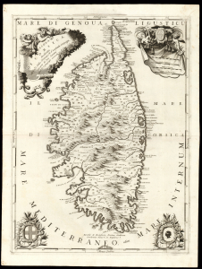
Isola di Corsica.
$1,000.00
Acquire
- Digital Map Information
- Suitable for large format printing
- DPI: 600
- File Size: 61.55 MB
- File Type: ZIP / TIFF
- ICC color profile embedded
- Delivered instantly via download link
This is a superb example of Vincenzo Coronelli's 1692 map of Corsica, one of the most beautifully engraved large-scale depictions of the island of the 17th century. (more details)
From Jesuit Reports of the Far East.
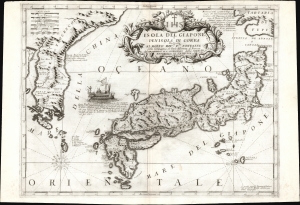
Isola Del Giapone e Penisola Di Corea.
$2,500.00
Acquire
- Digital Map Information
- Suitable for large format printing
- File Size: 29.85 MB
- File Type: ZIP / TIFF
- ICC color profile embedded
- Delivered instantly via download link
This is the 1692 Vincenzo Coronelli map of Japan and Korea. With bold engraving typical of Coronelli, this is among the most visually distinctive maps of the Japanese Islands produced in the 17th century. Moreover, it introduces unique new cartographic knowledge derived from the most up-to-date Jesuit sources. (more details)
Largest 17th century atlas map of Mexico.
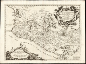
Parte della Nuova Spagna, ò del Mexico dove sono le Provincie di Guadalaira Xalisco Mecoacan e Mexico.
$950.00
Acquire
- Digital Map Information
- Suitable for large format printing
- DPI: 600
- File Size: 59.09 MB
- File Type: ZIP / TIFF
- ICC color profile embedded
- Delivered instantly via download link
This is a superb example of Vincenzo Coronelli's 1692 map of New Spain. In addition to its presentation of this region at the largest scale found in a 17th century atlas, it represents the first notable improvement on the mapping of this region since the 1579 map of Ortelius, upon which Coronelli's map (and indeed, virtually every map of this region for over a century) was based. (more details)
Central America for the Finest Globe of the 17th Century.
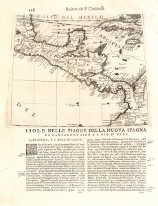
Isole Nelle Piagge Della Nuova Spagna da Cartagena Sino a S. Gio D'Ulua.
$950.00
Acquire
- Digital Map Information
- Suitable for large format printing
- Full resolution TIFF file
- ICC color profile embedded
- Delivered instantly via download link
This is Vincenzo Coronelli's 1696 map of southern Mexico and Central America, printed from his globe gore focusing on the Americas. This is Coronelli's only map to focus specifically on Central America, with coverage embracing modern-day Panama, Costa Rica, Nicaragua, Belize, El Salvador, Honduras, Belize, and Southern Mexico. (more details)
Coronelli's most focused map of the Hong Kong / Macao - Fujian - Manila circuit.
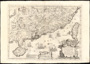
Quantung, e Fokien, Provincie della China, Dedicate Al Motlo Reverendo Padre Carlo Trigona, dell Compagnia di Gesu, Teologo diu Monsignor Illustriss. Arciuescovo di Palermo, etc.
$3,000.00
Acquire
- Digital Map Information
- Suitable for large format printing
- DPI: 600
- File Size: 73.55 MB
- File Type: ZIP / TIFF
- ICC color profile embedded
- Delivered instantly via download link
This is Vincenzo Coronelli's 1696 map of Guangdong and Fujian, China, including the islands of Hainan and Taiwan, the South China Sea, and part of Luzon in the Philippines. Of Coronelli's maps, it is the most focused on Hong Kong, the Pearl River Delta, and Macau, and is among the most detailed depictions of Taiwan of the 17th century. (more details)
Holy grail of Siam map collecting.
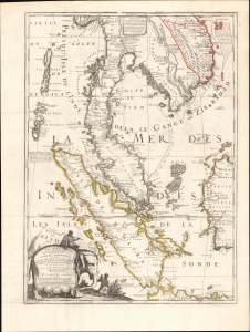
Royaume De Siam, avec Les Royaumes qui luy sont-Tributaries, et les Isles de Sumatra, Andemaon, etc.
$10,000.00
Acquire
- Digital Map Information
- Suitable for large format printing
- Full resolution TIFF file
- ICC color profile embedded
- Delivered instantly via download link
This is the important and influential Coronelli-Nolin map of Southeast Asia, considered one of the Holy Grails of Siam-related map collecting. Here in its 1742 edition, the map was first issued in 1687, following the 1685 first French embassy to Siam, led by Alexandre, Chevalier de Chaumont (1640 - 1710). Most Europeans were expelled from Siam a year later in 1688, making this the definitive model of all subsequent maps of Siam, and Southeast Asia in general until the 1821 John Crawfurd Embassy. (more details)