
Deverell, Walter (sold)

Walter Deverell (c. 1853 - 1920) was a surveyor and draftsman active in New Zealand in the early 20th century. He immigrated to New Zealand at a young age and began to work at the Lands and Survey Department in 1875. Initially posted in Dunedin, he spent most of his career at the department's Invercargill office, where he rose to be Chief Draughtsman. Deverell created detailed maps of the North and South Islands for parliamentary papers, along with topographic wall maps, maps for tourist guides, and more. He retired in 1917, upon which he was roundly praised as an expert draughtsman.
Crown Jewel of New Zealand's Tourist Industry.
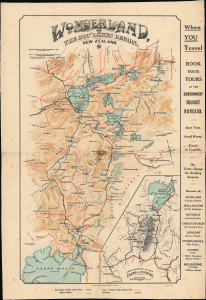
Wonderland, the Hot Lakes Region, New Zealand.
sold
- Digital Map Information
- Suitable for large format printing
- File Size: 11.36 MB
- File Type: ZIP / TIFF
- ICC color profile embedded
- Delivered instantly via download link
This is a c. 1909 Walter Deverell promotional map of the 'Wonderland' volcanic Hot Lakes region around Rotorua, on the North Island of New Zealand. At the time, this area was a major focus of government efforts to promote tourism, including the world's first government-funded tourism department. (more details)