
De Witt, Frederic M. (sold)

Frederic M. De Witt (fl. c. 1890 – 1930) was a publisher based in the San Francisco Bay Area in the late 19th and early 20th centuries. Little details are available about De Witt's life and training. He appears in San Francisco city directories beginning in 1890, listed as a salesman, but by the late 1890s he was publishing maps and guidebooks of his home city. He appears to have later relocated to Alameda in the East Bay. There is limited evidence that he continued to publish books, though not the maps and guidebooks of his earlier years. He may have also played a role in establishing Joaquin Miller Park in Oakland.
Late Glimpse of Pre-Earthquake San Francisco.
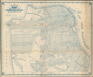
De Witt's indexed map of the city of San Francisco compiled from the latest official data.
sold
- Digital Map Information
- Suitable for large format printing
- File Size: 33.04 MB
- File Type: ZIP / TIFF
- ICC color profile embedded
- Delivered instantly via download link
An engaging 1904 folding map of the city of San Francisco prepared by Frederic M. De Witt. It depicts the city in a period of expansion and transformation, on the eve of the horrific destruction of the 1906 earthquake and fire. (more details)