
Dill, Harry Palmer (sold)

Harry Palmer Dill (July 11, 1845 - June 14, 1921) was a cartographer, publisher, and civil servant based in Phillips, Maine. His only known works are the 1876 pocket map 'The Lakes of Franklin and Oxford Counties, Maine' and a corresponding, undated photographic collection, Stereoscopic views of Rangeley and Richardson Lakes, the Sandy River and Vicinity. As a youngster, he appears to have attended the Maine Wesleyan Seminary in Kents Hill and then the Westbrook Seminary in Portland. He thereafter received training as a civil engineer and produced the works just mentioned, before joining the U.S. government's consular services, being posted in various places in Canada over a thirty-year career. Following his retirement from the consular service, he lived with his daughter and her husband in Lewiston.
One of the first maps of the Rangeley Lake Region.
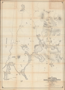
The Lakes of Franklin and Oxford Counties Maine. From Actual Surveys made during the winter of 1876. / Dill’s Survey of the Rangeley Lakes.
sold
- Digital Map Information
- Suitable for large format printing
- Full resolution TIFF file
- ICC color profile embedded
- Delivered instantly via download link
An essential work on the history and geography of western Maine, this rare 1876 pocket map by Harry P. Dill was one of the first to depict the Rangeley Lakes region in detail. (more details)