
Dobson, Thomas (sold)

Thomas Dobson (1751 - 1823) was an American publisher active in Philadelphia during the late 18th and early 19th centuries. Dobson was born in Edinburgh, Scotland in 1751 and emigrated to Philadelphia c. 1780. In Philadelphia, he established a successful printing business by republishing edited and updated versions of important British reference materials in matching quality but at a much lower price point. He is best known for publishing the first American edition of the Encyclopedia Britannica. He also published America's first Hebrew Bible. Cartographically Dobson's most notable work is 1818 republication of Pinkerton's fantastic Modern Atlas.
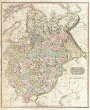
Russia in Europe.
sold
- Digital Map Information
- Suitable for large format printing
- DPI: 300
- File Size: 22.25 MB
- File Type: ZIP / TIFF
- ICC color profile embedded
- Delivered instantly via download link
Pinkerton's extraordinary 1818 map of Russia in Europe. Covers the European portions of Russia between Prussia and the Ural Mountains. Extends north to the Arctic and south as far as the Crimea and Black Sea. Offers considerable detail with political divisions ... (more details)
Spectacular trasitional map of Africa revealing an early state of 19th century European incursion into the continent.
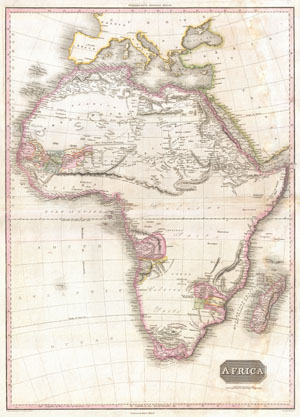
Africa.
sold
- Digital Map Information
- Suitable for large format printing
- Full resolution TIFF file
- ICC color profile embedded
- Delivered instantly via download link
This is John Pinkerton's stunning 1818 map of Africa. Nineteenth century mapmakers were particularly challenged by the difficult task of deciphering Africa. Despite a fairly constant flow of information about the continent dating to the middle ages, much of ... (more details)
An important 19th century map of Arabia.
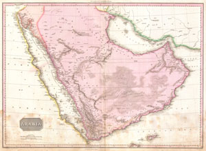
Arabia.
sold
- Digital Map Information
- Suitable for large format printing
- DPI: 300
- File Size: 18.41 MB
- File Type: ZIP / TIFF
- ICC color profile embedded
- Delivered instantly via download link
Extraordinary large format map of Arabia published in 1818 by cartographer John Pinkerton. Centered on the desert province of Neged, this map details the entire Arabian peninsula as well as the Red Sea, the Persian Gulf, and adjacent parts of Africa and ... (more details)
One of the most beautiful maps of Asia to appear in the 19th century.
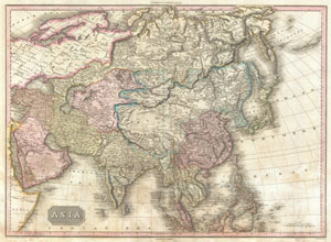
Asia.
sold
- Digital Map Information
- Suitable for large format printing
- DPI: 300
- File Size: 24.16 MB
- File Type: ZIP / TIFF
- ICC color profile embedded
- Delivered instantly via download link
This is John Pinkerton's stunning 1818 map of Asia. Covers from the Mediterranean to the Aleutian Islands and from the Arctic to the Equator. This beautifully rendered map is truly a masterpiece of engraving, with mountain ranges, lakes, deserts, and ... (more details)
One of the most beautiful maps of Australasia to appear in the 19th century.
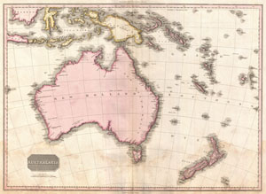
Australasia.
sold
- Digital Map Information
- Suitable for large format printing
- DPI: 300
- File Size: 18.11 MB
- File Type: ZIP / TIFF
- ICC color profile embedded
- Delivered instantly via download link
Truly a masterwork of copperplate engraving, this is Pinkerton's extraordinary 1818 map of Australia, New Zealand and parts of the East Indies and Polynesia. Covers from Borneo south past Australia as far as Tasmania, and New Zealand. Pinkerton offers ... (more details)
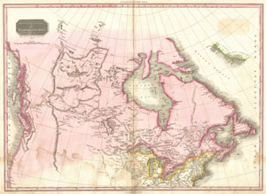
British Possessions in North America.
sold
- Digital Map Information
- Suitable for large format printing
- DPI: 300
- File Size: 19.66 MB
- File Type: ZIP / TIFF
- ICC color profile embedded
- Delivered instantly via download link
Pinkerton's extraordinary 1818 map of the British Possessions in North America. Based on Arrowsmith's historic map of North America, this map covers the continent north of the 40th degree of latitude, including all of the territory currently claimed by ... (more details)
Possibly the finest atlas map of Chile to appear in the 19th century.
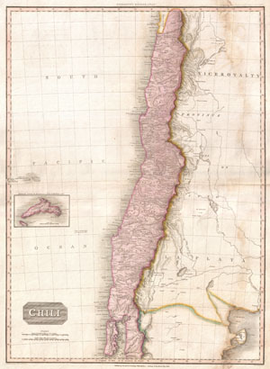
Chili.
sold
- Digital Map Information
- Suitable for large format printing
- Full resolution TIFF file
- ICC color profile embedded
- Delivered instantly via download link
This is John Pinkerton's stunning 1818 map of Chile. Covers the southwestern coast of South America from the Atacama Desert to the Isle of Chiloe. This beautifully rendered map is truly a masterpiece of engraving, with mountain ranges, lakes, ... (more details)
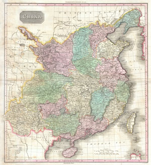
China.
sold
- Digital Map Information
- Suitable for large format printing
- DPI: 300
- File Size: 18.02 MB
- File Type: ZIP / TIFF
- ICC color profile embedded
- Delivered instantly via download link
John Pinkerton's highly decorative map of China, published 1818. Covers the China from Chinese Tartary to the kingdom of Tonkin (modern day Vietnam) and from Yunnan to Formosa and Korea. Includes the island of Formosa, alternately labeled ... (more details)
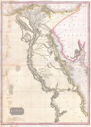
Egypt.
sold
- Digital Map Information
- Suitable for large format printing
- DPI: 300
- File Size: 19.14 MB
- File Type: ZIP / TIFF
- ICC color profile embedded
- Delivered instantly via download link
Pinkerton's extraordinary 1818 map of Egypt. Covers the region centered on the Nile River from its delta along the Mediterranean south to the Island of Philae and the city of Aswan. Notes numerous cities and villages along the river as ... (more details)
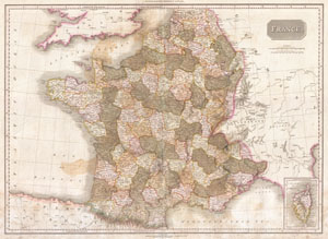
France.
sold
- Digital Map Information
- Suitable for large format printing
- Full resolution TIFF file
- ICC color profile embedded
- Delivered instantly via download link
Pinkerton's extraordinary 1818 map of France. Covers the entire country from the Bay of Biscay to the English Channel to the Mediterranean, to the borders with Switzerland and Germany. Drawn shortly after the Napoleonic Wars. Divided ... (more details)
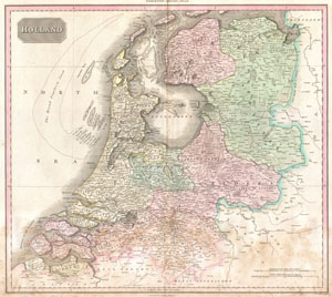
Holland.
sold
- Digital Map Information
- Suitable for large format printing
- DPI: 300
- File Size: 17.53 MB
- File Type: ZIP / TIFF
- ICC color profile embedded
- Delivered instantly via download link
Pinkerton's extraordinary 1818 map of Holland. Covers what is essentially today's Netherlands between the Belgium and Germany. Offers excellent undersea detail regarding various shoals and other dangers, including the Broad Fourteen ... (more details)
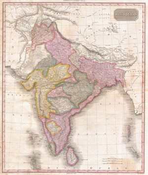
Hindostan
sold
- Digital Map Information
- Suitable for large format printing
- DPI: 300
- File Size: 18.01 MB
- File Type: ZIP / TIFF
- ICC color profile embedded
- Delivered instantly via download link
John Pinkerton's highly decorative map of India, published 1818. Covers the subcontinent from Tibet to Ceylon (Sri Lanka) and from the mouth of the Indus to the Kingdom of Pegu (Burma or Myanmar). Includes the modern day countries ... (more details)
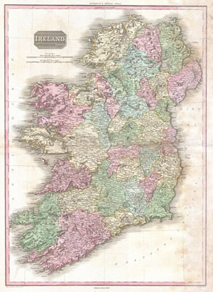
Ireland.
sold
- Digital Map Information
- Suitable for large format printing
- DPI: 300
- File Size: 25.12 MB
- File Type: ZIP / TIFF
- ICC color profile embedded
- Delivered instantly via download link
John Pinkerton's highly decorative map of Ireland, published 1818. Covers the entire Emerald Isle in considerable detail with political divisions and color coding at the county level. Identifies cities, towns, castles, important ... (more details)
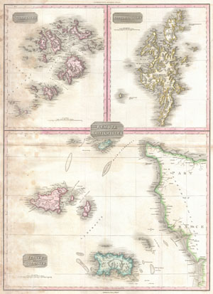
Remote British Isles. ⁄ Scilly Isles. ⁄ Shetland Isles. ⁄ Jersey and Guernsey
sold
- Digital Map Information
- Suitable for large format printing
- DPI: 300
- File Size: 17.19 MB
- File Type: ZIP / TIFF
- ICC color profile embedded
- Delivered instantly via download link
Pinkerton's extraordinary 1818 map of the 'Remote British Isles.' Essentially three maps in one, this chart depicts the Scilly Isles, the Shetland Isles and the Jersey and Guernsey Islands. Upper left map depicts the Scilly ... (more details)
An extremely unsual variant upon Pinkerton's seminal map of North America.

North America.
sold
- Digital Map Information
- Suitable for large format printing
- DPI: 300
- File Size: 17.9 MB
- File Type: ZIP / TIFF
- ICC color profile embedded
- Delivered instantly via download link
This is an extremely unusual mapping of North America prepared for the 1818 American edition of Pinkerton's Atlas. Although the basic engraving remains identical to Pinkerton's Atlas of 1813, published in London, the ... (more details)
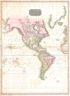
The World on Mercator's Projection Western Part.
sold
- Digital Map Information
- Suitable for large format printing
- DPI: 300
- File Size: 15.87 MB
- File Type: ZIP / TIFF
- ICC color profile embedded
- Delivered instantly via download link
A rare and important 1818 map of the Western Hemisphere by John Pinkerton. Depicts North America, Central America and South America as well as parts of Polynesia, Siberia, Greenland, Iceland, Europe and Africa. The ... (more details)
Identifies Lake Parima, supposed site of El Dorado.
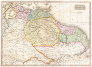
The Caracas.
sold
- Digital Map Information
- Suitable for large format printing
- DPI: 300
- File Size: 20.14 MB
- File Type: ZIP / TIFF
- ICC color profile embedded
- Delivered instantly via download link
This is a stunning, highly detailed, and extremely interesting map of northeastern South America. Covers the modern day countries of Venezuela, British Guyana, French Guyana, Surinam and parts of Brazil. Pinkerton ... (more details)
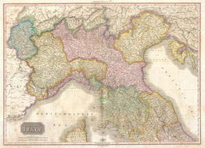
Northern Italy.
sold
- Digital Map Information
- Suitable for large format printing
- DPI: 300
- File Size: 27.09 MB
- File Type: ZIP / TIFF
- ICC color profile embedded
- Delivered instantly via download link
A stunning map of Northern Italy by John Pinkerton. Depicts from Switzerland to Corsica and from France to Venit Istria. Includes Tuscany, Piedmont, Mont Blanc, Genoa, Luca, Milan, Umbria, and the Venetian States. ... (more details)
Fascinating ethnographic commentary.
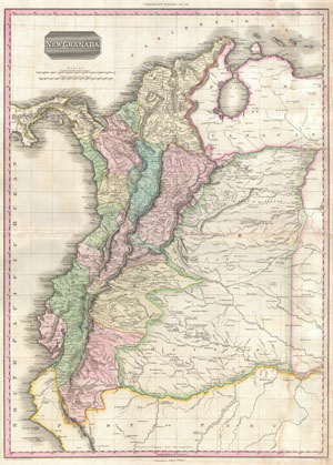
New Granada.
sold
- Digital Map Information
- Suitable for large format printing
- DPI: 300
- File Size: 18.25 MB
- File Type: ZIP / TIFF
- ICC color profile embedded
- Delivered instantly via download link
An altogether extraordinary 1818 map of the northwestern parts of South America by John Pinkerton. Covers the modern day countries of Columbia, Venezuela, Panama, and Ecuador as well as parts of Peru and Brazil. ... (more details)
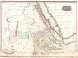
Abyssinia, Nubia & c.
sold
- Digital Map Information
- Suitable for large format printing
- DPI: 300
- File Size: 15.6 MB
- File Type: ZIP / TIFF
- ICC color profile embedded
- Delivered instantly via download link
Pinkerton's extraordinary 1818 map of Nubia and Abyssinia. Covers from Darfur east to the Gulf of Aden and from Aswan south to Gingiro. Includes the modern day countries of Sudan, Ethiopia, and Eretria as well ... (more details)
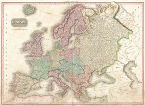
Europe.
sold
- Digital Map Information
- Suitable for large format printing
- DPI: 300
- File Size: 25.06 MB
- File Type: ZIP / TIFF
- ICC color profile embedded
- Delivered instantly via download link
Pinkerton's extraordinary 1818 map of Europe. Covers Europe at the beginning of the 19th century. Offers considerable detail with political divisions and color coding at the regional level. Identifies cities, ... (more details)
A significant advance in the mapping of the Amazon Basin.
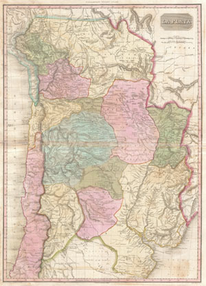
La Plata.
sold
- Digital Map Information
- Suitable for large format printing
- DPI: 300
- File Size: 21.89 MB
- File Type: ZIP / TIFF
- ICC color profile embedded
- Delivered instantly via download link
An altogether extraordinary 1818 map of the southern parts of South America by John Pinkerton. Covers the modern day countries of Argentina, Bolivia, Paraguay, Chile as well as parts of adjacent Brazil and ... (more details)
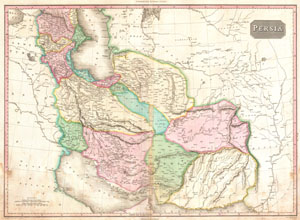
Persia.
sold
- Digital Map Information
- Suitable for large format printing
- DPI: 300
- File Size: 18.74 MB
- File Type: ZIP / TIFF
- ICC color profile embedded
- Delivered instantly via download link
A rare and important 1818 map of Persia by John Pinkerton. Depicts from the Black Sea eastward as far as the Indus Valley, extends north to the Aral Sea and South to the Persian Gulf and the Arabian Sea. ... (more details)
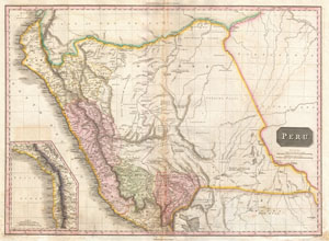
Peru.
sold
- Digital Map Information
- Suitable for large format printing
- DPI: 300
- File Size: 19.67 MB
- File Type: ZIP / TIFF
- ICC color profile embedded
- Delivered instantly via download link
This is John Pinkerton's stunning 1818 map of Peru. Covers the western parts of South America from the Gulf of Guayaquil, in modern Ecuador to Lake Titicaca, modern Peru-Bolivia, and inland well into the ... (more details)
Poland following the 1795 Third Partition.
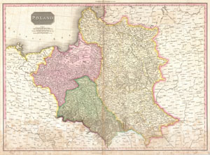
Poland.
sold
- Digital Map Information
- Suitable for large format printing
- DPI: 300
- File Size: 22.25 MB
- File Type: ZIP / TIFF
- ICC color profile embedded
- Delivered instantly via download link
Pinkerton's extraordinary 1818 map of Poland. Depicts the Polish state following the Third Partition of 1795 and before it was reconstituted by Napoleon as the Duchy of Warsaw. Shows the state divided ... (more details)
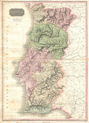
Portugal.
sold
- Digital Map Information
- Suitable for large format printing
- DPI: 300
- File Size: 18.31 MB
- File Type: ZIP / TIFF
- ICC color profile embedded
- Delivered instantly via download link
Pinkerton's extraordinary 1818 map of the Portugal. Covers from the entire nation of Portugal as well as parts of the adjacent Spanish provinces of Galicia, Leon, Estremadura and Andalucía. Offers ... (more details)
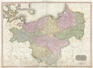
Prussian Dominions.
sold
- Digital Map Information
- Suitable for large format printing
- Full resolution TIFF file
- ICC color profile embedded
- Delivered instantly via download link
A scarce, beautiful, and exceptionally interesting example of John Pinkerton's stunning 1810 map of Prussia. The Map covers from the Baltic Sea to Upper Silesia and from Lower Saxony to Russia, ... (more details)
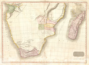
Southern Africa.
sold
- Digital Map Information
- Suitable for large format printing
- DPI: 300
- File Size: 18.14 MB
- File Type: ZIP / TIFF
- ICC color profile embedded
- Delivered instantly via download link
This fascinating hand colored 1818 map by Edinburgh cartographer John Pinkerton depicts Southern Africa. Covers Africa from Angola south to the Cape Colony (modern South Africa) and east to the ... (more details)
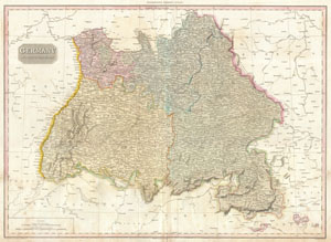
Germany South of the Mayn.
sold
- Digital Map Information
- Suitable for large format printing
- DPI: 300
- File Size: 23.1 MB
- File Type: ZIP / TIFF
- ICC color profile embedded
- Delivered instantly via download link
Pinkerton's extraordinary 1818 map of the southwestern part of Germany. Covers from the from Frankfort south to Lake Constance and east to Bishop. Includes the provinces of Swabia, Bavaria, ... (more details)
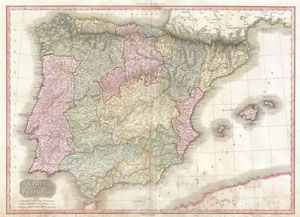
Spain and Portugal.
sold
- Digital Map Information
- Suitable for large format printing
- DPI: 300
- File Size: 25.23 MB
- File Type: ZIP / TIFF
- ICC color profile embedded
- Delivered instantly via download link
John Pinkerton's highly decorative map of Spain and Portugal, published 1818. Covers the entire region in considerable detail with political divisions and color coding at the regional ... (more details)
The finest commercial map of the American southwest to appear in the early 19th century.
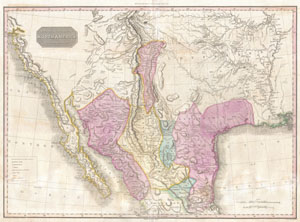
Spanish Dominions in North America Northern Part.
sold
- Digital Map Information
- Suitable for large format printing
- DPI: 300
- File Size: 20.54 MB
- File Type: ZIP / TIFF
- ICC color profile embedded
- Delivered instantly via download link
Possibly the finest commercial map of the American southwest to appear in the early part of the 19th century. Produced by John Pinkerton and based largely on the explorations of ... (more details)
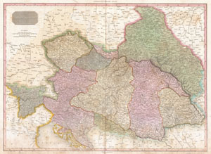
Austrian Dominions.
sold
- Digital Map Information
- Suitable for large format printing
- DPI: 300
- File Size: 25.44 MB
- File Type: ZIP / TIFF
- ICC color profile embedded
- Delivered instantly via download link
Pinkerton's extraordinary 1818 map of the Austrian Dominions. Covers the Austro-Hungarian Empire at the height of its influence. Includes Bohemia, Tyrol, Austria, Croatia, ... (more details)
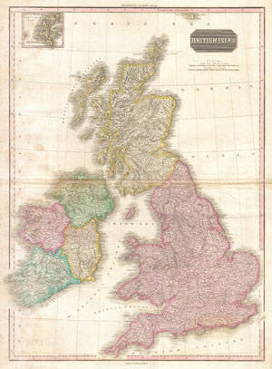
British Isles.
sold
- Digital Map Information
- Suitable for large format printing
- DPI: 300
- File Size: 19.97 MB
- File Type: ZIP / TIFF
- ICC color profile embedded
- Delivered instantly via download link
Pinkerton's extraordinary 1818 map of the British Isles. Includes England, Scotland and Ireland. Covers the entire region in considerable detail with political divisions ... (more details)
1818 Pinkerton Map of the East Indies and Southeast Asia (Singapore, Borneo, Java, Sumatra, Thailand
One of the most beautiful maps of the East Indies to appear in the 19th century.
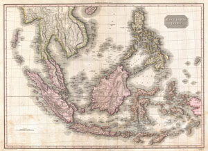
East India Isles.
sold
- Digital Map Information
- Suitable for large format printing
- DPI: 300
- File Size: 23.62 MB
- File Type: ZIP / TIFF
- ICC color profile embedded
- Delivered instantly via download link
Truly a masterwork of copperplate engraving, this is Pinkerton's extraordinary 1818 map of the East Indies. Covers from Burma south to Java and from the Andaman Islands ... (more details)
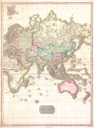
The World on Mercator's Projection Eastern Part.
sold
- Digital Map Information
- Suitable for large format printing
- DPI: 300
- File Size: 22.5 MB
- File Type: ZIP / TIFF
- ICC color profile embedded
- Delivered instantly via download link
A rare and important 1818 map of the Eastern Hemisphere by John Pinkerton. Depicts Asia, Europe, Africa and Australia. The routes of various important explores are ... (more details)
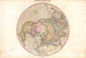
Northern Hemisphere.
sold
- Digital Map Information
- Suitable for large format printing
- DPI: 300
- File Size: 21.33 MB
- File Type: ZIP / TIFF
- ICC color profile embedded
- Delivered instantly via download link
A rare and important 1818 map of the Northern Hemisphere by John Pinkerton. On a Polar projection, this map depicts North America, Asia, the East Indies, and North ... (more details)
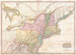
United States of America Northern Part.
sold
- Digital Map Information
- Suitable for large format printing
- DPI: 300
- File Size: 19.63 MB
- File Type: ZIP / TIFF
- ICC color profile embedded
- Delivered instantly via download link
John Pinkerton's highly decorative and important map of the northern parts of the United States, published 1818. Covers from Lake Huron eastward as far as New ... (more details)
Exceptional post-Revolutionary map of the America Southest.
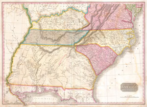
United States of America Southern Part.
sold
- Digital Map Information
- Suitable for large format printing
- DPI: 300
- File Size: 20.46 MB
- File Type: ZIP / TIFF
- ICC color profile embedded
- Delivered instantly via download link
A rare and important 1818 map of the southeastern part of the United States. Depicts from the Mississippi River eastward to the Pacific, extends north as far ... (more details)
Uncommon transitional map of the Antarctic with no Southern Continent.
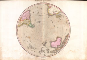
Southern Hemisphere.
sold
- Digital Map Information
- Suitable for large format printing
- DPI: 300
- File Size: 18.95 MB
- File Type: ZIP / TIFF
- ICC color profile embedded
- Delivered instantly via download link
A rare and important 1818 map of the Southern Hemisphere by John Pinkerton. On a Polar projection, this map depicts Australia, Polynesia, and the parts of ... (more details)
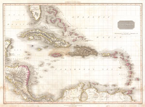
West Indies.
sold
- Digital Map Information
- Suitable for large format printing
- DPI: 300
- File Size: 17.6 MB
- File Type: ZIP / TIFF
- ICC color profile embedded
- Delivered instantly via download link
Extraordinary large format map of the West Indies published in 1818 by cartographer John Pinkerton. Centered on the island of Hispaniola or Santo Domingo, ... (more details)
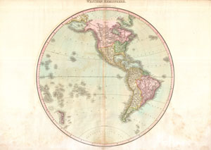
Western Hemisphere.
sold
- Digital Map Information
- Suitable for large format printing
- DPI: 300
- File Size: 18.66 MB
- File Type: ZIP / TIFF
- ICC color profile embedded
- Delivered instantly via download link
A rare and important 1818 map of the Western Hemisphere by John Pinkerton. Depicts North America, Central America and South America as well as parts of ... (more details)
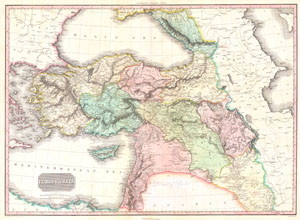
Turkey in Asia.
sold
- Digital Map Information
- Suitable for large format printing
- DPI: 300
- File Size: 20.62 MB
- File Type: ZIP / TIFF
- ICC color profile embedded
- Delivered instantly via download link
This is John Pinkerton's stunning 1818 map of Turkey in Asia. Covers the holdings of the early 19th century Ottoman Empire in Asia, inclusive of modern ... (more details)
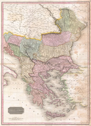
Turkey in Europe.
sold
- Digital Map Information
- Suitable for large format printing
- Full resolution TIFF file
- ICC color profile embedded
- Delivered instantly via download link
Pinkerton's extraordinary 1818 map of the Turkey in Europe. Covers the Ottoman Empire's holdings in Europe at the beginning of the 19th century. ... (more details)
Speculative course of the Niger River w/ apocryphal Mountains of Kong.
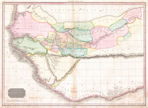
Western Africa.
sold
- Digital Map Information
- Suitable for large format printing
- DPI: 300
- File Size: 15.92 MB
- File Type: ZIP / TIFF
- ICC color profile embedded
- Delivered instantly via download link
This fascinating hand colored 1818 map by Edinburgh cartographer John Pinkerton depicts Western Africa. Depicts Africa roughly from the Salve ... (more details)