
Dougal, William Henry (sold)

William Henry Dougal (January 30, 1822 - October 17, 1895) was an American artist and engraver. Born in New Haven, Connecticut, Dougal was apprenticed to Sherman and Smith, New York City-based engravers, at the age of 15. He was working independently as an engraver in Washington, D.C. by 1844, receiving his first large commission to engrave the plates for the reports of the Wilkes expedition. He spent 1849-1850 in San Francisco as the owner and operator of a livery and grocery store. Dougal returned to Washington, D.C. by late 1850, where he worked for the Bureau of Printing and Engraving, a position he held until his death in 1895. Dougal married Mary Virginia Adler in 1851, with whom he had seven children.
Illustrates the beginning of the Peninsula Campaign during the American Civil War from Fort Monroe to Williamsburg.

Campaign Maps Army of the Potomac Map No. 1 Yorktown to Williamsburg Prepared by Command of Maj. Gen. George B. McClellan, U.S.A.
sold
- Digital Map Information
- Suitable for large format printing
- File Size: 15.76 MB
- File Type: ZIP / TIFF
- ICC color profile embedded
- Delivered instantly via download link
This is an 1862 separate-issue Henry Larcom Abbot map of part of the Virginia Peninsula during the American Civil War. Commissioned by Union Major General George B. McClellan to illustrate his Peninsula Campaign, the map depicts the region from the James River to the York River and from Williamsburg to Fortress Monroe and Chesapeake Bay. The first in a series of three maps, the sites of both the Siege of Yorktown and the Battle of Williamsburg (the first major battle of the Peninsula Campaign) are both illustrated. (more details)
Region around the first pitched battle of the Peninsula Campaign during the American Civil War.
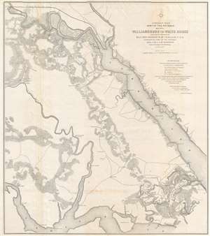
Campaign Maps Army of the Potomac Map No. 2 Williamsburg to White House Prepared by Command of Maj. Gen. George B. McClellan, U.S.A.
sold
- Digital Map Information
- Suitable for large format printing
- File Size: 16.56 MB
- File Type: ZIP / TIFF
- ICC color profile embedded
- Delivered instantly via download link
This is an 1862 separate-issue Henry Larcom Abbot map of part of the Virginia Peninsula during the American Civil War (1861 - 1865) commissioned by Union Major General George B. McClellan to illustrate the Peninsula Campaign. The map depicts from the James River to the York River, and from White House and the Richmond and York River Railroad to Williamsburg and the James River. This is the second in a series of three maps. Williamsburg, Virginia, the site of the first major pitched battle of the Peninsula Campaign, is located in the lower part of the map just right of center. Although the theater of war is illustrated, very few notations are present to indicate the state of war between Union and Confederate forces. Earthworks along the roads southeast of Williamsburg, known as Fort Magruder, are the only features that denote war. Roads, rivers, forests, and individual buildings however, are illustrated. (more details)