
Emory, William Hemsley
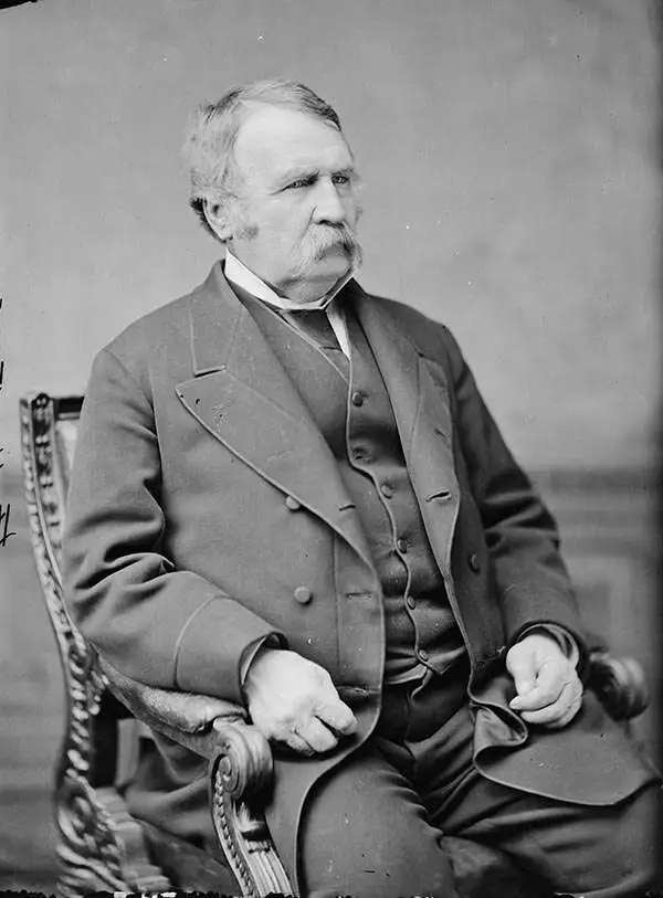
William Hemsley Emory (September 7, 1811 - December 1, 1887) was an American surveyor, civil engineer, and Army officer. Born in Queen Anne's County, Maryland, Emory graduated from the United States Military Academy at West Point in 1831, was assigned to the Fourth Artillery, and resigned from service in 1836 to pursue civil engineering. He returned to the army in 1838 to serve in the newly-formed Army Corps of Topographical Engineers. During the Mexican-American War, Emory served in the Army of the West under the command command of Stephen Watts Kearny. While serving with Kearny, he kept a detailed journal that was then published as Notes of a Military Reconnaissance from Fort Leavenworth to San Diego and soon became an important guidebook for the route to Southern California. After the war, Emory served as part of the team that surveyed the United States-Mexican border. When the American Civil War started, Emory was stationed in Indian Territory and immediately realized the likelihood that Confederates would capture him and his men. To avoid this, Emory quickly secured the services of Black Beaver, the famous Lenape warrior, to guide them out of the territory. Emory and his troops, on their way from Fort Washita to Fort Leavenworth, captured a number of their Confederate pursuers, which were the first prisoners taken during the war. Emory then served in the Army of the Potomac, in the Western Theater, and in the Shenandoah Valley Campaign of 1854. After the war, Emory held the post of commander of the Department of the Gulf during Reconstruction and, in September 1874, President Ulysses S. Grant ordered Emory to New Orleans, where he successfully negotiated a peace with the white supremacist paramilitary organization the White League, which led to the White League being disbanded. Emory married Matilda Wilkins Bache on May 29, 1838 in Philadelphia, with whom he had two sons, both of which served in the United States armed forces. Matilda Bache was Alexander D. Bache's sister. Alexander Bache was one of the most influential superintendents of the United States Coast Survey.
'One of the greatest contributions ever made to American geography' - G. K. Warren
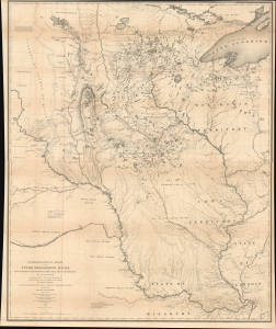
Hydrological Basin of the Upper Mississippi River From Astronomical and Barometrical Observations, Surveys, and Information.
$2,200.00
Acquire
- Digital Map Information
- Suitable for large format printing
- Full resolution TIFF file
- ICC color profile embedded
- Delivered instantly via download link
This is Joseph N. Nicollet's foundational 1843 map of the Upper Mississippi River Basin, which far surpassed all earlier maps of the area. It was the culmination of Nicollet's life's work and four surveying expeditions, which also helped launch the careers of John C. Frémont and William H. Emory, two of the greatest American explorers of the 19th century. (more details)
The battle just before Colonel Price and his men reached Taos, New Mexico to put down the Taos Revolt.
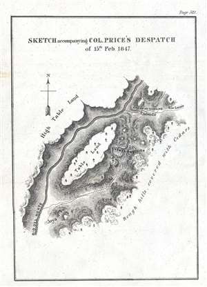
Sketch accompanying Col. Price's Despatch of 15th Feb. 1847.
$300.00
Acquire
- Digital Map Information
- Suitable for large format printing
- DPI: 300
- File Size: 1.14 MB
- File Type: ZIP / TIFF
- ICC color profile embedded
- Delivered instantly via download link
This is an 1847 William Hemsley Emory map of the Battle of Embudo Pass, one of the battles during the Taos Revolt in and near Taos, New Mexico, which was part of the Mexican-American War. Oriented to the north, the map depicts a section of Embudo Pass, a canyon not far from Taos. Colonel Sterling Price and the force he was leading to put down the Taos Revolt needed followed the Rio Grande (Rio del Norte) after defeating the insurrectionists at the Battle of Cañada. The column needed to travel along the road from La Joya (Joya) El Embudo (Embudo), which was flanked on both sides by high, rocky terrain, giving the region the look of a canyon. The road and the insurgent's positions are noted and labeled here, along with the Rio Grande and the highlands on either side of the canyon. (more details)
'...the most important milestone in the cartographic development and accurate delineation of the Southwest.' - Carl Wheat

Military Reconnaissance of the Arkansas Rio del Norte and Rio Gila.
$1,500.00
Acquire
- Digital Map Information
- Suitable for large format printing
- Full resolution TIFF file
- ICC color profile embedded
- Delivered instantly via download link
This is William Hemsley Emory's seminal 1848 map of the American Southwest. Depicting from Forth Leavenworth, Kansas (then in Missouri) to the west coast, the map follows Emory's military reconnaissance through the territory newly-acquired by the United States from Mexico. It is the first thorough examination of this region after the Mexican American War (1846 - 1848). (more details)