
Fry, Joshua (sold)

Joshua Fry (1699–1754) was an English adventurer, professor, investor who became an official in the colony of Virginia. He is best known as a surveyor and cartographer who collaborated with Peter Jefferson, the father of future U.S. president Thomas Jefferson in producing the quintessential colonial map of Virginia and Maryland.
Fry was born in Somerset, England, and educated at Oxford. He sought his fortune in the colonies, emigrating to Virginia in 1726. There he would marry and raise a large family. He would become a professor of mathematics and natural philosophy. After marrying a young widow, he would give up his professorship to operate her plantation. At that time he would begin a public career as a judge but would also buy and sell real estate, and worked as well as a surveyor. In 1746 Fry and Peter Jefferson were commissioned to survey Lord Fairfax's lands in the Piedmont region of Virginia, and three years later the two were tasked with surveying the boundary with North Carolina. In 1750 they would be assigned to survey the border with Maryland as well. On the strength of these and other surveys, Fry and Jefferson would produce their 1751 masterpiece map, A Map of the most Inhabited part of Virginia containing the whole Province of Maryland. Fry had served as colonel in Albemarle County's militia, and at the beginning of the French and Indian War he was named Commander-in-Chief of colonial forces, given command of the Virginia Regiment, and ordered to capture Fort Duquesne from the French. On the way, he fell from his horse and died from the resultant injuries. He was succeeded in command of the Virginia Regiment by a young officer named George Washington.
Fry was born in Somerset, England, and educated at Oxford. He sought his fortune in the colonies, emigrating to Virginia in 1726. There he would marry and raise a large family. He would become a professor of mathematics and natural philosophy. After marrying a young widow, he would give up his professorship to operate her plantation. At that time he would begin a public career as a judge but would also buy and sell real estate, and worked as well as a surveyor. In 1746 Fry and Peter Jefferson were commissioned to survey Lord Fairfax's lands in the Piedmont region of Virginia, and three years later the two were tasked with surveying the boundary with North Carolina. In 1750 they would be assigned to survey the border with Maryland as well. On the strength of these and other surveys, Fry and Jefferson would produce their 1751 masterpiece map, A Map of the most Inhabited part of Virginia containing the whole Province of Maryland. Fry had served as colonel in Albemarle County's militia, and at the beginning of the French and Indian War he was named Commander-in-Chief of colonial forces, given command of the Virginia Regiment, and ordered to capture Fort Duquesne from the French. On the way, he fell from his horse and died from the resultant injuries. He was succeeded in command of the Virginia Regiment by a young officer named George Washington.
Best colonial map of Virginia and Maryland.
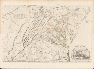
A Map of the most Inhabited part of Virginia containing the whole Province of Maryland with Part of Pensilvania, New Jersey and North Carolina drawn by Joshua Fry and Peter Jefferson in 1775.
sold
- Digital Map Information
- Suitable for large format printing
- Full resolution TIFF file
- ICC color profile embedded
- Delivered instantly via download link
This is the monumental 1775 Fry/Jefferson map of Virginia and Maryland, the most important colonial map of Virginia, in its original four-sheet English version. Drawn by Joshua Fry and Peter Jefferson in 1751 and first printed in 1753, this was the first accurate survey of the interior of Virginia. It was the first printed map to approximate the parallel ridges and valleys of the Appalachian Mountains, and the first to accurately depict the Blue Ridge Mountains. Following the revision of the map in 1755, this was the first map to include Virginia's road system, also marking routes used by frontier traders and Native Americans. Following that revision, it contained the best mapping of the Upper Ohio Valley and the Virginia frontier produced during the French and Indian War (1754 - 1763) and remained the prototype for all subsequent maps of Virginia until the 19th century. As both Fry and Jefferson were denizens of the colony, this further represents the first map of Virginia produced by Virginians. (more details)