
Gatier, Félix (sold)

Félix Gatier (February 28, 1916 - January 5, 2017) was a French architect. The son of the painter Pierre Gatier (1878 - 1944) and his wife, Gatier earned his diploma on November 13, 1945. He served as an architecte-voyer of Paris from 1962 through 1964. He renovated the l’îlot des jardins Saint-Paul in the fourth arrondissement of Paris from 1970 until 1987. This also resulted in the birth of the Village Saint-Paul, a popular neighborhood in the Marais. Over the course of his career he published numerous works, among which were numerous works on the Marais and even a few maps of the Marais District. During World War II, Gatier was part of the French resistance during World War II and as a chevalier of the Legion of Honor and had been awarded the Croix de Guerre 1939 - 1945.
Visit the Centre Pompidou and the Musée Carnavalet in this popular Parisian district.
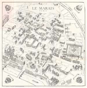
This is a 1979 Félix Gatier pictorial map of the Marais District (Le Marais), Paris, France. The map depicts from the Rue Beaubourg and the Centre Pompidou to the Place des Vosges, and from the intersection of the Boulevard du Temple and the Rue Charlot to the Seine River. Buildings are illustrated in profile and labeled, including banks, churches, and private homes. Other specifically identified places include the Centre Pompidou, the Place des Vosges, the Mémorial du Martyr Juif Inconnu (today's Mémorial de la Shoah), the Musée Carnavalet, the Archives Nationales, and the Église Saint-Gervais. (more details)
Visit the Centre Pompidou and the Musée Carnavalet in this popular Parisian district.
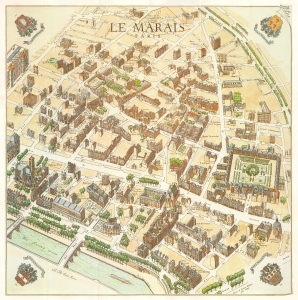
This is a full color 1985 Félix and Sylvie Gatier pictorial map of the Marais District (Le Marais), Paris, France. The map depicts from the Rue Beaubourg and the Centre Pompidou to the Place des Vosges, and from the intersection of the Boulevard du Temple and the Rue Charlot to the Seine River. Buildings are illustrated in profile and labeled, including banks, churches, and private homes. Other specifically identified places include the Centre Pompidou, the Place des Vosges, the Mémorial du Martyr Juif Inconnu (today's Mémorial de la Shoah), the Musée Carnavalet, the Archives Nationales, and the Église Saint-Gervais. Numerous hôtel particuliers, urban mansions built by Paris's nobility in the 1600s, are labeled as well. (more details)