
Dépôt de la Guerre (sold)

The Dépôt de la Guerre (fl. 1750 - 1887), active from the Revolution until the end of the 19th century was the engineering and cartographic arm of the French military. The Depot was responsible for many of the finest French topographical maps to appear in the 18th and 19th centuries.
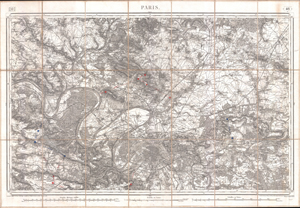
Paris.
sold
- Digital Map Information
- Suitable for large format printing
- DPI: 300
- File Size: 118.53 MB
- File Type: ZIP / TIFF
- ICC color profile embedded
- Delivered instantly via download link
An extremely attractive mid 19th century military pocket map of Paris and its northern environs. Covers from Versailles north as far as Orry, also extends westward along the Seine to Meulan and eastward as far as Jablines. Offers extraordinary detail throughout ... (more details)