
Lauvergne, Barthélemy (sold)

Barthélemy Lauvergne (July 4, 1805 - November 15, 1871) was a French painter, maritime, and landscape artist active throughout the middle years of the 19th century. Lauvergne was born in Tulon and mastered drawing under Pierre Letuaire (1798 - 1885). He was immediately drawn the exotic and began to travel son after reaching adulthood - circumnavigating the world three times. He first accompanied the French naval officer Jules Sébastien César Dumont d'Urville (1790 - 1842) onboard the L'Astrolabe (1826 - 1829), then Cyrille Pierre Théodore Laplace (1793 - 1875) on La Favorite (1830 - 1832), and finally Auguste-Nicolas Vaillant (1793 - 1858) La Bonite (1836 - 1837). He also participated as an artist on Arctic voyages to Iceland, Spitzbergen, Finland, and Norway. In February of 1841 he was appointed to the Dépôt des Cartes et Plans de la Marine, where with government sponsorship, he published hundreds of finely lithographed images from his voyages - creating unique visual record of cultural interactions between European explorers and indigenous peoples. He painted a portrait of Napoleon III in 1851. Lauvergne retired to his hometown, Toulon, in 1863, and died 8 years later in 1871.
Infamous island, murky history.
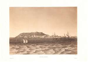
Ile-de-Goree.
sold
- Digital Map Information
- Suitable for large format printing
- DPI: 600
- File Size: 26.04 MB
- File Type: ZIP / TIFF
- ICC color profile embedded
- Delivered instantly via download link
This is a c. 1835 Lauvergne / Himely view of Gorée Island, off the coast of Dakar, Senegal. Various European powers fought over this strategically located island for more than three centuries, during which it became a conduit in the Transatlantic Slave Trade. In the 20th century, the island's Maison des Esclaves became one of the world's most prominent memorials to the slave trade. (more details)
One of the earliest obtainable views of Honolulu.
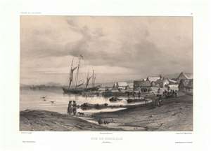
Vue de Honolulu. Iles Sandwich.
sold
- Digital Map Information
- Suitable for large format printing
- Full resolution TIFF file
- ICC color profile embedded
- Delivered instantly via download link
One of the earliest obtainable views of Honolulu, Hawaii, this c. 1840 image was drawn by Barthélemy Lauvergne. Lauvergne was one of several artists accompanying the 1836 - 1837 Auguste-Nicolas Vaillant (1793 - 1858) circumnavigation. The scientific expedition arrived in Hawaii on September 28, 1836 and stayed through October 11. It is safe to assume that Lauvergne sketched this view in early October 1836. The view reveals the ragtag European coastal village set beside the tiny harbor of Kou. Note the European style buildings - as opposed to traditional high roofed Hawaiian thatched structures. Two sailing ships are anchored just offshore. Within 20 years, this small settlement would grow to become the economic hub of the entire north Pacific. In 1850, there are records of more than 100 whaling ships crowding the harbor and 3000 drunken sailors wandering the rough streets in search of … the things for which drunken sailors search. (more details)
One of the earliest obtainable views of Singapore.
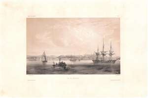
Vue de Sincapour.
sold
- Digital Map Information
- Suitable for large format printing
- DPI: 600
- File Size: 26.17 MB
- File Type: ZIP / TIFF
- ICC color profile embedded
- Delivered instantly via download link
One of the earliest obtainable views of Singapore, this is a rare c. 1845 chromolithograph by Barthélémy Lauvergne, one of the resident artists on the Bonite Expedition (1836 - 1837), a French scientific and diplomatic circumnavigation. It presents the British colony in its early days of development as a bustling port and meeting point of cultures. (more details)
View of Kealakekua and Kealakekua Bay, important sites in Native Hawaiian culture.
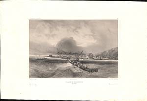
Village De Kearakekoua / [Kealakekua Village].
sold
- Digital Map Information
- Suitable for large format printing
- Full resolution TIFF file
- ICC color profile embedded
- Delivered instantly via download link
This is a c. 1845 lithograph view of the village of Kealakekua, Hawaii (Sandwich Islands) showing two groups of indigenous inhabitants in canoes with the village in the background. The view was sketched by Barthélémy Lauvergne, one of the resident artists on the Bonite expedition, a French scientific and diplomatic voyage around the world in 1836 - 1837. (more details)