
Mahlmann, Heinrich (sold)

Heinrich Mahlmann (1812 - December 12, 1848) was a German engraver, lithographer, and cartographer based in Berlin. He worked with Carl Ritter (1779 - 1859), Franz August von Etzel (1784 - 1850), and Heinrich Kiepert (1818 - 1899), among others. We have found references to both 'Carl Heinrich Wilhelm Mahlmann' and 'Heinrich Christian Ludwig', some suggesting they were brothers, and both involved in cartography. Which Heinrich is which, however, is unclear. We believe the engraver who signed his work 'H. Mahlmann' is most likely the latter, 'Heinrich Christian Ludwig'.
Deciphering the Himalayas.
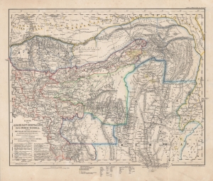
Karte von Asam, Ost-Bengalen und Nort-Birma Nebst Bhutan, Munipur, Catschar, etc.
sold
- Digital Map Information
- Suitable for large format printing
- DPI: 600
- File Size: 41.7 MB
- File Type: ZIP / TIFF
- ICC color profile embedded
- Delivered instantly via download link
This is Carl Ritter and Heinrich Mahlmann's 1840 map of Bhutan, northern Burma, northeastern India, and northern Bangladesh. This map was compiled at a time when Europeans knew little of this region. Thus, it represents a dense amalgam of explorers' accounts and speculation expounded through the lens of Ritter's German Romantic theories of the Earth as a 'cosmic individual'. (more details)