
Mahmoud Bey al-Falaky (sold)
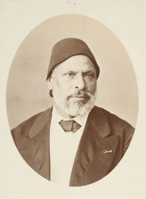
Mahmoud Bey al-Falaky (محمود حمدي الفلكي ; 1885 - 1815), born Amin Sabbagh (صباغ أمين), was an Egyptian cartographer, astronomer, and government official in the Khedivate. In fact, his honorary title literally translates to 'Mahmoud Bey, the astronomer' (الفلكي). Born in Gharbia in the heart of the Nile Delta, he moved to Alexandria as a child with his older brothers and received primary education. He then trained at the Naval Arsenal School (مدرسة الترسانة البحرية) established by Mohammed Ali Pasha, learning shipbuilding from French and Italian teachers, and completing his training in 1833. He then attended the Polytechnic School (مدرسة البوليتكنيك), graduating first in his class and then becoming a mathematics teacher at the School of Engineering (مدرسة المهندسخانة) in Boulaq (Cairo) and undertook an intensive study of astronomy. Having gained fluency in French, he had access to the latest European publications on mathematics and astronomy, and used them to establish a state-of-the-art observatory. He became a trusted expert for the Khedivate, determining latitude and longitude for usage on maps of the Nile Delta that were used to determine tax obligations. In 1850, he and several other Egyptian scientists were sent on a mission to France, and spent most of the next decade in Europe, continuing his astronomical and cartographic studies and producing the most advance map of northwestern Europe in Arabic to date. On returning to Egypt in 1859, he oversaw a newly-constructed observatory in Abbassia (Cairo), became a member of the Egyptian Scientific Academy, and became president of the Egyptian Geographical Society. In 1860, he gained international attention for his notes on observations of a solar eclipse made from northern Sudan. Late in his career, Mahmoud al-Falaky undertook additional roles with the Egyptian government, including studies on flood control and irrigation on the Nile, and eventually rose to Minister of Works in 1882 and then serving as Undersecretary of the Ministry of Education. He continued to publish works, including on the Arabic calendar, the history of ancient Alexandria, and other topics.
Foundational map of the Nile Delta and the basis of all subsequent regional maps.
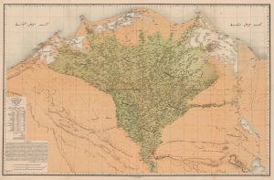
كهاريطات الءواجه الءباحاري ليلأقاليم الءميصريياه / [Map of the Egyptian Regions facing the Sea].
sold
- Digital Map Information
- Suitable for large format printing
- File Size: 168.02 MB
- File Type: ZIP / TIFF
- ICC color profile embedded
- Delivered instantly via download link
A striking, important, and rare Arabic-language chromolithographed map of the Nile Delta, prepared in 1872 by Mahmoud Bey al-Falaky. Aside from its aesthetic qualities, it also represented the most accurate map of the region when it was produced, combining the most up-to-date cartographic methods with extensive research on local placenames, terrain, and topography. As this map replaced French benchmark maps of the region from the early 19th century, it became the new gold standard and was continually used as the basis for most subsequent maps. (more details)