
Mapping Unit of the Israel Ministry of Education and Culture (sold) (יחידת המיפוי)

The Mapping Unit (c. 1991 - present) of the Israel Ministry of Education and Culture (יחידת המיפוי) is a government body that has occasionally produced maps relating to matters of public interest, particularly the Israeli-Palestinian Peace Process, in conjunction with the Publications Service at the Information Center (שירות הפרסומים במרכז ההסברה) of the same ministry.
AKA: יחידת המיפוי
A map for the roadmap to peace.
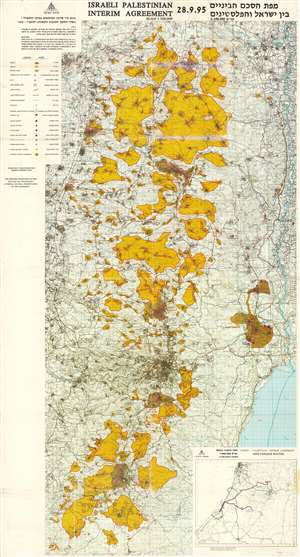
Map of the Interim Agreement between Israel and the Palestinians 09-28-95 / [מפת הסכם הביניים בין ישראל והפלסטינים 28.9.95].
sold
This is a map of the West Bank, Israel / Palestine, illustrating the 'Oslo II' Accords, signed in Taba, Egypt in 1995, following the Oslo Accord (Oslo I) two years earlier. It illustrates the bewildering complexity of trying to create distinct Israeli and Palestinian areas, the latter of which moved towards a degree of self-government following the agreements. (more details)