
Norman, John (sold)

John Norman (1748 - June 8, 1817) was an engraver and publisher in Boston, Massachusetts. Born in England, he apprenticed as a printer under the elder William Faden, father of the mapmaker William Faden II (1749 - 1836). Norman completed his apprenticeship in October of 1773 and shortly thereafter moved to Philadelphia. There he established himself as an engraver, publishing his first map The Theatre of War in North America in 1777. He relocated to Boston in 1781. He is best known for nautical charts, many of which represent the earliest American-produced sea charts of the areas depicted, and are consequently among the most important American printed works of the 18th century. Norman had engraved two of the charts for the first American nautical atlas (Mathew Clark’s 1790 A Complete Set of Charts of the Coast of America). The success of this venture inspired Norman to publish is own atlas in 1791, The American Pilot. This is one of the most important American atlases, and loose examples of Norman’s charts are extremely rare on the market. Norman’s work includes portraits, illustrations and architectural diagrams; he also produced maps for publication in works such as Boston Magazine and Malham’s Naval Gazetteer. He died of typhoid in 1817. His son, William Norman (17?? - 1807) began working with him and fully took over publication of the The American Pilot around 1794.
One of the only maps of the world produced in America during the 18th century by one of America's first mapmakers.
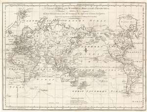
A General Chart of the World on Mercator's Projection, exhibiting all the New Discoveries and the Tracks of the different Circum-Navigators. Engraved for Spotswood's and Nancrede's Edition of Malham's Naval Gazetteer.
sold
- Digital Map Information
- Suitable for large format printing
- DPI: 600
- File Size: 17.76 MB
- File Type: ZIP / TIFF
- ICC color profile embedded
- Delivered instantly via download link
This 1797 map of the world by John Norman is one of the few printed in America prior to the 19th century. It was published in Boston for the first edition of Reverend John Malham's Naval Gazetteer. The map was engraved by John Norman, one of the first American mapmakers, of whose cartographic output virtually all ranks among the rarest and most sought-after nautical charts of the 18th century. It illustrates the routes of nautical explores, speculative routes through North America, names the Sea of Korea, and the legendary Chinese colony of Fusang. (more details)