
Ogilby, John
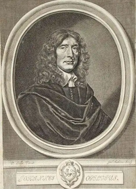
John Ogilby (November 17, 1600 - 1676) was a Scottish translator and cartographer. John Ogilby's life seems to be one of extremes, teetering between wealth and poverty, success and failure. Ogilby was born near Edinburgh, Scotland, into a once wealthy family laid low by extreme debt. Struggling with poverty at every turn, Ogilby involved himself in various businesses ranging from dancing master, to actor, to tutor. In 1612, at age 12, Ogilby won a lottery run to advance the colonial interests of Virginia. His winning were sufficient to pay of many of his father's debts and apprentice himself to a dancing master. Ogilby proved a natural and graceful dancer and even made extra money tutoring his fellow apprentices. Starcrossed as he was, Olgiby's dancing career ended when a misstep when a misstep at a masked ball injured his leg and left him lame for live. Afterwards he managed to leverage his contacts in the dance world to secure a position as a dance instructor to the daughters of Sir Ralph Hopton. Hopton struck an immediate friendship with Olgiby and trained him in Military Science. Later Ogilby relocated to Ireland where he worked an as actor and later as Master of Revels. The Irish Rebellion of 1641 again dashed Ogilby's fortunes and forced him to flee Dublin by ship. On the way, the ship sunk but the survivors were rescued and eventually made their way to England, which was then under the strict rule of Oliver Cromwell. Ogilby took refuge at Cambridge where he mastered Greek and Latin. Following the Restoration of Charles II, Ogilby invested in his first major literary venture, a translation of Virgil into English. This work earned him the patronage of Charles II, despite the ridicule of prominent poets Dryden and Pope. Under Royal patronage Ogilby published several volumes relating to the Restoration. In short order he has established a successful London publisher based out of the Whitefriars district. This, unfortunately turned out to be a fateful choice of location as in 1666 the Great Fire of London tore through this are destroying Ogilby's publishing stock, home, and business. Once again Ogilby exhibited a remarkable phoenix-like ability to literally rise from the ashes. Shortly after the Great Fire, he began his most important ventures as a publisher of geographical works. In order to recover from the fire, Ogilby and his grandson were took positions as surveyors commissioned to create a large property map of London. The resultant map of London, "London Survey'd", was published in 1677 and earned Ogilby the honorific "Kings Cosmographer and Geographic Printer". His most famous works are his 1675 Road Atlas of England, Britannia which redefined road mapping, and his 1671 Atlas of the Americas.
Early French Settlement in Florida.
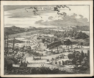
Arx Carolina.
$750.00
Acquire
- Digital Map Information
- Suitable for large format printing
- File Size: 13.88 MB
- File Type: ZIP / TIFF
- ICC color profile embedded
- Delivered instantly via download link
This is a beautifully realized 1671 Arnoldus Montanus view of Arx Carolina, or Fort Caroline, situated on the present-day St. John's River, in the vicinity of Jacksonville, Florida. It portrays the French Huguenot fort, imagined as it was before its 1565 destruction by the Spanish. (more details)
The Dutch Sack Olinda.
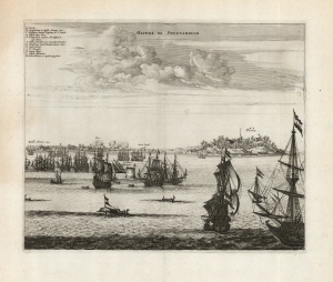
Olinda de Phernambuco.
$350.00
Acquire
- Digital Map Information
- Suitable for large format printing
- DPI: 600
- File Size: 32.76 MB
- File Type: ZIP / TIFF
- ICC color profile embedded
- Delivered instantly via download link
This is a 1671 Arnold Montanus view of the 1630 Dutch attack and capture of Olinda, the Portuguese capital of the captaincy of Pernambuco in Brazil. This establishment of a Dutch foothold in Brazil represented a high point in the globally fought Dutch-Portuguese War (1602 - 1654). The Dutch victory was short-lived as Brazilian 'New Holland' would only last until 1654. Nevertheless, the event was celebrated in Dutch histories, hence Montanus' inclusion of this image in his De Nieuwe en Onbekende Weereld and its concurrent printing in Ogilby's America. (more details)
Oldest European City in the United States.
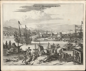
Pagus Hispanorum in Florida.
$850.00
Acquire
- Digital Map Information
- Suitable for large format printing
- File Size: 11.4 MB
- File Type: ZIP / TIFF
- ICC color profile embedded
- Delivered instantly via download link
This is a beautifully realized Arnoldus Montanus/John Ogilby view of the Spanish settlement of St. Augustine, Florida, the oldest European city within the bounds of what would be the United States. St. Augustine was founded by Pedro Menendez in 1565 to protect the northernmost frontier of the Spanish Empire on America's east coast and to project Spanish power over the trade route passing from the Gulf of Mexico through the passage between Florida and the Bahamas. (more details)
Among the First Views of Colonial Mexico City.
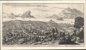
Nova Mexico.
$600.00
Acquire
- Digital Map Information
- Suitable for large format printing
- File Size: 22.63 MB
- File Type: ZIP / TIFF
- ICC color profile embedded
- Delivered instantly via download link
A rare and impressive view of Mexico City from John Ogilby's 1671 America. This is one of the first representations of Mexico City as a Spanish colonial center. (more details)
Ogilby's innovative strip maps.
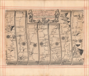
The road from London to Montgomery North Wales...
$400.00
Acquire
- Digital Map Information
- Suitable for large format printing
- Full resolution TIFF file
- ICC color profile embedded
- Delivered instantly via download link
A c. 1675 strip road map by John Ogilby depicting the road from London to Montgomery in Wales. This map represents an early and thus innovative example of this distinctive genre. It was engraved for Ogilby's Britannia, Volume the first: An illustration of the kingdom of England and dominion of Wales. (more details)
Essential Map for the Carolina Collector.
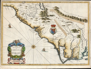
A New Description of Carolina.
$4,500.00
Acquire
- Digital Map Information
- Suitable for large format printing
- Full resolution TIFF file
- ICC color profile embedded
- Delivered instantly via download link
A bright example of the important and scarce map of the Carolina colony engraved by Francis Lamb for inclusion in the 1676 Bassett and Chiswell edition of John Speed's atlas. It is one of the earliest English maps of the colony acquirable by the collector, published just six years after the founding of Charleston. It is a map of seminal importance: an essential document in the history of the Carolinas and the British settlements in North America. (more details)
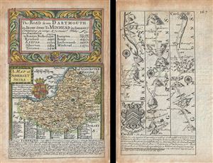
A Map of Somerset Shire. The Road from Darmouth in Devon Shire to Minhead in Somerset S.
$175.00
Acquire
- Digital Map Information
- Suitable for large format printing
- DPI: 300
- File Size: 3.19 MB
- File Type: ZIP / TIFF
- ICC color profile embedded
- Delivered instantly via download link
This is a scarce 1736 example of John Owen and Emanuel Bowen's map of the County of Somerset, England. The map is printed on both sides. The map on recto features a detailed map of the County of Somerset (commonly known as Somersetshire until the late 19th ... (more details)
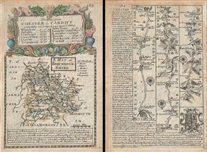
A Map of Brecknock Shire. The Road from Chester to Cardiff.
$175.00
Acquire
- Digital Map Information
- Suitable for large format printing
- DPI: 300
- File Size: 3.27 MB
- File Type: ZIP / TIFF
- ICC color profile embedded
- Delivered instantly via download link
This is a scarce 1736 example of John Owen and Emanuel Bowen's map of the County of Brecknockshire, Wales. The map is printed on both sides. The map on recto features a detailed map of the County of Brecknockshire (also known as Brecknock or the County of ... (more details)
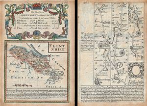
Flintshire. The Road from Shrewsbury to Holywell.
$175.00
Acquire
- Digital Map Information
- Suitable for large format printing
- DPI: 300
- File Size: 3.2 MB
- File Type: ZIP / TIFF
- ICC color profile embedded
- Delivered instantly via download link
This is a scarce 1736 example of John Owen and Emanuel Bowen's map of the County of Flintshire, Wales. The map is printed on both sides. The map on recto features a detailed map of the County of Flintshire with a decorative title cartouche ornamented with ... (more details)