
Palma, Gaetan (sold)

Gaetan Palma (17?? - 18??), or Gaetano di Palma, was a military engineer and cartographer who served in the French army during the Napoleonic Wars. He is credited with just 2 known maps, both of important and of exceptional quality. These, covering Greece and the Illyrian Provinces, were issued in Trieste under the auspices of the French Grande Armée and Marshal August de Marmont (1774 - 1852), first Governor-General of the Illyrian Provinces. Little is known of his life, although some scholarship suggest he may have been of Italian origins
First scientific map of Slovenia, Croatia, Bosnia-Herzegovina, and Montenegro.
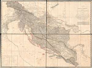
Carte des Provinces Illyriennes Comprenant La Bosnie L'Herzegovine le Monténéro et quelques pays adjacens.
sold
- Digital Map Information
- Suitable for large format printing
- Full resolution TIFF file
- ICC color profile embedded
- Delivered instantly via download link
This detailed and expansive 1812 Gaetan Palma map of the short-lived Illyrian Provinces, a Napoleonic subordinate state embracing modern day Slovenia, Croatia, Bosnia-Herzegovina, and Montenegro. Coverage extends along the Adriatic from Venice to Albania and inland as far as Serbia and Hungary. It is the first specific map of this region to be compiled based on a detailed trigonometrical survey. The map is one of two commissioned by Marshal August de Marmont (1774 - 1852), first Governor-General of the Illyrian Provinces, in anticipation of a Napoleonic invasion of the Ottoman Empire. (more details)