
Pitchner, Wilhelm (sold)

Dr. Wilhelm Pitschner was a Prussian scientist and astronomer alive during the mid-19th century. He led and expedition to the summit of Mont Blanc in the Alps where he and his team spent four weeks on the summit taking astronomical measurements, surveying, and making other observations.
Illustrates the night sky after four weeks of observation and survey work on the summit of Mont Blanc.
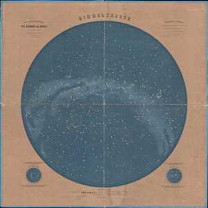
Himmelskarte.
sold
- Digital Map Information
- Suitable for large format printing
- File Size: 37.57 MB
- File Type: ZIP / TIFF
- ICC color profile embedded
- Delivered instantly via download link
This is an 1875 Dr. Wilhelm Pitschner celestial map of the night sky over central Europe as seen from the summit of Mont Blanc. Highly detailed, numerous constellations, stars, and other celestial bodies are illustrated, including Andromeda and Cassiopeia. The ... (more details)