
Rock, William Henry (sold)

William Henry Rock (fl. c. 1840 - 1860) was an English cartographer and publisher active in London during the middle part of the 19th century. Little is known of Rock's life and his corpus is small, consisting exclusively of pocket plans of London, Brighten, and other English tourist destinations.
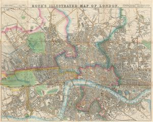
Rock's Illustrated Map of London.
sold
- Digital Map Information
- Suitable for large format printing
- DPI: 300
- File Size: 18.89 MB
- File Type: ZIP / TIFF
- ICC color profile embedded
- Delivered instantly via download link
An appealing map of Victorian London issued by William Henry Rock in 1845. Centered on the River Thames River, Rock's beautifully produced map covers central London from Kensington Palace and Kensington Gardens to Victoria Park, the Grand Surrey Inner Dock, and ... (more details)