
Roessler, Anton R. (sold)

Anton R. Roessler (c. 1833 - 1893) was a surveyor and cartographer who played an important role in the mapping of Texas in the early statehood period. Little is known about his early life aside from his being born in the Austro-Hungarian Empire. He arrived in Texas in the late 1850s and spent most of his adult life in Austin. He participated in the 'Shumard Survey,' led by the chief geologist of the state, Benjamin Franklin Shumard. Roessler worked as a geological assistant and draughtman on the survey, which was disbanded due to the Civil War in 1862 (Roessler's maps are the only ones that survive from the Shumard Survey). Roessler then worked as chief draughtsman for the Texas State Military Board's arsenal. Towards the end of the war, he shifted to the Union side, moving to New Orleans and informing federal troops about Confederate defenses and the geography of Texas. After the war, he worked for the U.S. Land Office (General Land Office) and began to publish maps of Texas and of individual counties of Texas under his own name. He also published scholarly papers related to geology and, for a time, relocated to New York, where he worked to promote immigration to Texas through the Texas Land and Immigration Company of New York. Mystery and controversy surrounded Roessler. The records of the Shumard Survey all were lost or destroyed, save for those in Roessler's possession. He was later publicly attacked by State Geologist S. B. Buckley, who accused Roessler of hoarding the only remaining copies of the Survey's maps and using them for personal gain.
'Texas is, or will be, the wealthiest state in the Union, possessing as she does great agricultural capabilities, all the varieties of soils, minerals and useful rocks known to exist in the world.' - Roessler
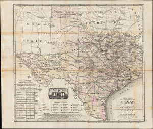
New Map of the State of Texas compiled from the Latest Authorities and Published June 1876.
sold
- Digital Map Information
- Suitable for large format printing
- File Size: 18.71 MB
- File Type: ZIP / TIFF
- ICC color profile embedded
- Delivered instantly via download link
A significant 1876 map of Texas by mining engineer Anton Roessler highlighting railroads, minerals, and geological features. It captures the state's geography in a period of transition, on the cusp of transitions that accompanied the adoption of a new state constitution in 1876. (more details)