
Roman, John (sold)

John Roman (1950 - present) is an artist and illustrator best known for his illustrated maps of various American cities and landscapes. Roman has produced illustrations for clients including the National Park Service, the Massachusetts Audubon Society, Marriott Hotels, and publications like the Wall Street Journal and Time. His most famous map is likely 'Cowboy America,' done in the style of earlier 'Brags Maps' like Daniel Wallingford's 'A New Yorker's Idea of The United States of America.' Roman has also taught at the Massachusetts College of Art and Design since 1993. In 2015, Roman published the book The Art of Illustrated Maps: A Complete Guide to Creative Mapmaking's History, Process and Inspiration, which combines extensive historical research with his own experience as a cartographic artist.
Boston Before the Big Dig
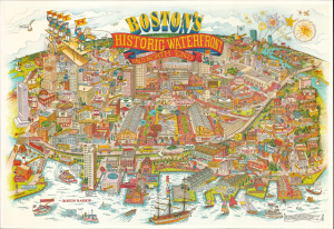
This is a scarce large-format 1984 pictorial view of Boston, Massachusetts, prepared by illustrator John Roman for White Mountain Graphics. Although highlighting the area's historic landmarks, it also serves as a promotional map for contemporary businesses and captures this part of the city on the cusp of a major transformation brought about by the 'Big Dig' and other infrastructure projects. (more details)