
Sands, John (sold)

John Sands (November 12, 1818 - August 16, 1873) was an engraver, stationer, and printer active in Australia during the mid-19th century. Born in Sandhurst, Berkshire, England, Sands undertook an apprenticeship in England as a mapcolorer and engraver. He left for Australia in 1837 and arrived in Sydney with £500 worth of stationary and established a shop on George Street. Sands took over Mary Reibey's house and store front in 1848, which is where the firm operated until 1970. Over the course of his career, Sands formed several partnerships in Sydney and Melbourne. In 1851, he entered into the first with his brother-in-law Thomas Kenny. This partnership took over James Williams's printing firm in Melbournes in 1852. Dugald McDougall (June 7, 1834 - January 18, 1885) joined the firm as early as 1856 and, around 1860, became the manager of the firm in Melbourne, which became known as Sands, Kenny, and Company. In December 1861, Kenny retired, and the firm became Sands and McDougall. The firm was one of the largest of its kind in Australia by 1870 and operated as stationers, booksellers, and account book manufacturers. He married Marjory Moffat on December 6, 1860, in Sydney, with whom he had six children, five sons and a daughter. After his death, Marjory separated the businesses. The Sands family took the business in Sydney, known as John Sands Ltd, and the McDougall family operated the business in Melbourne, known as Sands and McDougall. Sands's eldest son Robert took over the firm in after his apprenticeship. And Herbert Guy Sands was director of the firm for many years.
A highly detailed city map of Melbourne.
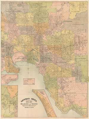
Norman Bros. New Map of Melbourne and Suburbs.
sold
- Digital Map Information
- Suitable for large format printing
- Full resolution TIFF file
- ICC color profile embedded
- Delivered instantly via download link
This is a c. 1950 Norman Brothers city plan or map of Melbourne, Australia. Streets are labeled throughout, and red dashed lines and solid red lines along streets trace electric and cable tramways. Town halls are illustrated and shaded red. Melbourne University, the Royal Park, Princes Park, Studley Park, and the Metropolitan Lunatic Asylum are identified. Noticeable black dots appear sporadically throughout and, per the 'references' table in Port Philip Bay, they mark bowling clubs. The black lines trace railways and the black boxes are stations, all of which are named. Concentric circles mark distances in quarter-mile increments from downtown Melbourne. The inset maps along the lower border are continuation maps that illustrate Sunshine, Footscray, and Braybrook. (more details)