
Scott-Elliot, William (sold)
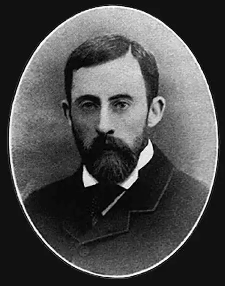
William Scott-Elliot (March 24, 1849 - September 2, 1919) was a Scottish nobleman, merchant banker, theosophist, and amateur historian. Scott-Elliot was born in Edinburgh and inherited the title of Laird of Arkleton. He attended the Rugby School, in Edinburgh, before going on to a career in London with the banking firm Wallace Brothers. He was an early member of the London Lodge of the Theosophical Society and is today best known for his accounts of the lost continents of Atlantis and Lemuria, based on the clairvoyant visions of Charles Webster Leadbeater (1847 - 1934).
Rise and fall of Lemuria.
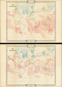
Lemuria at its Greatest Extent. / Lemuria at a Later Period.
sold
- Digital Map Information
- Suitable for large format printing
- File Size: 31.55 MB
- File Type: ZIP / TIFF
- ICC color profile embedded
- Delivered instantly via download link
An intriguing set of 2 maps, c. 1904, tracing the rise and fall of the lost civilization of Lemuria based upon the writings of William Scott-Elliot and the clairvoyant visions of Charles Webster Leadbeater. The maps underscore the late 19th and early 20th-century obsession with Lemuria, Atlantis, and all things 'mystical,' as well as the need to contextualize 'clairvoyant' visions with history and science. (more details)
Rise and fall of Atlantis.
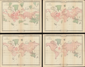
Atlantis at its Prime. / Atlantis in its Decadence. / Ruta and Daitya. / Poseidonis.
sold
- Digital Map Information
- Suitable for large format printing
- Full resolution TIFF file
- ICC color profile embedded
- Delivered instantly via download link
An intriguing set of 4 maps, c. 1900, tracing the rise and fall of the lost civilization of Atlantis based upon the writings of William Scott-Elliot and the clairvoyant visions of Charles Webster Leadbeater. The maps underscore the late 19th and early 20th century obsession with Atlantis and all things 'mystical', as well as the need to contextualize 'clairvoyant' visions with history and science. (more details)